
5 - Is there an Unconformity at the Bottom of the Salt ?
The answer is yes, since, as seen previously, in Kwanza basin there are three salt domains :
(i) Inner Kwanza basin ;
(ii) Coast Arch and
(iii) Outer Kwanza basin.
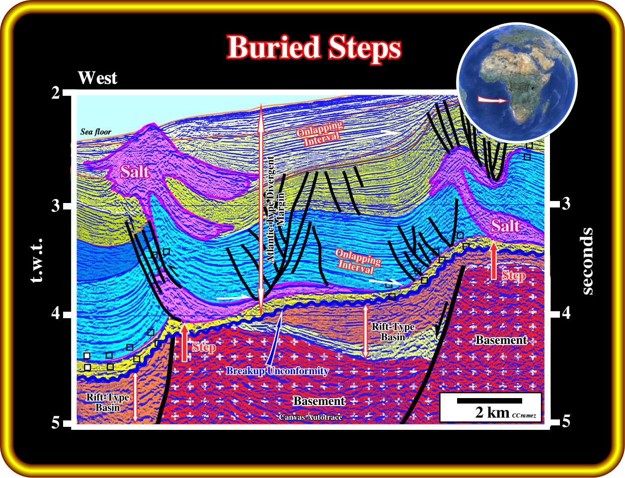
In this geological cross-section of the Kwanza basin, fore major basement steps define three salt provinces : (i) The Outer Kwanza Basin, where the salt thickness can reach more than 3000 meters ; (ii) The Coastal Arch, in which the maximum thickness of the salt ranges is around 650 meters and (iii) The Inner Kwanza Basin, in which the maximum salt thickness is around 2300 meters. The onlapping of the salt over the infra-salt sediments is, naturally, more evident along the major steps, as illustrated next.
The largest basement step (around 1425 meters), between the outer Kwanza basin and the coastal arch, defines what several geoscientists call the Atlantic Hinge Zone.
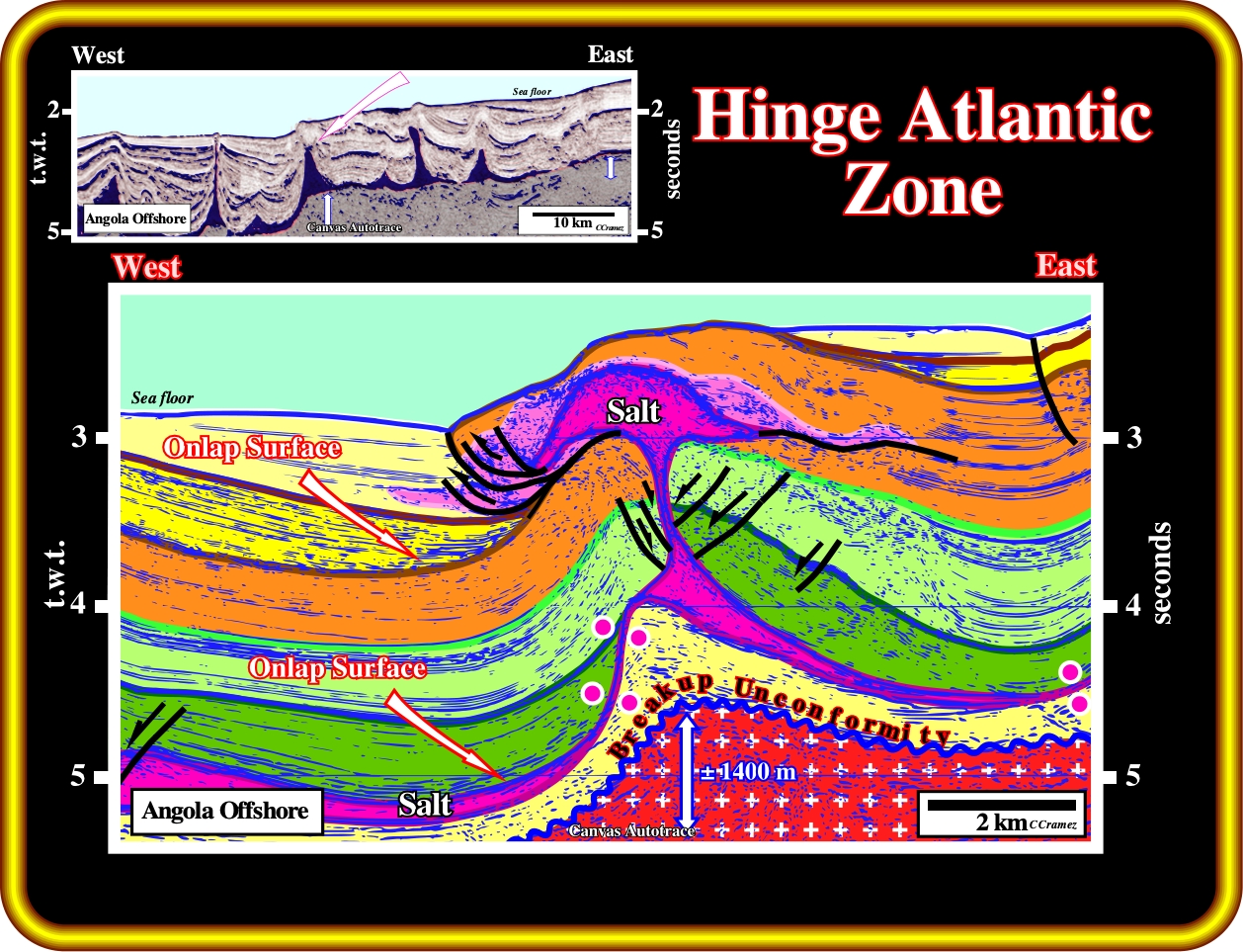
In this geological tentative interpretation of a seismic line of the Angola deep offshore, the major step (around 1400 meters), on the top of the infra-salt sediments, separates the outer Kwanza basin (1) from the coastal arch (2) ; the Atlantic hinge zone, is obvious. It is characterized by an onlap surface of the evaporites (see next plate), over the unconformity (erosional surface) developed at the top of : (i) The margin infra-salt sediments (if they exist) ; (ii) The subaerial lava flows, which postdate the breakup unconformity ; (iii) The rift-type margins sediments or (iv) The basement. As sedimentation takes place above the salt, the salt starts to move seaward. If the sedimentation rate is insufficient to cover the bathymetric escarpment, the sediments onlap above the step and are translated basinward after deposition, producing a landward dipping package of onlapping strata. The distance from a given onlap to the step records the amount of translation. All this is probably better recognized on the next plate.
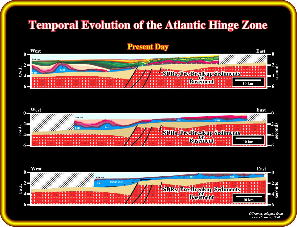
Presently, the seismic lines westward of the Atlantic hinge zones clearly illustrate a landward dipping sedimentary intervals onlapping the intervals deposited immediately above the salt (upper sketch). The proposed reconstitutions (middle and lower sketch) strongly suggest not only a significant seaward depocenters, but an onlapping of the salt fossilizing the different pre-salt step.
Similar steps with, more or less the same amplitude, have been recognized in other salt basins, as illustrated below (Santos basin) :
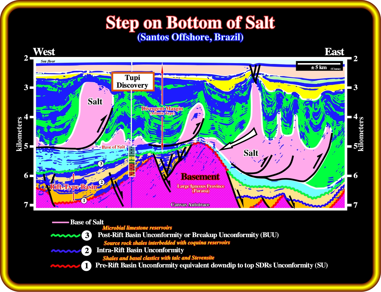
On this geological tentative interpretation of a depth seismic line (reverse time migration) of Santos deep offshore (Brazil), a step of around 1000 meters is obvious at the bottom the salt, as in offshore Angola (Atlantic Hinge Zone). The pre-rift unconformity (unconformity 1), an unconformity (2) within the rift-type basin (as in Cabinda onshore) and the breakup unconformity (unconformity 3) as quite obvious. Here, the infra-salt margin sediments (reservoirs-rocks) seem to be associated to a carbonate platform, which disappear westward and potential source rocks are possible (equivalent of the source-rocks found in Falcão well, in Angola offshore). Do not forget that the step, at the top of the infra-salt sediments (escarpment), suggests a diachronism to the bottom of salt. In other words, the synform eastward of Tupi high was filled up by salt before it covers the carbonate platform. As in Angola offshore, the salt onlaps an unconformity, which, locally, can be tectonically enhanced (angular unconformity).
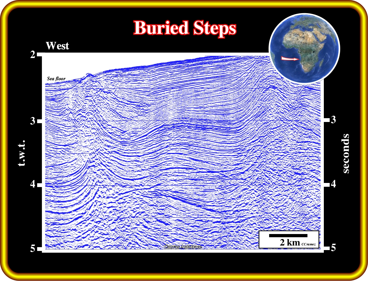
Exercise 1 :
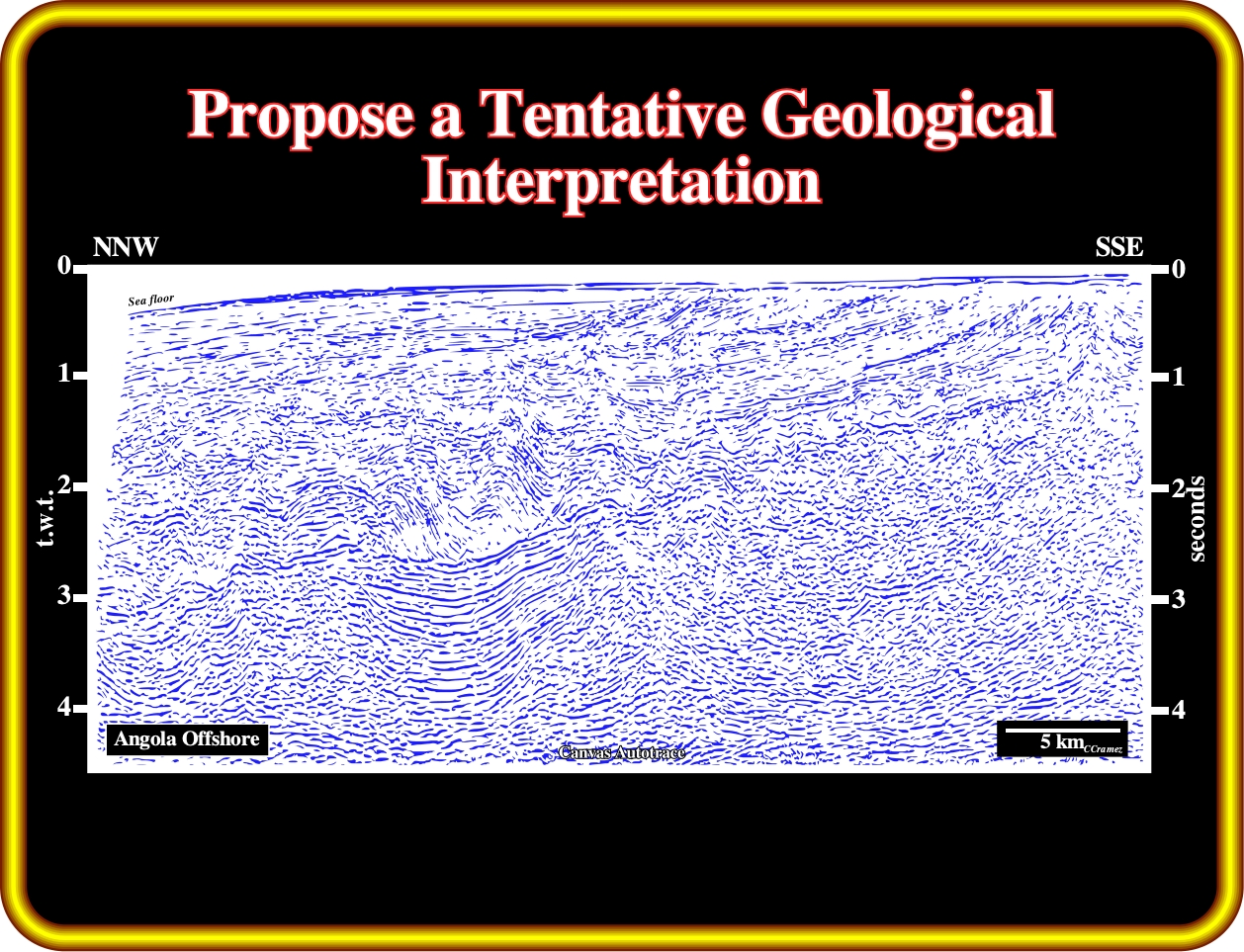
Propose a tentative geological interpretation of this seismic line, taking into account that you must recognize:
(i) The basement ;
(ii) The breakup unconformity ;
(iii) Rift-type basins ;
(iv) The Atlantic-type divergent margin ;
(v) The margin infra-salt sediments, that certain geoscientists call the sag basin ;
(vi) The salt induced tectonic disharmony ;
(vii) The more likely location of the Atlantic hinge zone ;
(viii) Finally, calculate, approximately (in time) the Tertiary uplift of the eastern part of the basin.
Exercise 2 :
On this seismic line of the Angola deep offshore, located at the limit between the coastal arch and outer Kwanza basin, you must locate the two step at the top of the salt that underline the Atlantic hinge zone. Then,
(i) Pick the two major onlapping intervals dipping landward ;
(ii) Pick the limits of the salt ;
(iii) What is, more or less, the amplitude of the two salt steps ?
(iv) How many rift-type basins do you recognize on this line ?
(v) Pick the breakup unconformity.
(v) Locate a potential salt glacier.
Exercise 3 :
Make plain and comprehensible this tentative geological interpretation. In other words, take a sheet of paper an write what the interpreter recognized on this line. Do not forget, that in Geology and particularly in seismic interpretation all observations are theory dependent.
to continue press
next
![]()