
7- How many Salt Layers there are in Kwanza Basin ?
In stratigraphic terms, in Kwanza basin, there is one Aptian salt layer, as illustrated on the next seismic lines.
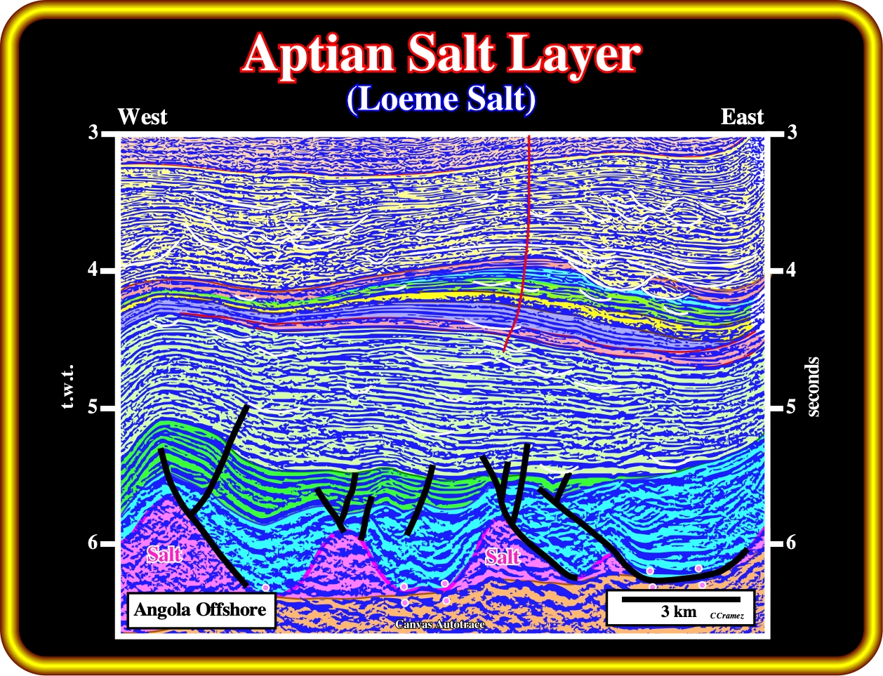
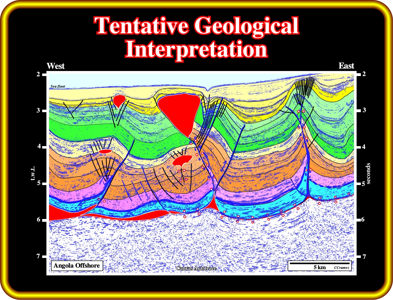
On this tentative geological interpretation of a seismic line of the Angola deep offshore (westward of the Atlantic hinge zone), just a salt layer is evident. In addition, in spite of vertical flowage of the salt, which developed small salt welds between the salt structure, it is important to notice that the salt is in its stratigraphic position, that is to say, below Albian carbonate (blue interval) and the basal infra-salt margin sediments.
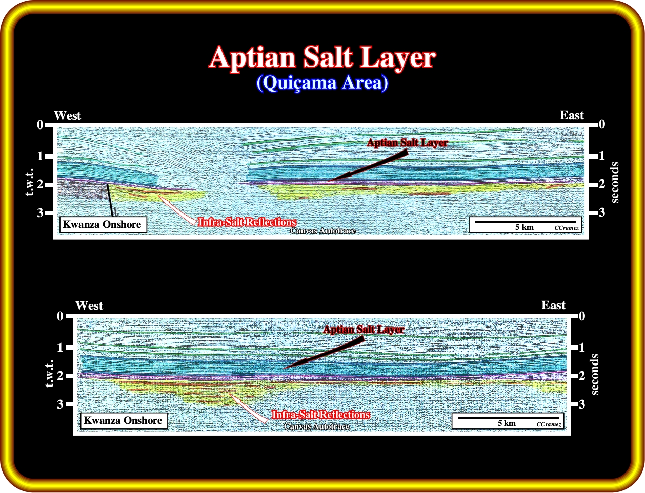
These geological tentative interpretations of two old onshore seismic lines (shot in the 60's), clear indicate the presence of single salt layer, probably in continuity, with a thickness more or less constant (purple interval). These lines are probably located on the coastal arch or near the western edge of the inner Kwanza basin. It is interesting to notice that the salt layer is almost undeformed and the presence of few seismic reflexions below the salt. Taking into account the quality of the old onshore seismic data, it is plausible than the new seismic lines shot, recently, by Sonangol will show quite well, not only mappable infra-salt margin sediments but rift-type basin sediments as well.
Spatially the Aptian salt layer can be autochthonous, that is to say, resting in the original strata or surface on which it accumulated by evaporation (salt is in its stratigraphic position) or allochthonous overlying part of its overburden (often a sheet like salt body tectonically emplaced at stratigraphic levels overlying the autochthonous salt layer). An allochthonous salt lies within stratigraphically younger strata, as illustrated below.
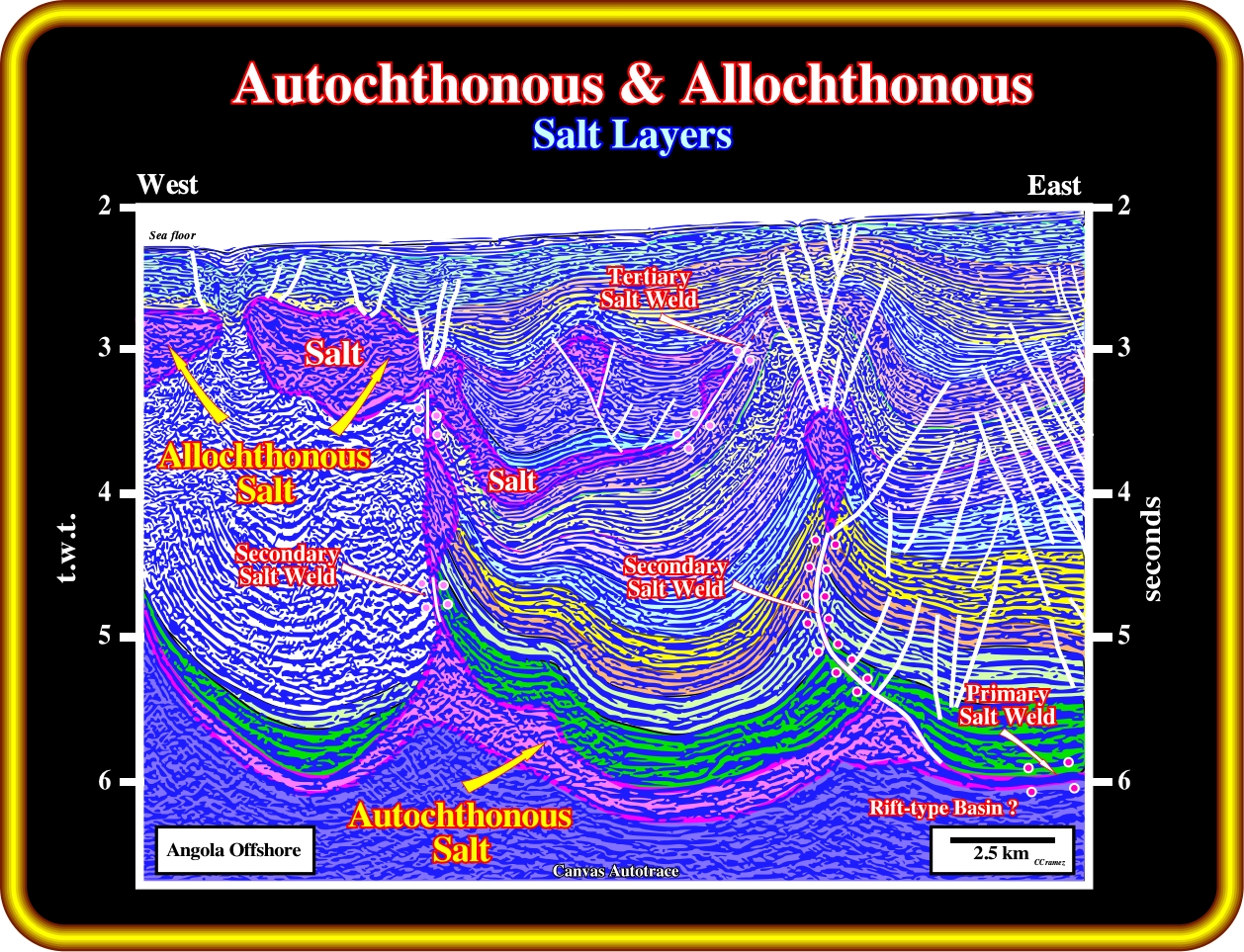
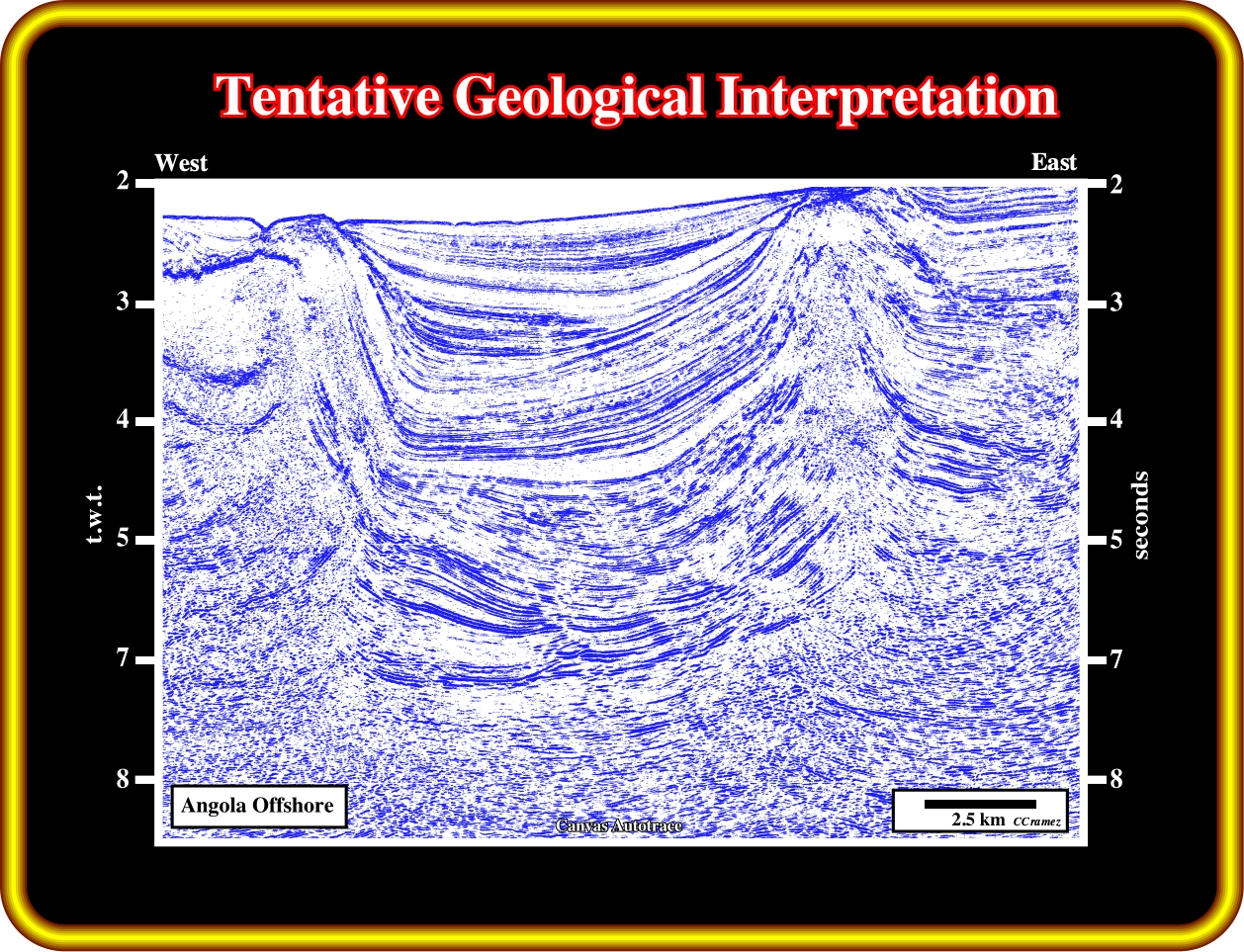
On this tentative interpretation, it is quite evident that, spatially, the Aptian salt layer can be autochthonous (in is right stratigraphic position), as it it the case in the lower part of the seismic line, or allochthonous, i.e., tectonically (generally by halokinesis) emplaced in another stratigraphic position, as it is the case in the upper part of the seismic line. Very often, the two Aptian salt layers (autochthonous and allochthonous) are connected by a, more or less, vertical structures (dome or diapirs) or by vertical secondary salt welds. Secondary salt welds, generally, correspond to salt diapirs squeezed by local compressional tectonic regimes, what seems to be the case in this line.
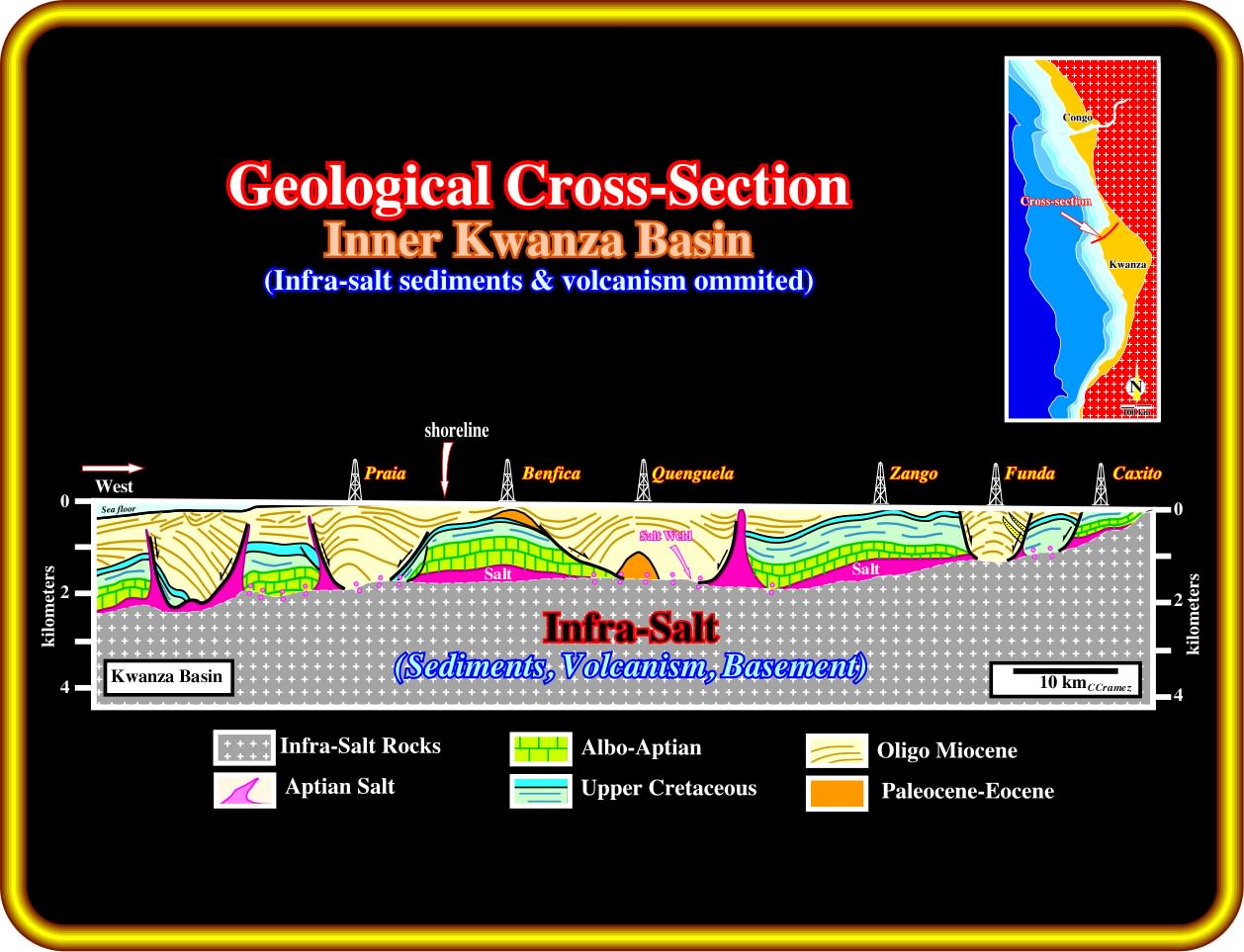
In the coastal arch and inner Kwanza basin (broadly, in the onshore), taking into account the geological cross-sections, on can say, that, prima facie, the Aptian salt is present just in allochthonous layers or primary salt welds. In spite of the fact that we have omitted all sediments below the salt, the morphology of the bottom of the salt, suggests, in the central part of the inner Kwanza basin (Quenguela - Zango - Funda), as well in the outer Kwanza basin (westward of Praia), a conceivable presence of thick marginal infra-salt sediments overlying rift-type basins, in other words, a credible hydrocarbon potential.
In the 70's, after Petrangol (Petrofina) drilled Maculongo ≠1, a rumour run that the well found two salt layer separated by, more or less, 200 meters. The first reaction of Total CAP's geoscientists (at that time just two oil companies were exploring the Kwanza basin, i.e., Petrangol and Total Cap) was to assume that the well was not located in the top of the turtle back structure and so it crossed a fault weld (fault filled by salt) before drill the autochthonous salt layer (see below).
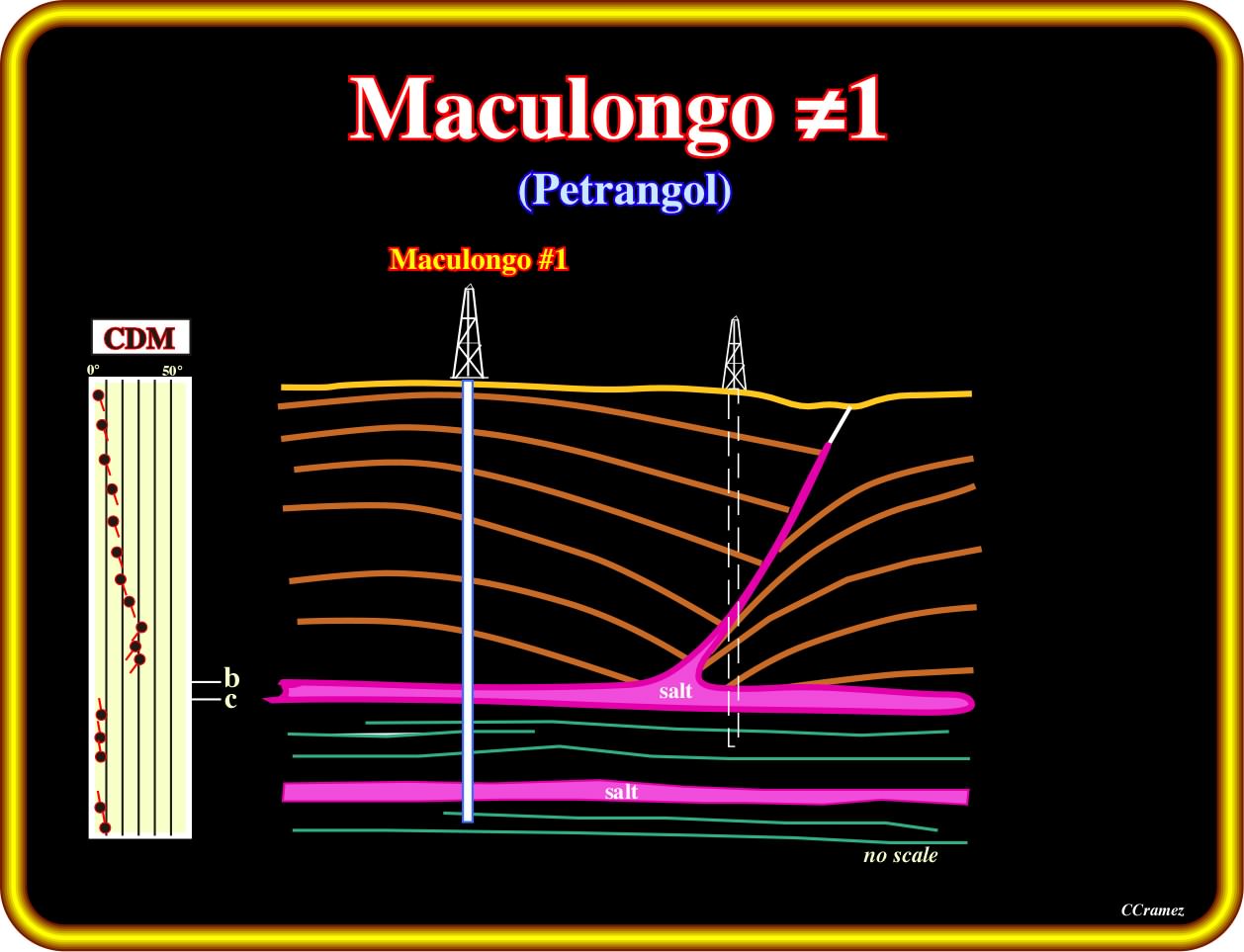
The reprocessing of few seismic lines in the 60's, by Petrangol, in the south of the inner Kwanza basin and the reinterpretation of Maculongo well's results have allowed : (i) The calibration of the two stratigraphic salt layers drilled by the well ; (ii) To corroborate a significant infra-salt interval underlying the salt turtle back structure (initial target of the well), as well as, the calibration of the organic rich shales (potential source-rocks) recognized at the bottom of the well. The conjecture advanced by Total CAP's geoscientists seems to be refuted. The first salt layers recognized by the well corresponds to the autochthonous salt layer. The second salt layer belongs either to the margin infra-salt sediments, postdating the breakup lithosphere, or to a rift-type basin salt deposit. So far we can just guess. However, we have a way to test both hypothesis. If the lower salt layer is rich in potash and poor in magnesium, probably it belongs to the infra-salt margins sediments. On the contrary, if its composition does not requires an hydrothermal enrichment, it is probably associated with the development of rift-type basins predating the breakup unconformity.
Exercise 1:
(i) The bottom of the autochthonous salt (or associated salt welds) ;
(iii) The translation onlap surfaces ;
(iv) The pull-up anomaly induced by the allochthonous salt.
Finally calculate the amplitude of the step at the bottom of the salt.
Exercise 2:
After proposing a tentative interpretation, that you must make plain and comprehensible, answer the following questions :
- How many tectonic regimes can you recognized on this seismic line ?
- Are the sediments shortened or lengthened ?
- The salt was deformed by halokinesis (equilibrium tectonic regime, with a tectonic stress nil) or by another tectonic regime or by both ? Explain you answer.
- How the allochthonous salt was developed ?
- Did you recognize the breakup unconformity ?
- How many rift-type basins did you recognized ?
Exercise 3:
- Did you recognize the breakup unconformity ?
- How many rift-type basins did you recognized below the breakup unconformity ?
- Did you differentiated the rift-type basin sediments from the margin infra-salt sediments ?
- Characterize their internal configuration ? Are they dipping in the same direction ?
Exercise 4:
Criticize this tentative interpretation of a seismic line from Angola deep offshore and explain :
- The difference between a primary and a secondary fault weld.
- How do you characterize an autochthonous salt layer ?
- What is an allochthonous salt layer ?
- How the secondary salt welds were formed ?
- Taking into account that before deforming the sediments they must be deposited, how many tectonic regimes do you recognize on this tentative interpretation ?
- How many salt bottom steps, did you recognize on this tentative ?
- Were the salt structures squeezed by late compressional tectonic regimes ?
- How do you class the faults on the top of squeezed salt structures, i.e., are them normal, reverse or strike-slip faults?
Exercise 5:
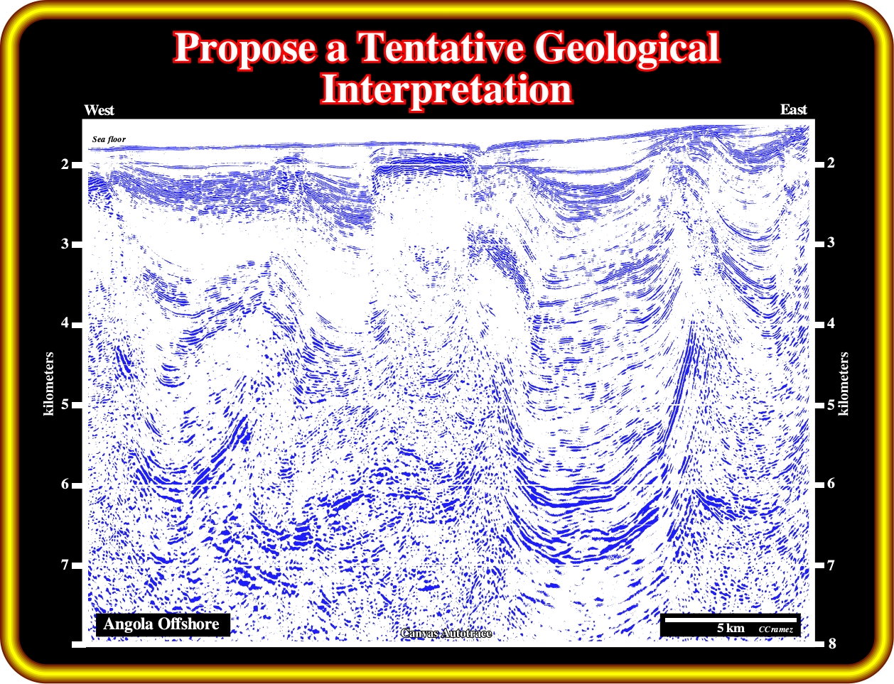
Propose a geological tentative interpretation, picking in detail:
(i) The bottom of the autochthonous salt ;
(ii) The limits of the allochthonous salt ;
(iii) The primary and secondary salt welds ;
(iv) The fault patterns.
to continue press
next
![]()