A toplap is a termination of strata, or seismic marker, against an overlying surface, mainly, resulting of non-deposition (sedimentary bypassing) with perhaps only minor erosion. Each unit of strata laps out in a landward direction at the top of the unit, and each successive termination lies, progressively, seaward.
Three different kinds of toplap can be considered :
a) Coastal toplap ;
b) Marine toplap ;
c) Non-marine toplap.
a) Coastal toplap
Up-dip termination of a coastal stratum or strata (field) or their association reflections (seismic lines).
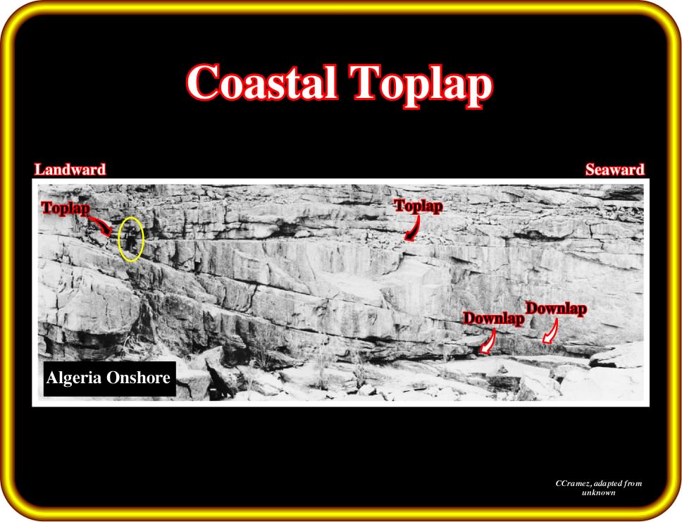
Plate 172 - First of all notice the scale of this photograph. Geology is scale dependent. The scale is given by the geoscientist near the toplap termination (yellow ellipse). Toplap strata termination are, here, well visible. The strata laps out in the landward direction, but the successive terminations lie, progressively, seaward. The down-dip strata terminations are downlaps and, specially, distal downlaps.
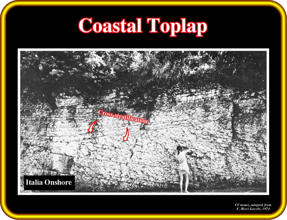
Plate 173 - Toplapping should not be confused with cross-stratification. As illustrated here, cross-bedding occurs at a small scale. Often the cross-stratification (arrangement of sediment strata deposited at an angle to the main stratification) thickness is measured in centimeters. Genetically, cross-bedding is produced by migration of bed forms, particularly ripples (which form small-scale cross-lamination) and dunes (which form medium to large-sale cross-lamination or cross-bedding). The most common type of cross-stratification is produced by the migration of sand dunes or ripples. Certain geoscientists name cross-bedding, cross-stratification in which the individual strata are greater than 1 cm and cross-lamination when the individual strata are less than 1 cm in thickness.
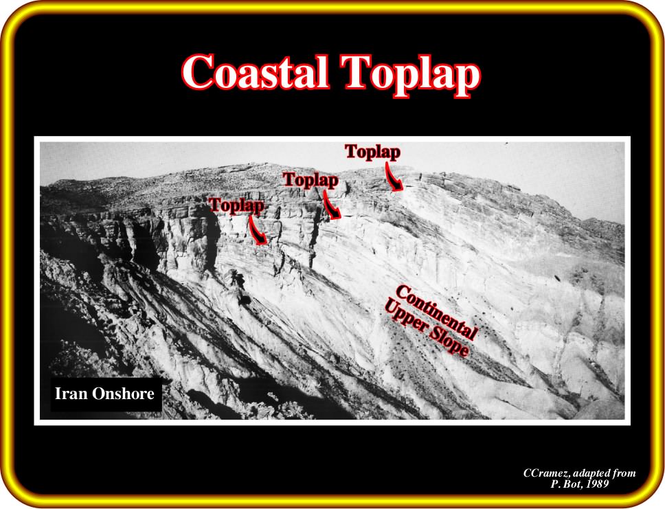
Plate 174 - Toplap is, often, associated with shelf breaks as recognize in this outcrop. In this particular example (photo taken by P. Bot), some strata laps out in the landward direction but far away from the shelf break. Toplap strata terminations implies an absence of erosion, i.e., the geometry is, mainly, induced by non-depositional processes. When erosion is associated with the upper limit of a stratigraphic cycle, certain geoscientists use the term truncation (erosional toplap for others).
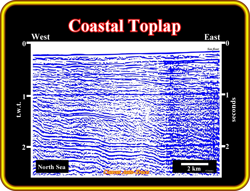
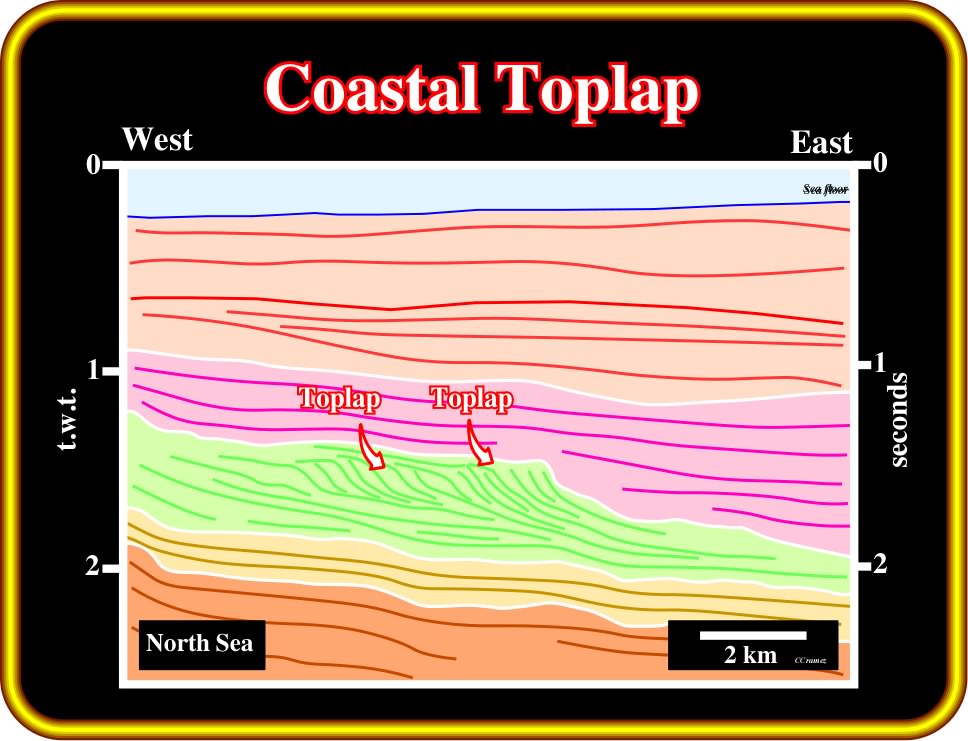
Plate 175- Theoretically, toplapping implies non-deposition, i.e., sedimentation with minor erosion. On seismic lines and particular on regional lines such as the one, of this auto-trace tentative interpretation, it is, often, difficult to recognize the magnitude of erosion to differentiate toplap from erosional truncation. As a guess, we hypothesize that on this tentative interpretation, the toplaps are associated with coastal deposits and they should be considered as coastal toplaps. It is important to differentiate disconformity and unconformity (tectonically enhanced, i.e., angular unconformity). Both represent a break in deposition (erosion, submergence and again deposition). A disconformity surface is characterized by two indicators : (i) an erosional surface (generally marked by laterite, bauxite and other terrestrial deposits at the contact) and (ii) a difference in the age of the rocks above and below. An unconformity surface is characterized by (a) an erosional surface ; (b) a difference in the age of the rocks above and below and (c) truncation (erosional toplaps) of the underlying beds against the surface of unconformity (tectonically enhanced). When the underlying sediments are just uplifted and then submerged keeping the same dip and strike, the erosional surface corresponds to a disconformity. When the underlying sediments are uplifted and tilted, the erosional surface corresponds to an tectonically enhanced unconformity (angular unconformity).
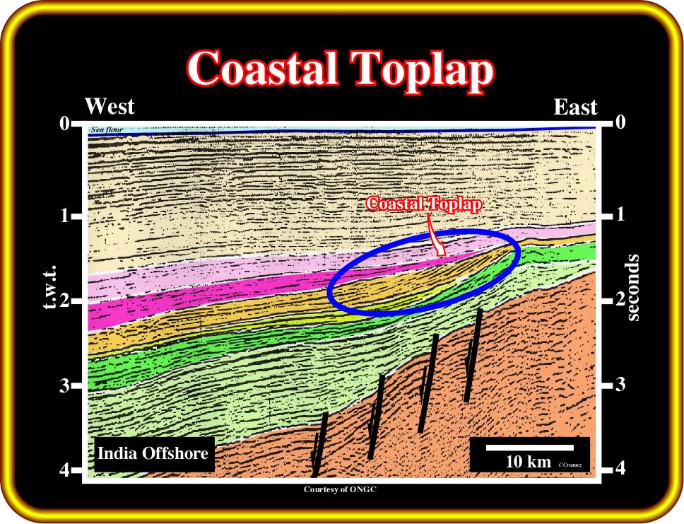
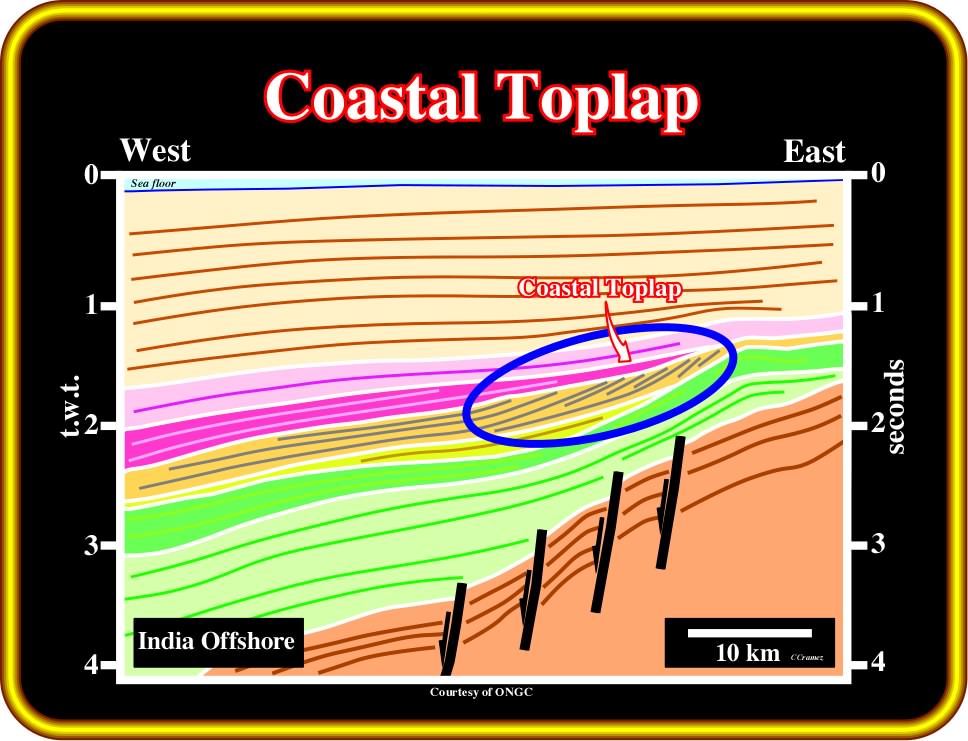
Plate 176 - On this tentative interpretation of a regional line of west offshore of India, the depositional inclined reflectors, probably, associated with carbonate sediments, terminate up-dip by toplap geometrical relationships. Taking into account that they occur in a likely shallow water environment, they can, easily, be considered as coastal toplaps. They are clearly associated with an upper boundary of a stratigraphic cycle. Actually, as we will see later, one can say they occur along the upper cycle-sequence boundary (a sequence-cycle is a stratigraphic cycle induced by a 3rd order eustatic cycle).
b) Marine toplap
Up-dip termination of a marine stratum or strata (field) or their association reflections (seismic lines), at deposition time, i.e., before tectonic deformation.
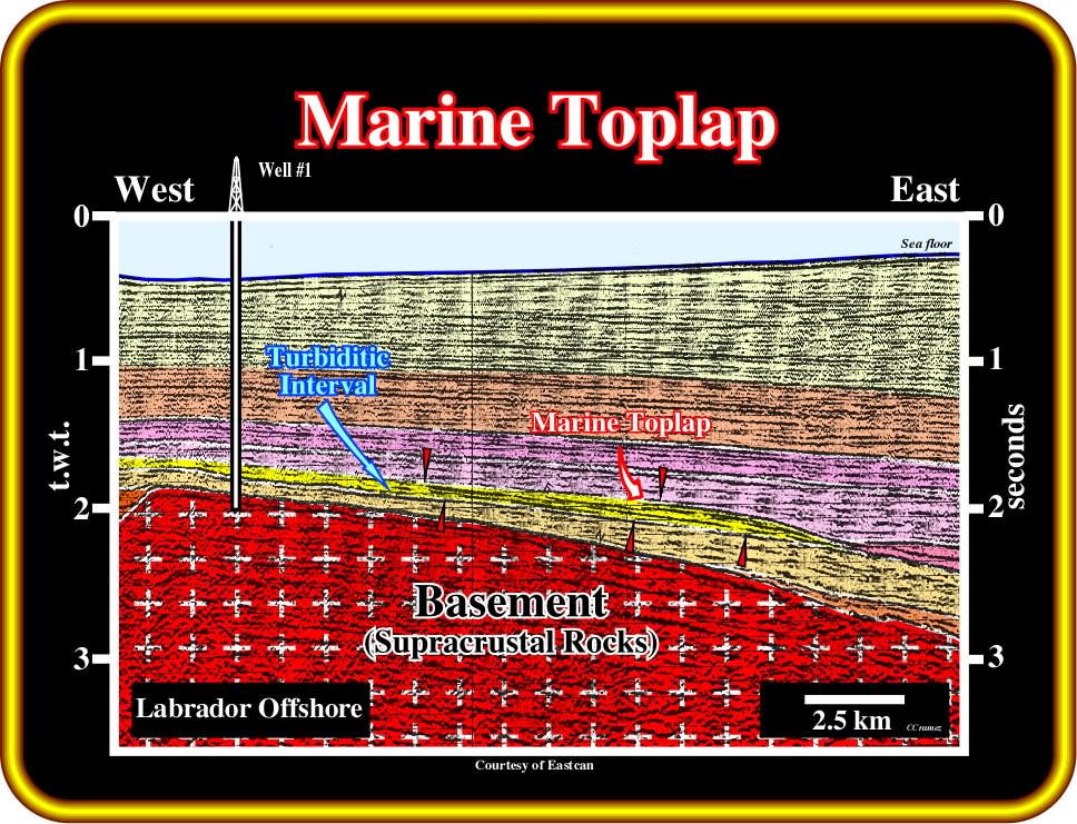
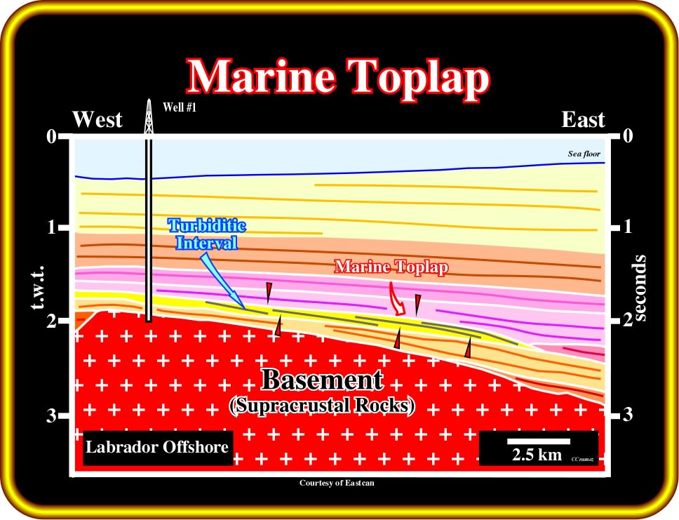
Plate 177 - Marine toplaps are here associated with a turbidite interval, which was corroborated by the results of well drilled by Total in the 70's. It is, relatively, easy to recognize the internal geometry of the turbidite interval (shingled progradation). Toplap terminations are inferred to be the result of lateral stacking and shifting of turbidite depositional lobes, which induces a progradational geometry. The non-conformity visible, often, between the different turbiditic lobes do not correspond to an unconformity (relative sea level fall) but rather to lateral shift of the lobes (G. Dailly's pendulum effect).

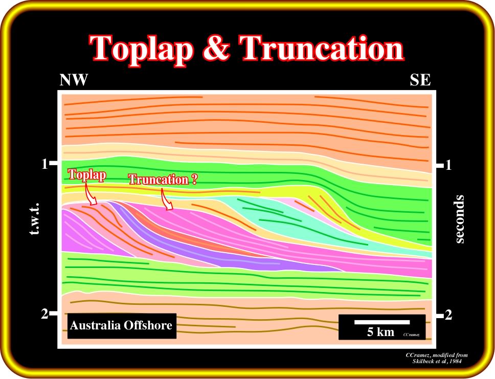
Plate 178 - On this tentative interpretation of an auto-trace of seismic line of Australia offshore, toplaps (no significant erosion) and truncations (obvious erosion) seem to be side by side. The differentiation between them is, often, so difficult that certain geoscientists use the term toplap to express all up-dip reflection terminations. When erosion is evident, they speak of toplap by erosion. Toplap by non-deposition is used when sedimentary bypassing is paramount (sedimentary transport across areas of non-deposition, as in the case where one particle size passes another that is being simultaneously transported or continues in motion after the other has come to rest, Eaton, 1929).
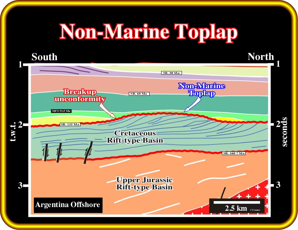
c) Non-marine toplap
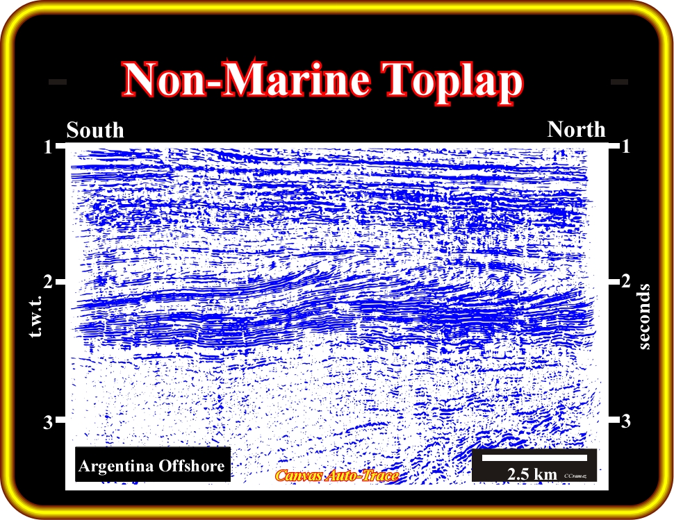
Plate 179 - On this auto-trace tentative interpretation, the internal configuration of the sedimentary interval between the unconformities SB. 16o (?) and SB 135 Ma, which as we will see later corresponds to a continental encroachment sub-cycle, is progradational. In terms of sequential stratigraphy, the upper unconformity (SB. 135 Ma) is an erosional surface induced, mainly, by a relative sea level fall associated to the breakup unconformity and characterized by toplap geometrical relationships. These toplaps are, likely, non-marine toplaps since the sediments of Cretaceous rift-type basin are, mainly, non-marine.
Truncation is a termination of strata or seismic reflections interpreted as strata along an unconformity surface due to post-depositional or structural effects. Truncation occurs along the upper limit of stratigraphic cycles. Erosional truncation implies the deposition of strata and their subsequent removal along an unconformity surface.
Structural truncation is, quite, different from erosional truncation. Structural truncation is a lateral termination of a stratum by structural disruption, produced by faulting, gravity sliding, salt flowage, or igneous intrusion.
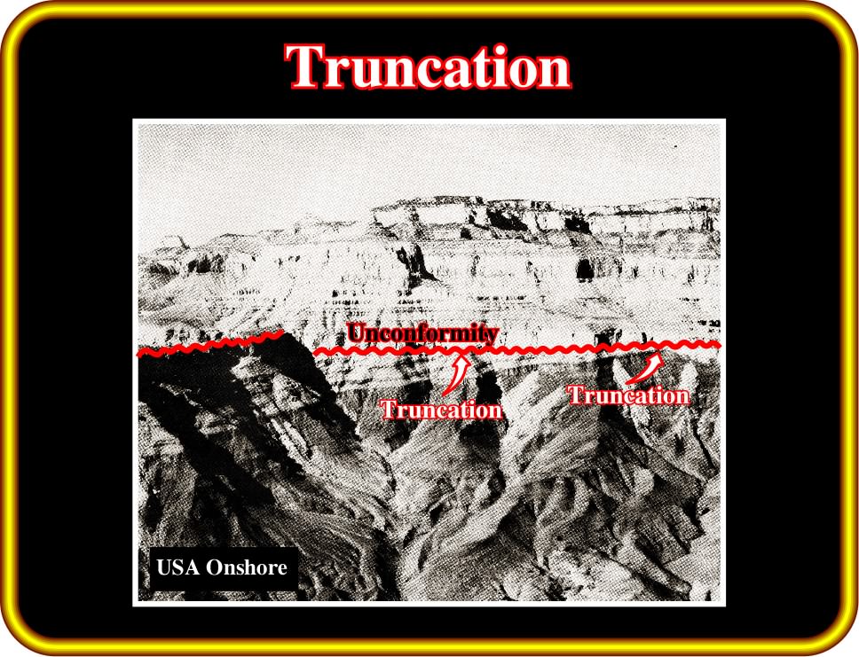
Plate 180 - Truncation of sediments, underlying an erosional surface (unconformity) is evident on this photograph (Colorado Canyon, USA). According to the terminology followed in these notes, these obvious stratal terminations do not correspond to sedimentary toplaps but to toplaps created by truncation (the rocks underlying the unconformity have been tilted and shortened). The ecstatically induced unconformity was tectonically enhanced (angular unconformity for geoscientists structuralists).

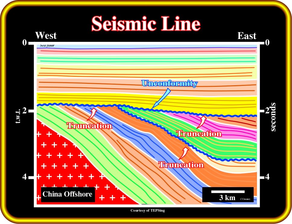
Plate 181- Truncation reflection terminations are, easily, recognized on this tentative interpretation of an auto-trace of an offshore China seismic line. Erosional surfaces, that is to say, unconformities cannot be picked in continuity. Their associated interfaces change, laterally, quite a lot. Its picking oblige geoscientists to jump from a peak to a trough or trough to peak depending on the impedance contrasts. Truncation or erosional truncation (associated with an erosional surface) correspond always to a limit of a stratigraphic cycle, which is, generally, not the case with a structural truncation (structural disruption).
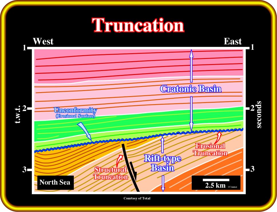
Plate 182 - On this tentative interpretation of an autotrace of a North Sea seismic line, truncation reflection terminations are associated with the erosional surface between a Mesozoic Cretaceous rift-type basin and the Cenozoic cratonic sediments. In the rift-type sediments, another type of truncation is observed (structural truncation association with a normal faulting).
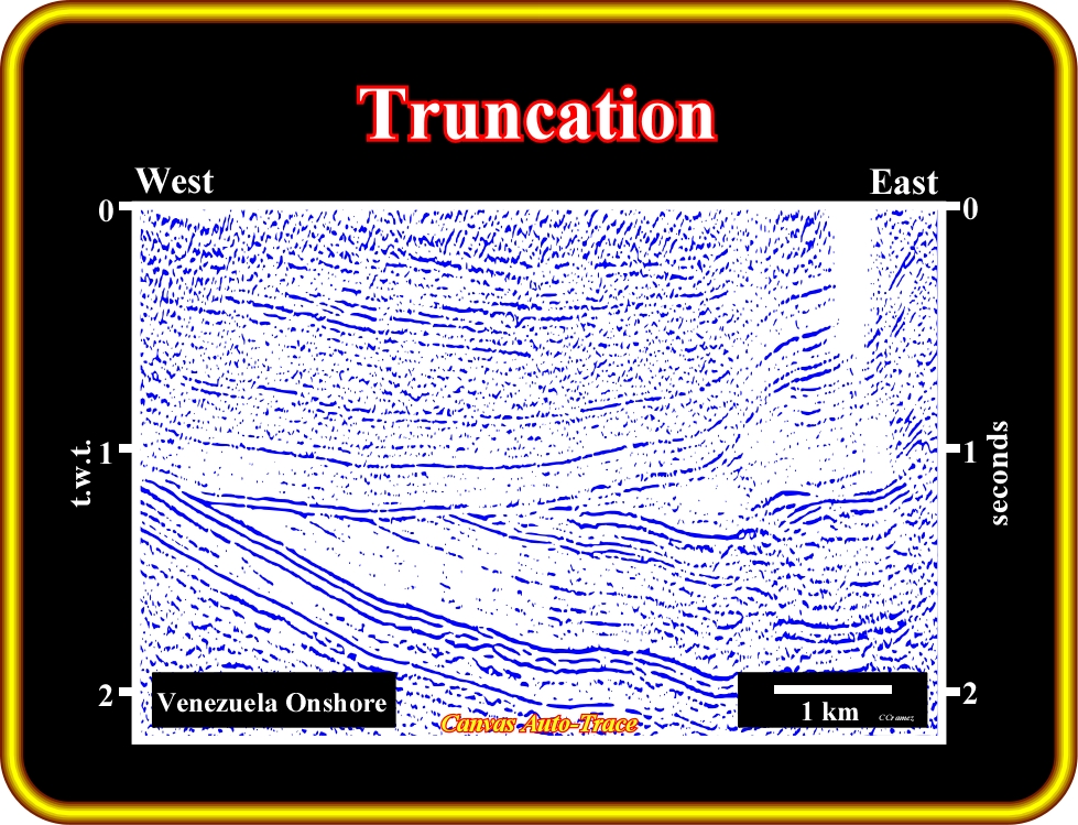
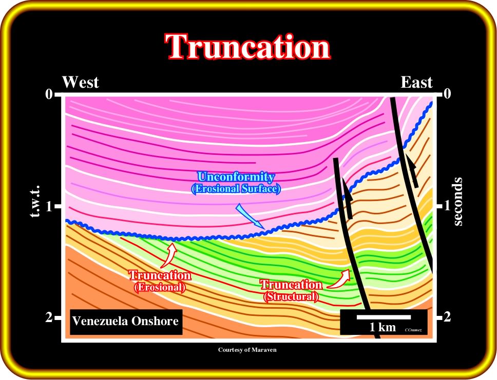
Plate 183 - This is a tentative interpretation of an auto-trace of a seismic line shot in Venezuela onshore (eastward of Maracaibo lake). The regional structural context of the area is compressional. Several compressional tectonic regimes took place, particularly, during the Cenozoic. The sediments were shortened, uplifted and eroded as tectonic inversions took place. An Upper Miocene unconformity truncated pre-Miocene sediments creating sharp truncation reflection terminations. Later, during the Mio-Pliocene, another tectonic regime took place folding and faulting the sediments. In certain areas, where folding was not enough to accommodate the sediments, reverse faults developed to shorten the sediments to respect volume problems. The sediments were broken and displaced along the reverse fault planes creating structural truncation terminations at the reflectors ending against the fault planes. Structural truncations and erosional truncation are not synonyms.
to continue press