A33- France Offshore (Armorican Offshore):
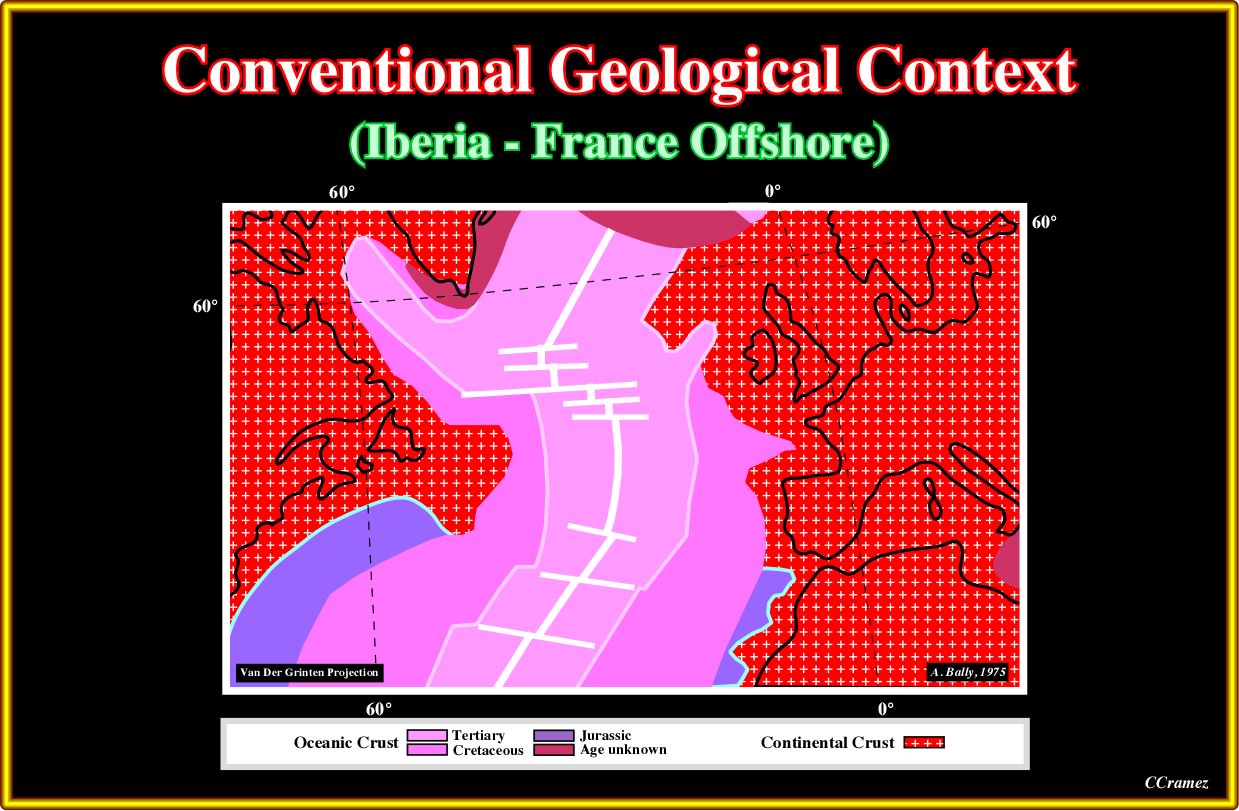
Plate A33.01- Let’s start saying the COB (continental oceanic boundary) in deep offshore Newfoundland and Iberia are quite anomalous in relation to the COB in North Africa and offshore USA, where SDRs are well known. On the other hand, the morphology of the sea floor is also quite particular, as illustrated next.
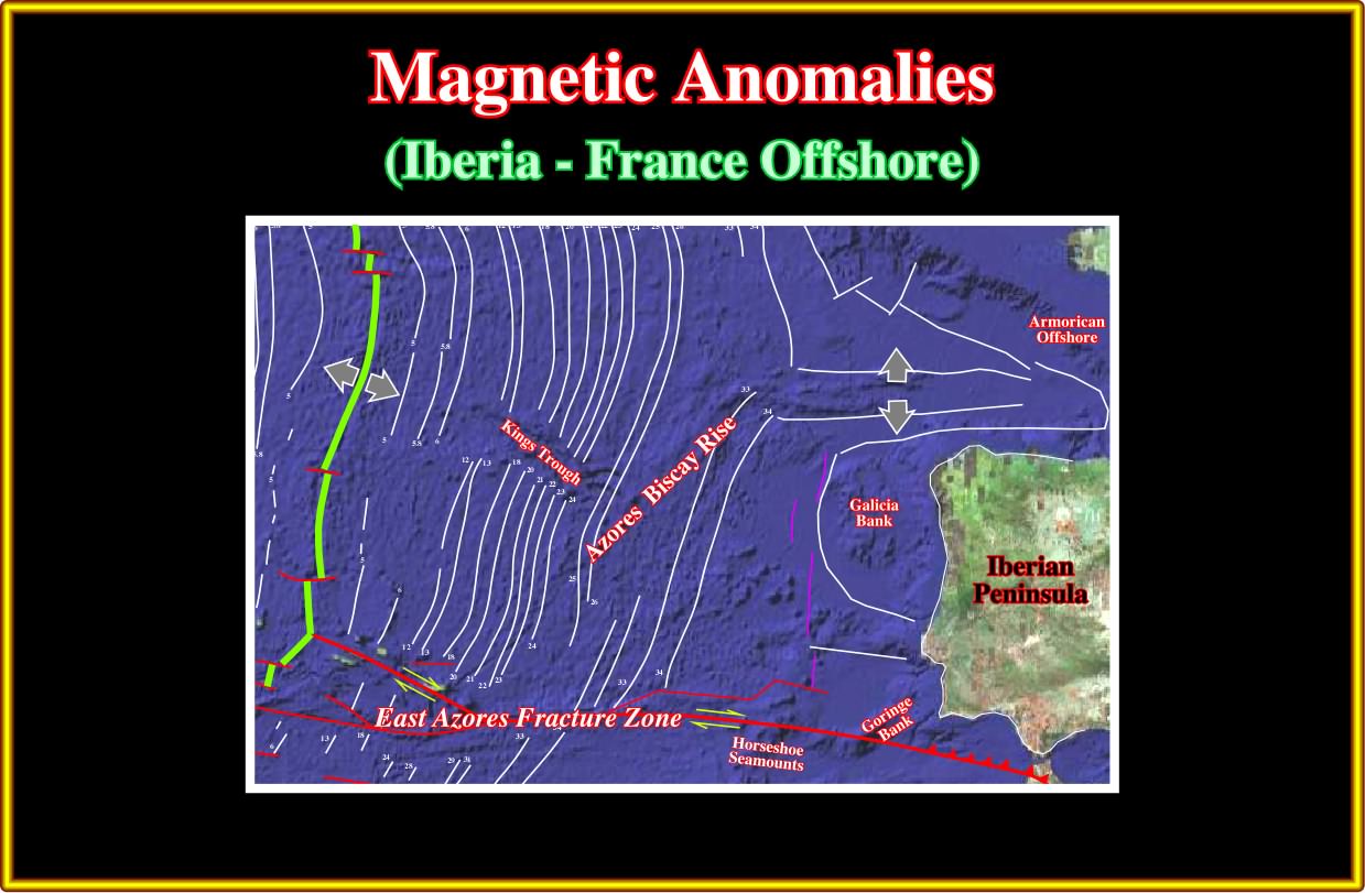
Plate A33.02- To understand the Iberian Peninsula and Armorican offshore, before all, one must take into account: (i) The East Azores Fracture Zone ; (ii) The Azores Biscay Rise ; (iii) The Galicia Bank ; (iv) Middle North Atlantic Ridge ; (v) The position of the Magnetic Anomalies ; (vi) the Goringe Bank and (vii) the Extensional Zone between the Galicia Bank and the Armorican offshore. All these geological features, strongly, suggest this area does not correspond to a typically Atlantic-type divergent margin.
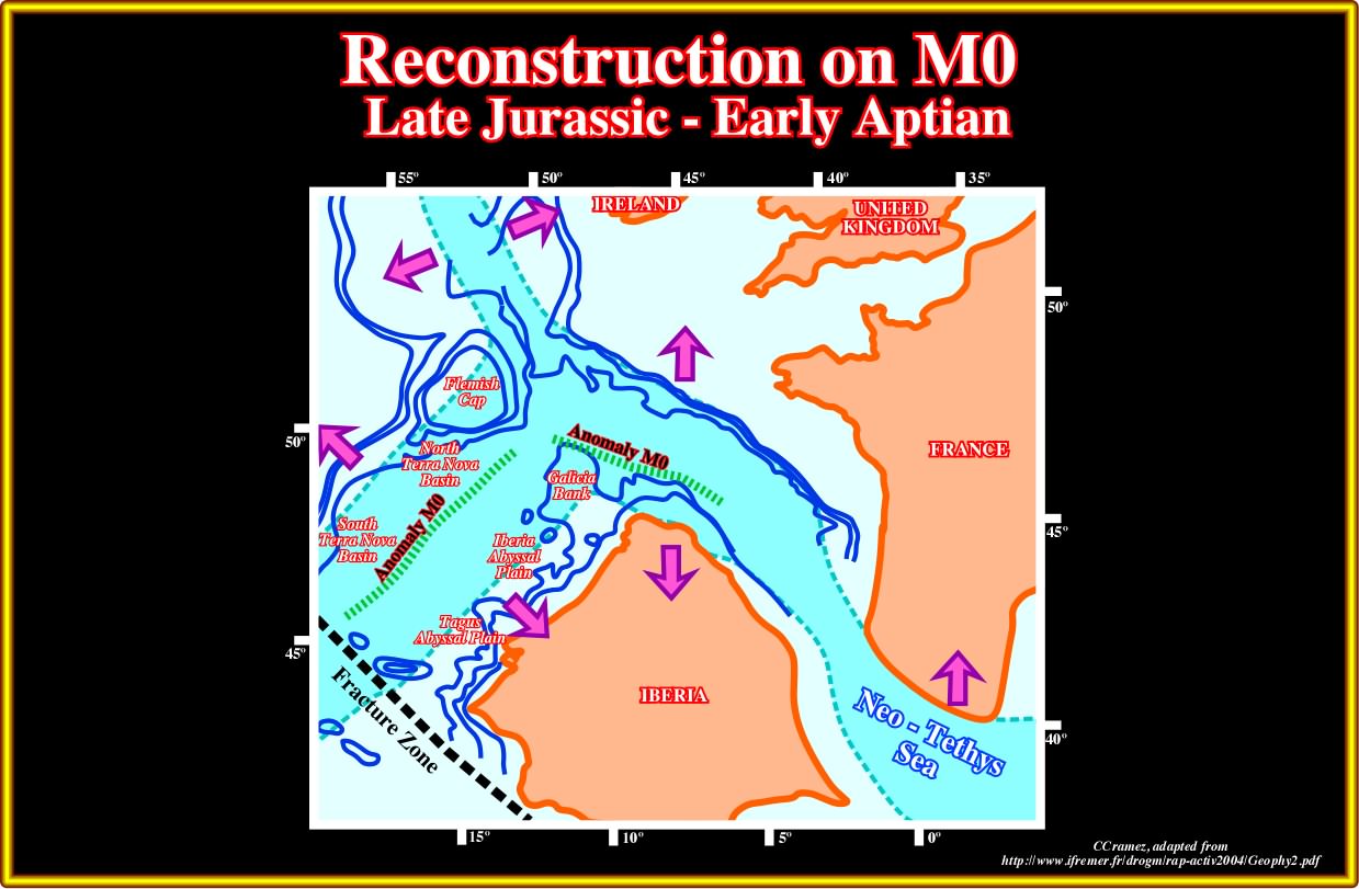
Plate A33.03- A reconstruction at the magnetic anomaly M0 (see later), around 118 Ma, strongly, suggests at the onset of the sea-floor spreading, that Galicia Bank was, more or less, adjacent to Flemish Cap. The Iberia and Tagus Abyssal Plains seem to match with the North and South Terra Nova geographic basins. A major fracture zone existed already between South Newfoundland and South Iberia. A triple point, northward of Flemish Cap and Galicia bank could be predicted. The extension between M0 and M25 (see later) underline the motion of the lithospheric plates and emphasized the geological particularities of Newfoundland and West Iberia offshores when compared with the conventional Atlantic offshores. Summing up, it is important do not forget the Neo-Tethys Sea, northward of Iberia and the triple point between Galicia Bank and Flemish Cap, in which SDRs are likely as illustrated next.
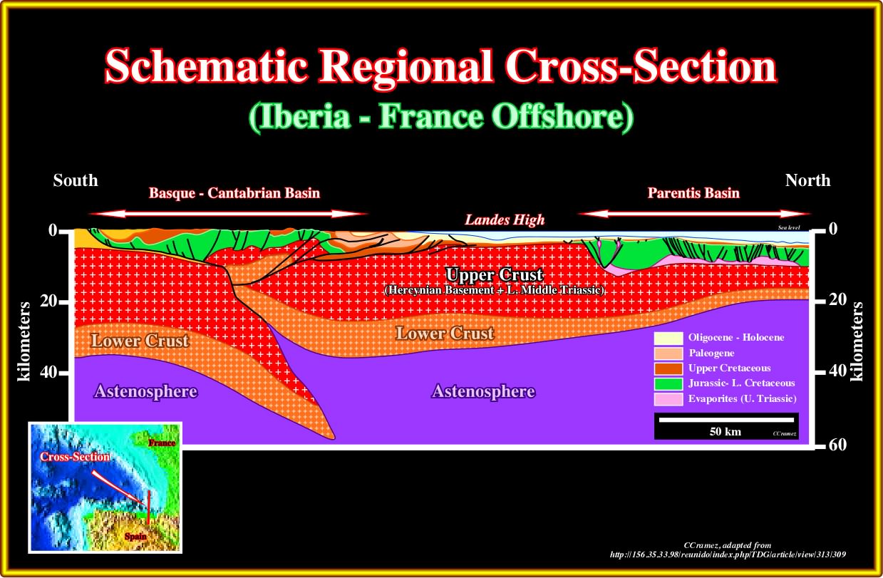
Plate A33.04- As illustrated here, the present Iberia-France offshore has nothing to see with the Atlantic-type divergent margins illustrated so far. An A-type (Ampferer) subduction zone is easily recognized under below the Basque-Cantabrian basin, as well as, the evaporitic Parentis geographic basin northward of the Landes high. An advocate of the volcanic continental margin can always advance that one cannot see the SDRs in this area because they had been sucked down by the subduction zone, what cannot be refuted by the next plate.

Plate A33.05- Taking into account this tectonic sketch, one cannot refute the conjecture that SDRs were present, as in the Armorican offshore (see next plate) but disappeared (sucked down) along the A-subduction, which associated accretion prism front is, easily, recognized on the seismic line (see later, plate A34.01).
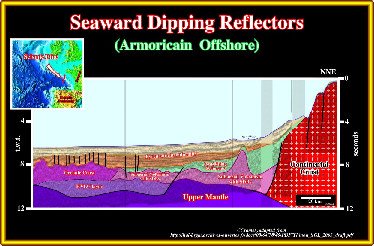
Plate A33.06- This regional seismic line, clearly, illustrate the presence of sub-aerial volcanism between the lengthened continental crust and the oceanic crust. In the northern part of the line, an younger volcanic intrusion sharply cut the sub-aerial volcanism and the post-rifting sediments. Close-ups of different seismic lines shot in this area, exhibit nice seaward dipping reflectors as illustrated in next plate.
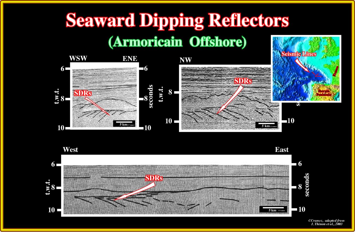
Plate A33.07- Seems to us that the recognition of seaward dipping reflectors (sub-aerial lava-flows) on these close-ups is difficult to refute, even their sub-aerial volcanic facies.
A34- Spain - France Offshore (Biscay Bay):
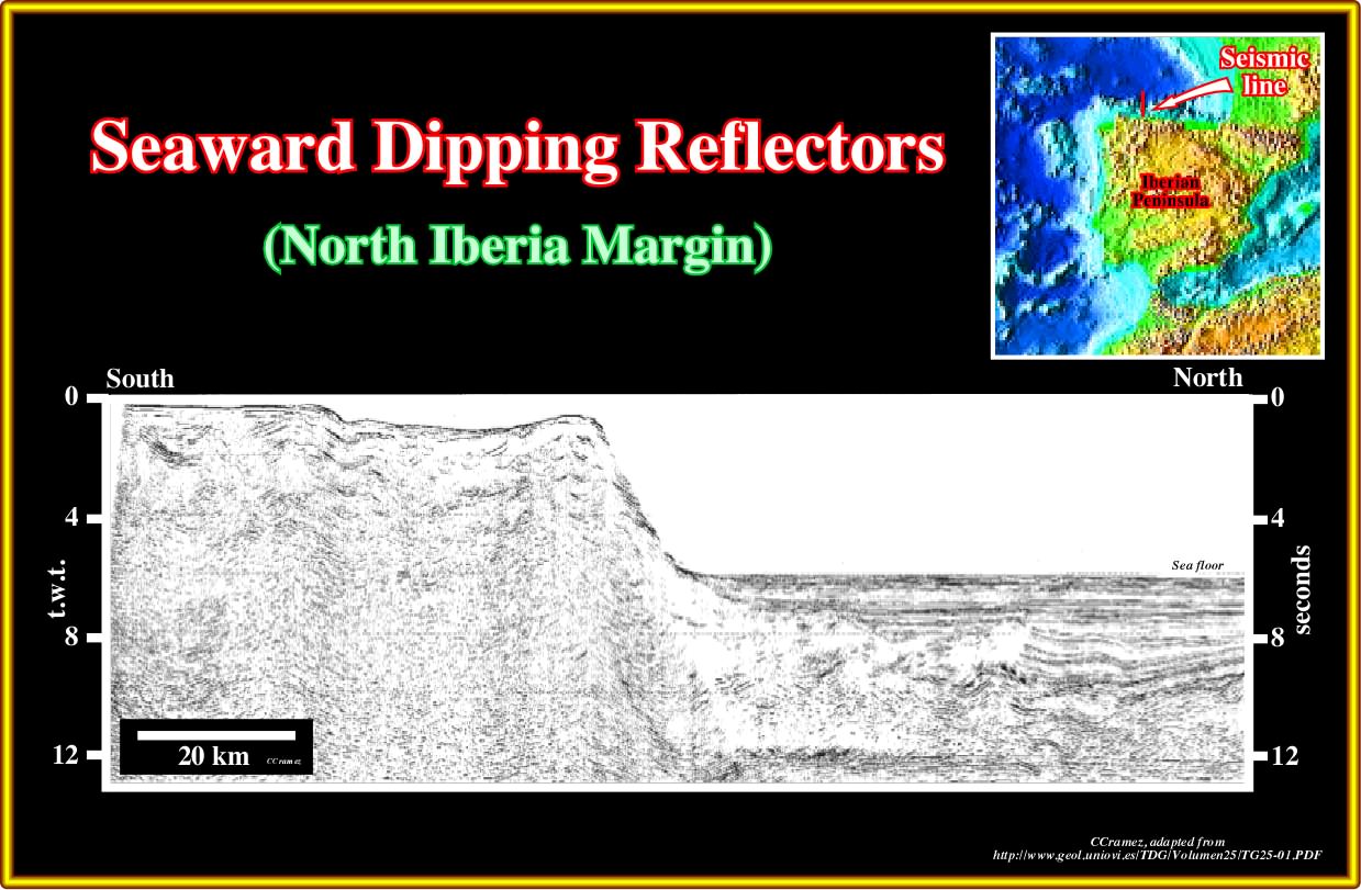
Plate A34.01- This regional seismic line illustrates the distal part of the Basque-Cantrabrian geographic basin with its accretionary prism developed by the associated A-type subduction zone, which is located southward of this line. The southern continental lithospheric plate (Iberian plate) plunges under the northern continental plate (Basque-Cantabrian geographic basin, Landes high and Parentis geographic basin).
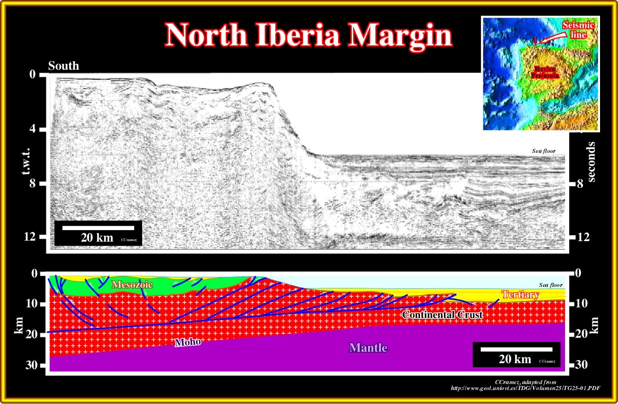
Plate A34.02- The previous seismic line is here, tentatively, interpreted in depth. The detachment plane, here schematically interpreted, and the associated reversal faults are much better visible on the close-up illustrated next.

Plate A34.03- The tentative interpretation of this line is illustrate in next plate, where the fault planes of the reverse faults are, easily, picked by the reflection terminations. Notice that on a seismic line, in the majority of the cases, there are not reflections associated with the fault planes (they can be deducted from the reflection terminations). There are few exception: (i) When the fault planes are injected by salt or volcanic material ; (ii) When the fault plane puts in juxtaposition basement and sediments ; (iii) When there is a fault gouge, etc.
Plate A34.04- On this interpretation, the pre-Upper Cretaceous sediments corresponds, probably, to rift-type basins developed during the lengthening of Pangea super-continent or sub-aerial lava-flows (taking into account the internal configuration). Scientifically speaking, in the absence of wells one cannot exclude or refute a volcanic facies.
A35- Spain Offshore (Galicia):
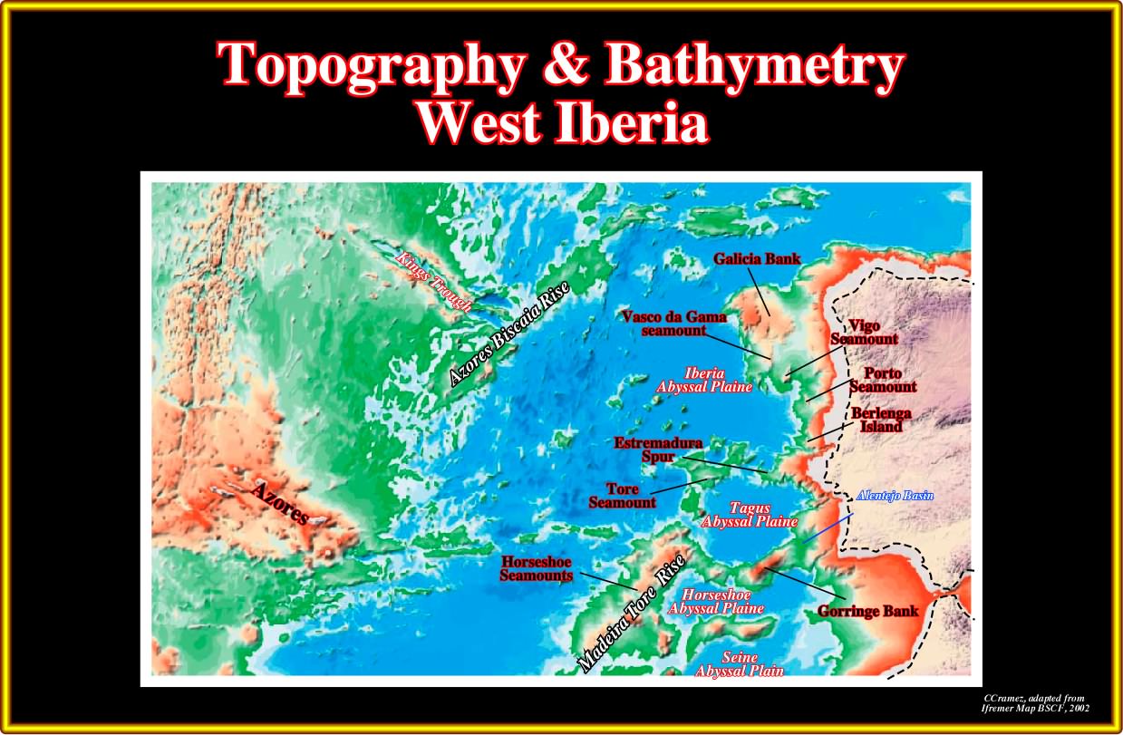
Plate A35.01- In Galicia offshore, i.e., in the area where several geoscientists advanced the conjecture that the Atlantic margins were non-volcanic, before all, it is important to recognize, from North to South : Galicia Bank, Vasco da Gama - Vigo - Porto seamount,s Iberia abyssal plain, Estremadura Spur, Tore seamount, Tagus abyssal plain, Gorringe Bank, Horseshoe abyssal plain and Madeira Tore Rise. The Mid-Oceanic ridge, Azores islands, Azores Biscay rise and Kings through are also, easily, recognized. It is important to notice that the morphology of western Iberia bathymetry does not fits well with the bathymetry of offshore Newfoundland.
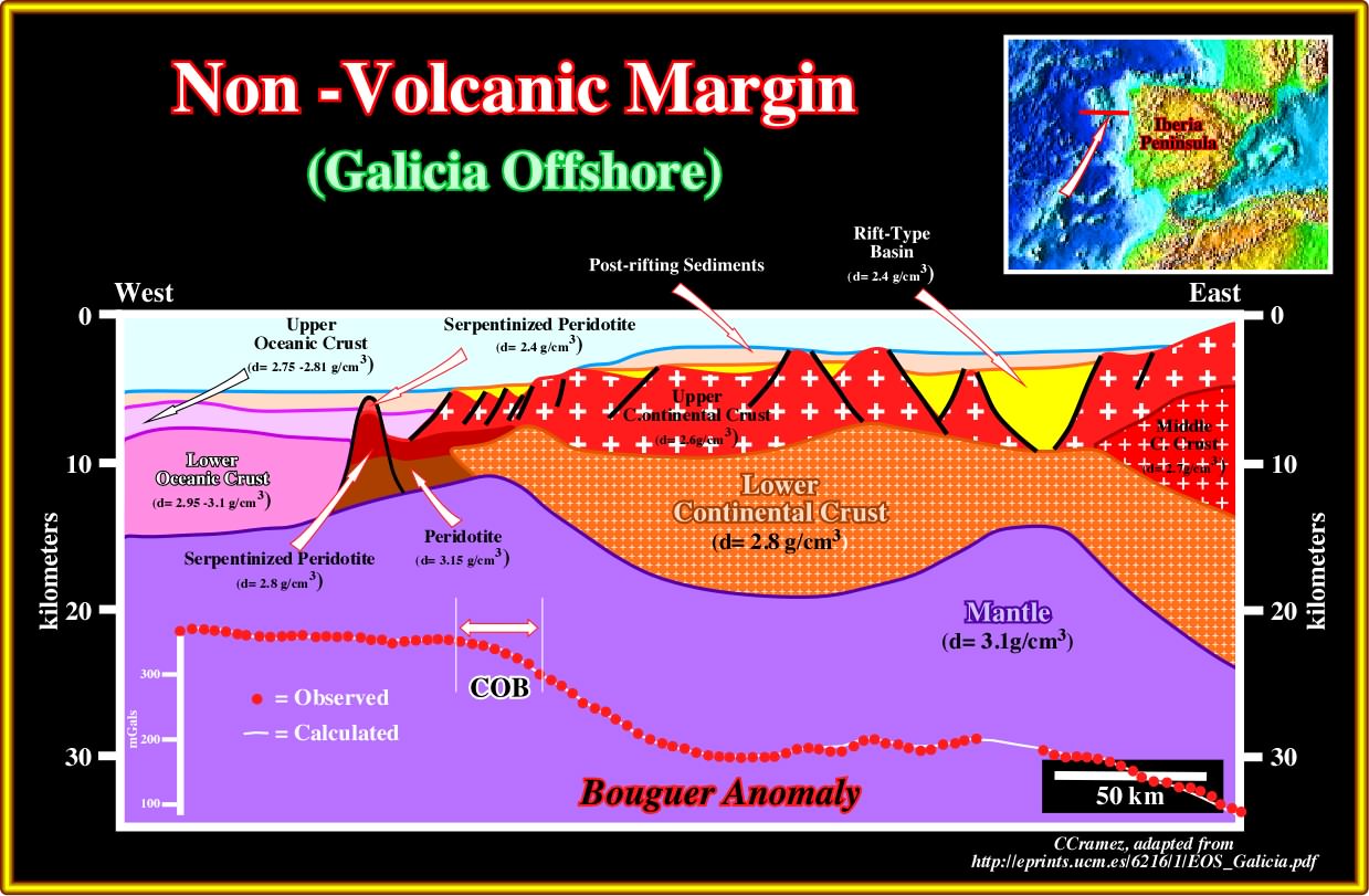
Plate A35.01- This geological cross-section depicts, more or less, the geological model adopted by the advocates of the non-volcanic divergent margin to explain the observed data: (i) An important thinning of the continental crust with development of the rift-types (the distal rift-type basins are starved, that is to say, partially, filled by deep water sediments, which is quite an anomalous for rift-type ; (ii) The limit between the continental crust and oceanic crust is marked by serpentinized peridotites, which development and formation nobody understand. The continental-oceanic boundary is relatively well corroborated by the Bogus anomaly, but corroboration means just that the gravimetry does not refute the model, which can, eventually, be refuted by new data.
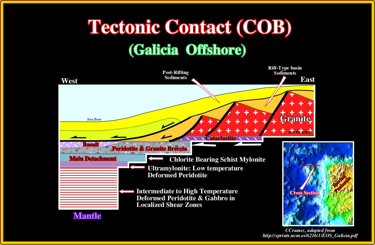
Plate A35.02- Several geoscientists based on the well's results, drilled in the area, recognized, above the detachment surface, peridotite and granite breccia, basalt and, at the base of the distal continental crust cataclastie. The main detachment surface is underline by the presence of chlorite bearing schist mylonite. Below them, ultra-mylonites (low temperature) and deformed peridotites. Below, intermediate to high temperature deformed peridotite and gabbro are recognized in local shear zones.
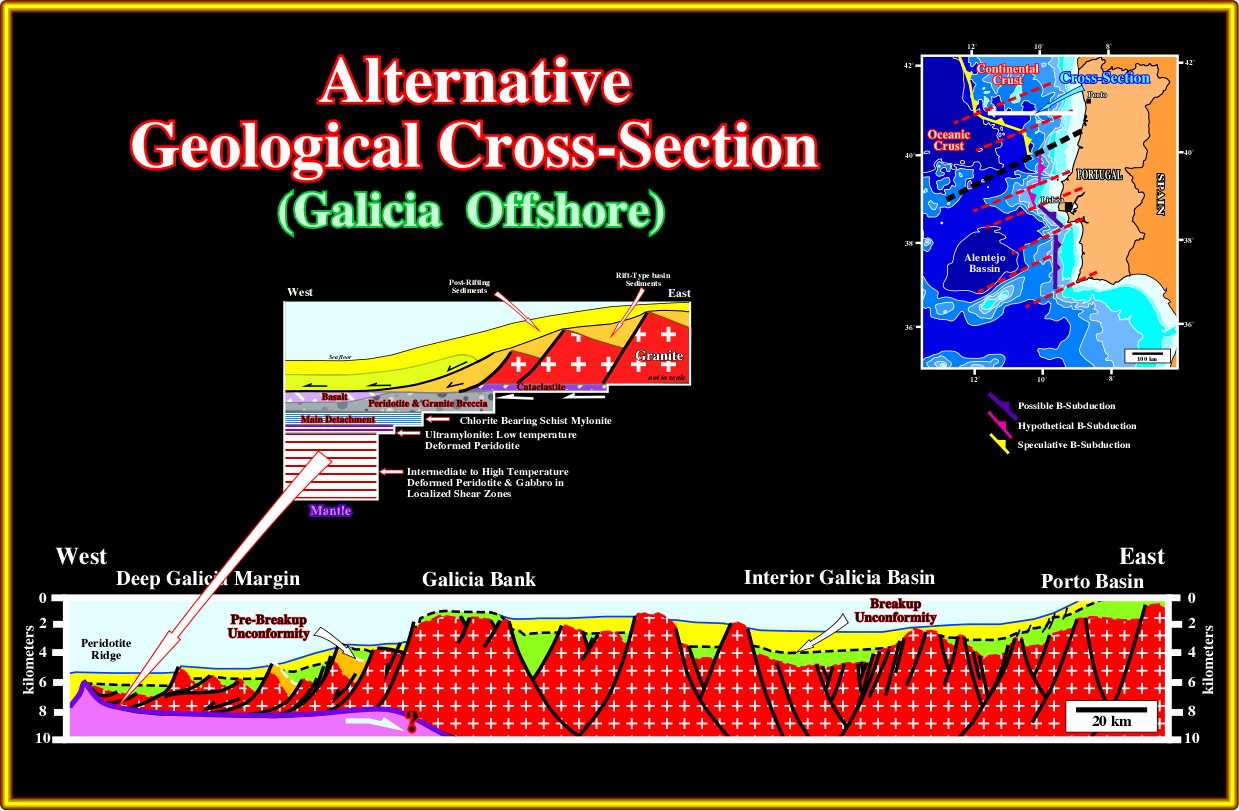
Plate A35.03- An alternative to the previous model is consider that the detachment surface correspond in fact to an incipient B-type subduction zones, as it is suggested by several Portuguese geoscientists. Such an alternative, which must be boldly tested, has at least the advantage to explain the compressional earthquake occurring in the offshore and onshore of Portugal. If such alternative is not refuted, the Galicia-West Portugal margin cannot any more be considered as an Atlantic-type divergent margin, but rather as a convergent margin. Said in another way, the SDRs were there must were suck down along the subduction zone.
A36- Portugal Offshore (Lusitania & Alentejo Geographic Basins):

Plate A36.01- A simple glance at this geological map points out that the Lusitania geographic basin has been inverted. Jurassic sediments outcrop in the central and topographic higher parts of the basin, while younger Cretaceous sediments outcrop in the border and lower areas. Such a tectonic inversion, which is quite recent, is not refuted by seismic data. As a working hypothesis, in the Galicia-West Portugal, the COB can be proposed as depicted : (i) A lengthening of the lithosphere and its breakup under a significant water depth, probably, without SDRs (volcanic material cannot flow under the water, northward of the major fracture zone, which limits northward a speculative subduction zone. Southward of the major fracture zone, the rifting and breakup took place in a non-marine environment, eventually with formation of the SDRs that partially or totally were sucked along the B-subduction zone. In Alentejo basin, due to the amplitude of the compression, the B-subduction zone is considered as possible.
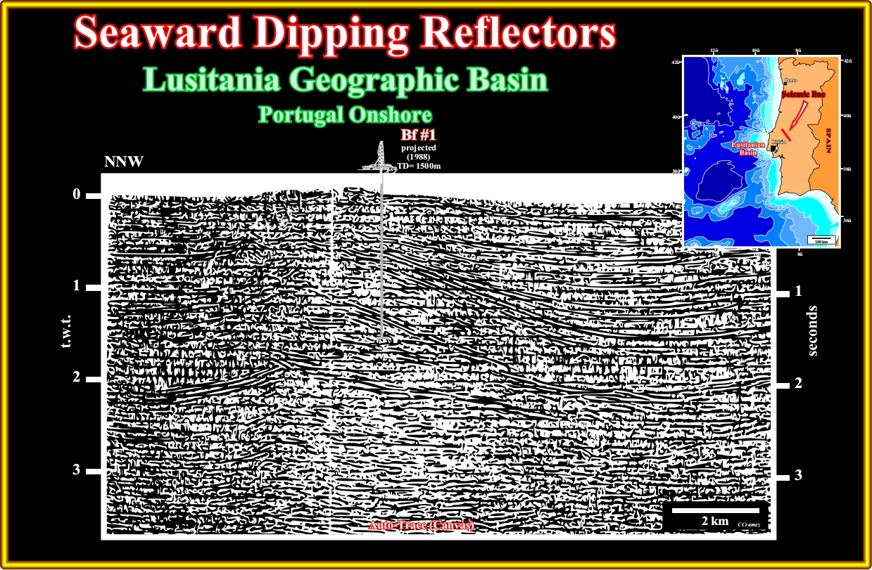
Plate A36.02- This seismic line, clearly, illustrates the tectonic inversion in the Portugal onshore. A compressional tectonic regime, probably, developed in association with the hypothetical B-type subduction assumed in Portugal offshore, is corroborated in all onshore seismic lines of the Lusitanian geographic basin.
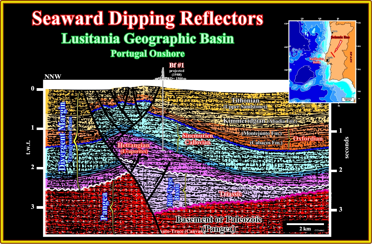
Plate A36.03- Taking into account the disconformities and thickness variations induced by salt tectonics, particularly, by compensatory subsidence (often ignored by the geoscientists working in the field), the rift-type basins and overlying margin sediments have been shortened, probably since Upper Miocene-Pliocene, by buckling and reactivation, in reverse movement, of the preexistent normal fault bordering the rift type-basins. The responsible compressional tectonic regime can quite well be induced by the plunging of the oceanic crust under the continental crust. The probably absence of SDRs in the offshore seismic lines can always be explained by sucking down of the sediments covering the plunging lithospheric plate.
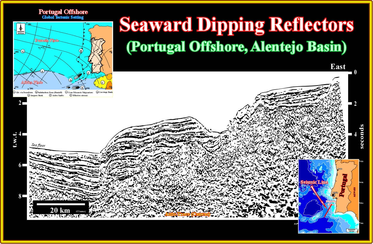
Plate A36.04- The major compressional tectonic regime responsible by the shortening and uplift of the sediments of this seismic line (significant reverse fault on the western part) corroborates the hypothesis, advanced by few Portuguese geologists, that the southern part of the west offshore of Portugal is not anymore an Atlantic-type divergent margin, but a convergent margin. The second part of the Wilson cycle is, already, present, at least, in SW offshore of Iberia.
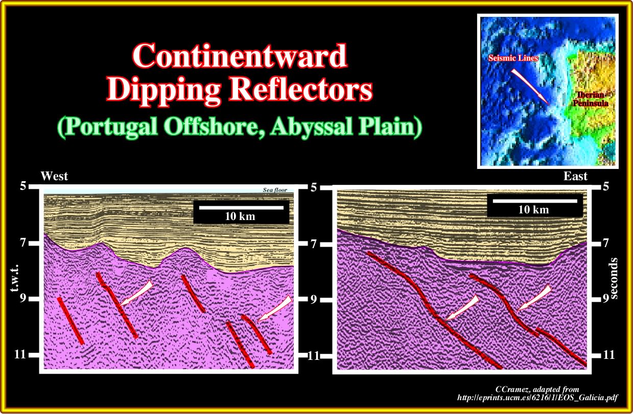
Plate A36.05- The SDRs visible on the seismic lines of the abyssal plain of the Portugal offshore are, often, used, by the advocates of volcanic Atlantic-type duvergent margins, to corroborate their model.
to continue press
next

Send E-mails to carloscramez@gmail.com or to carlos.cramez@bluewin.ch with comments and suggestions to improve these geological notes.
Copyright © 2012 Ccramez, Switzerland
Last updated: July, 2014