
Part II: Salt Tectonics Interpretation Workshop associated with Salt
B) Gulf of Mexico Regional Seismic Lines
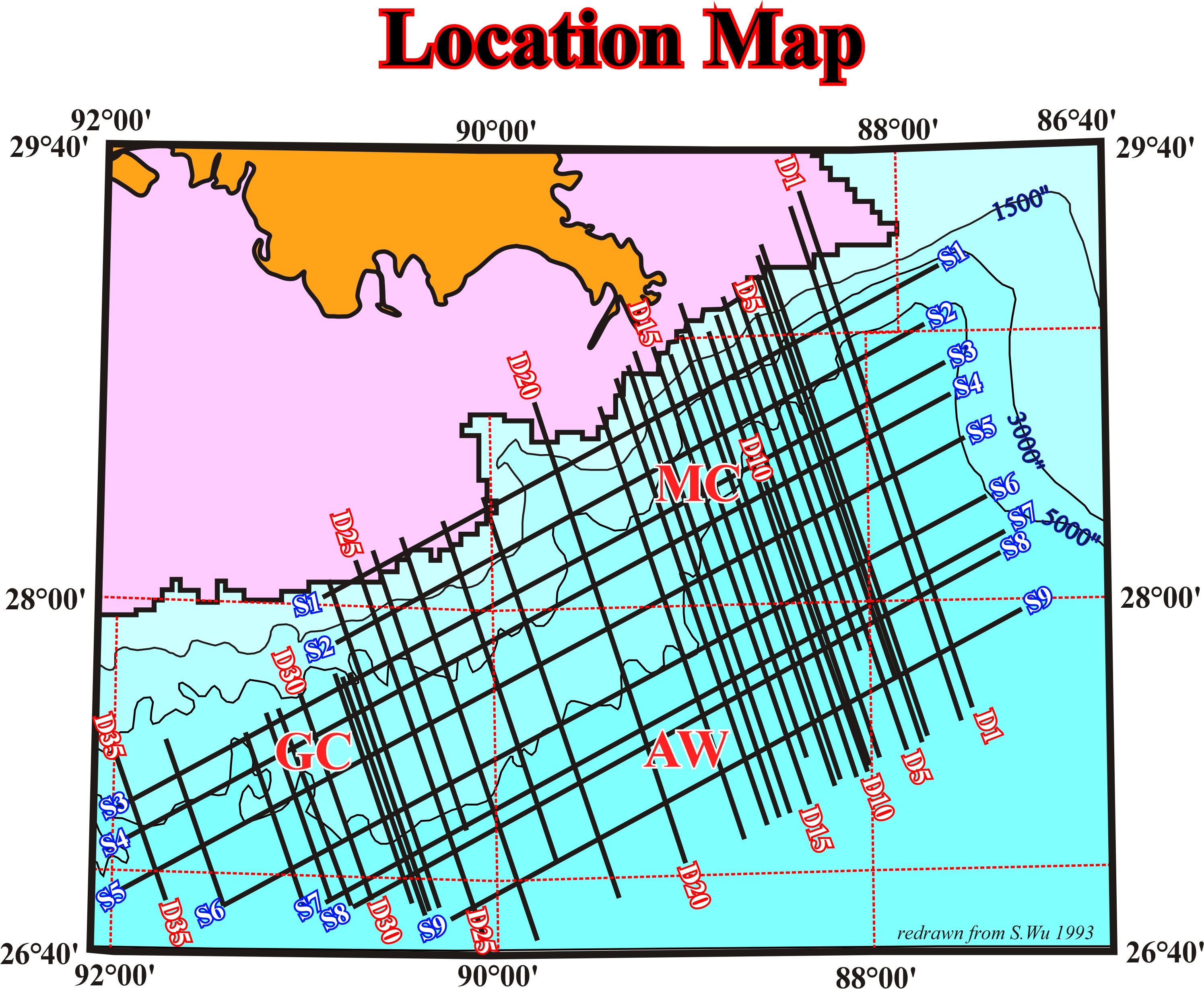
Fig. 329 - This map illustrates the location of few regional seismic lines shot south of the Mississippi delta. Tentative geological interpretations of manual autotraces are proposed shown below. Make some comments are criticize the proposed tentative interpretations.
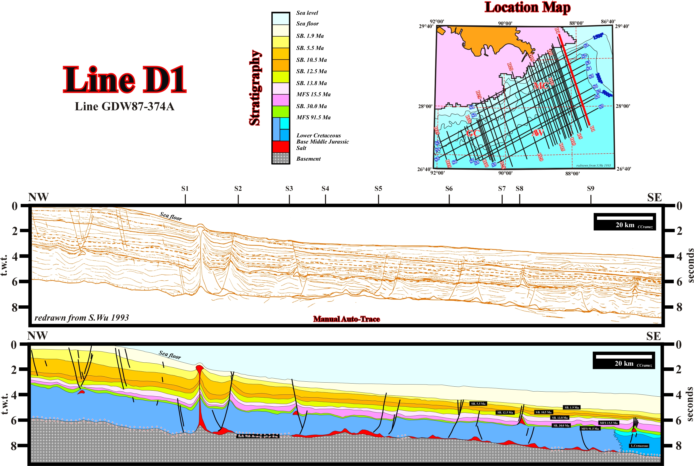
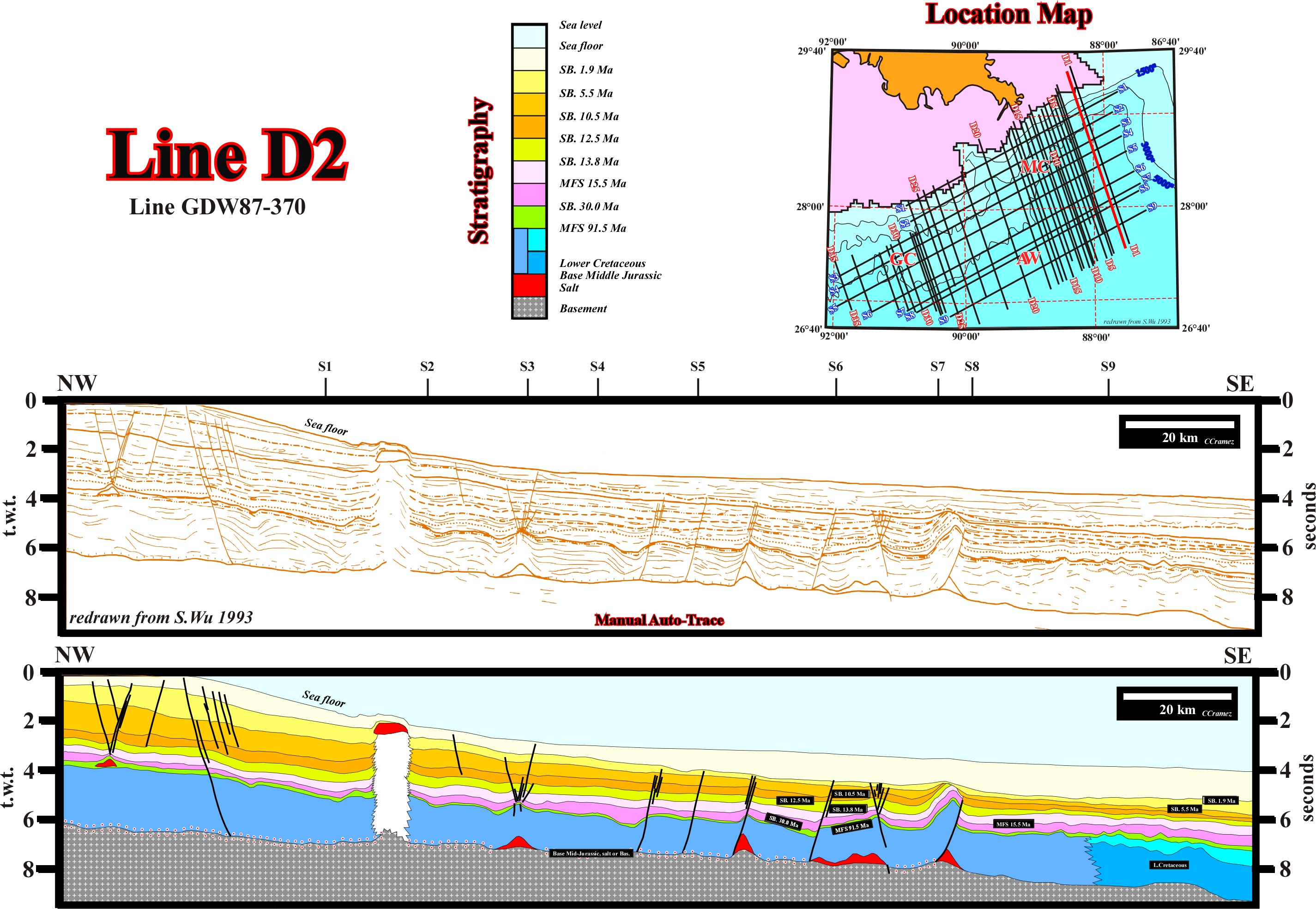
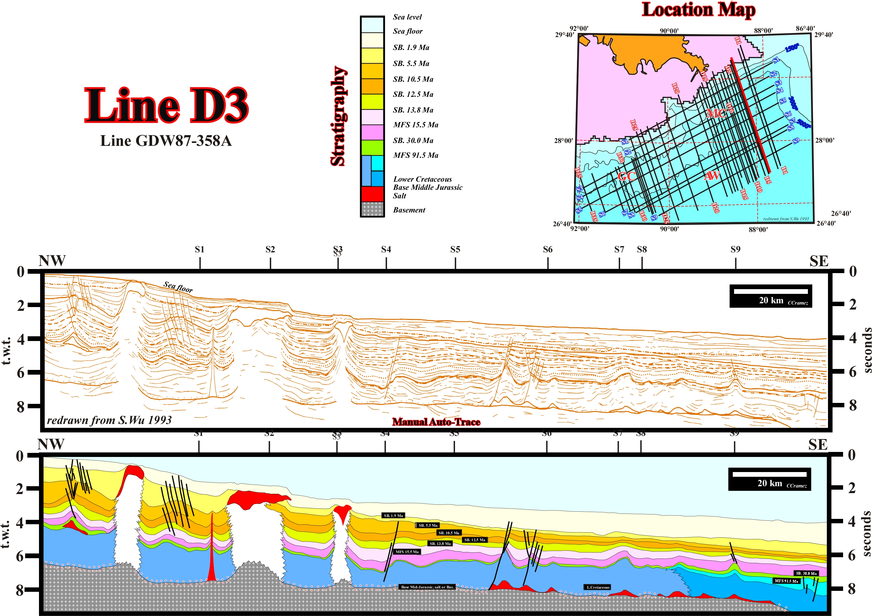

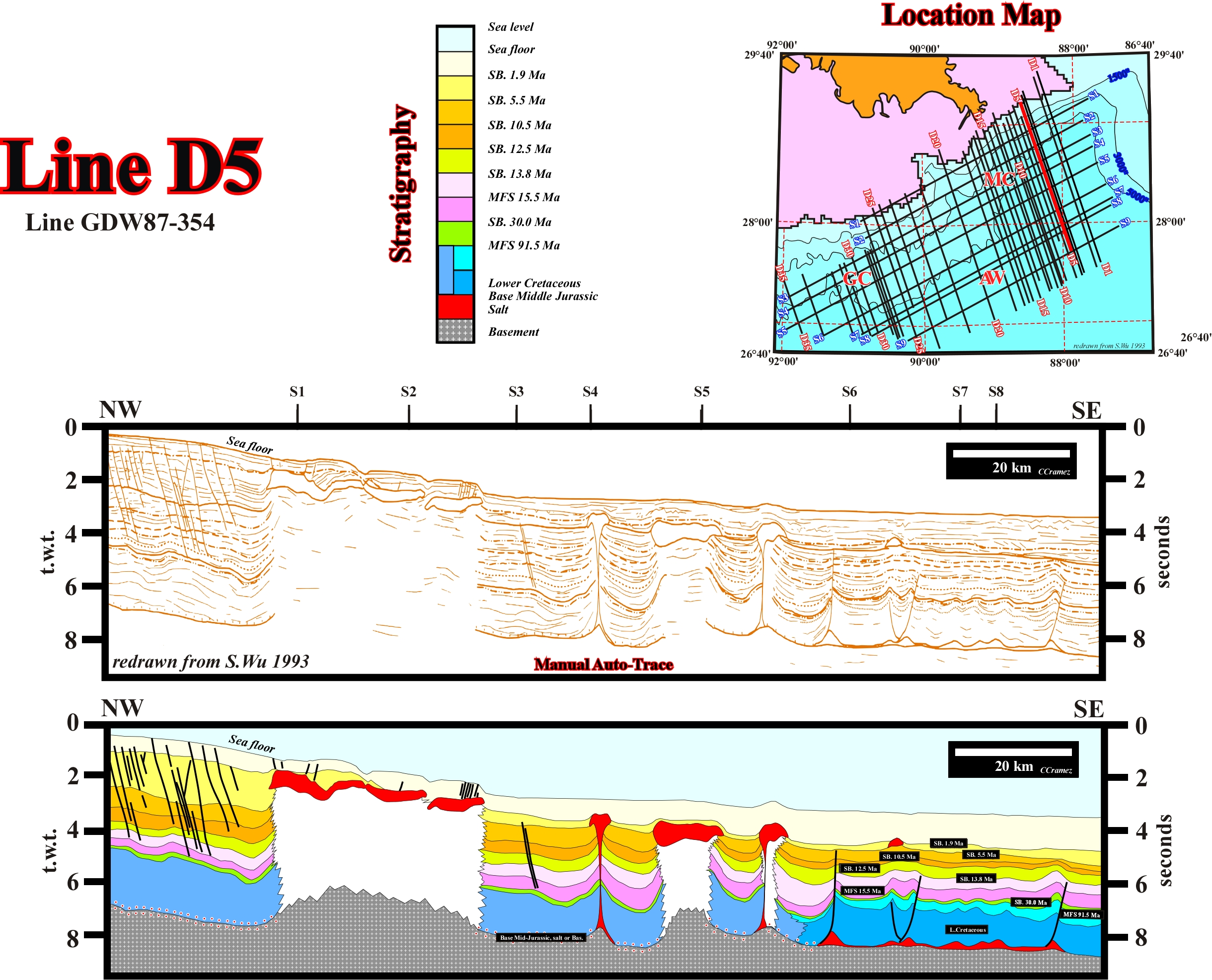
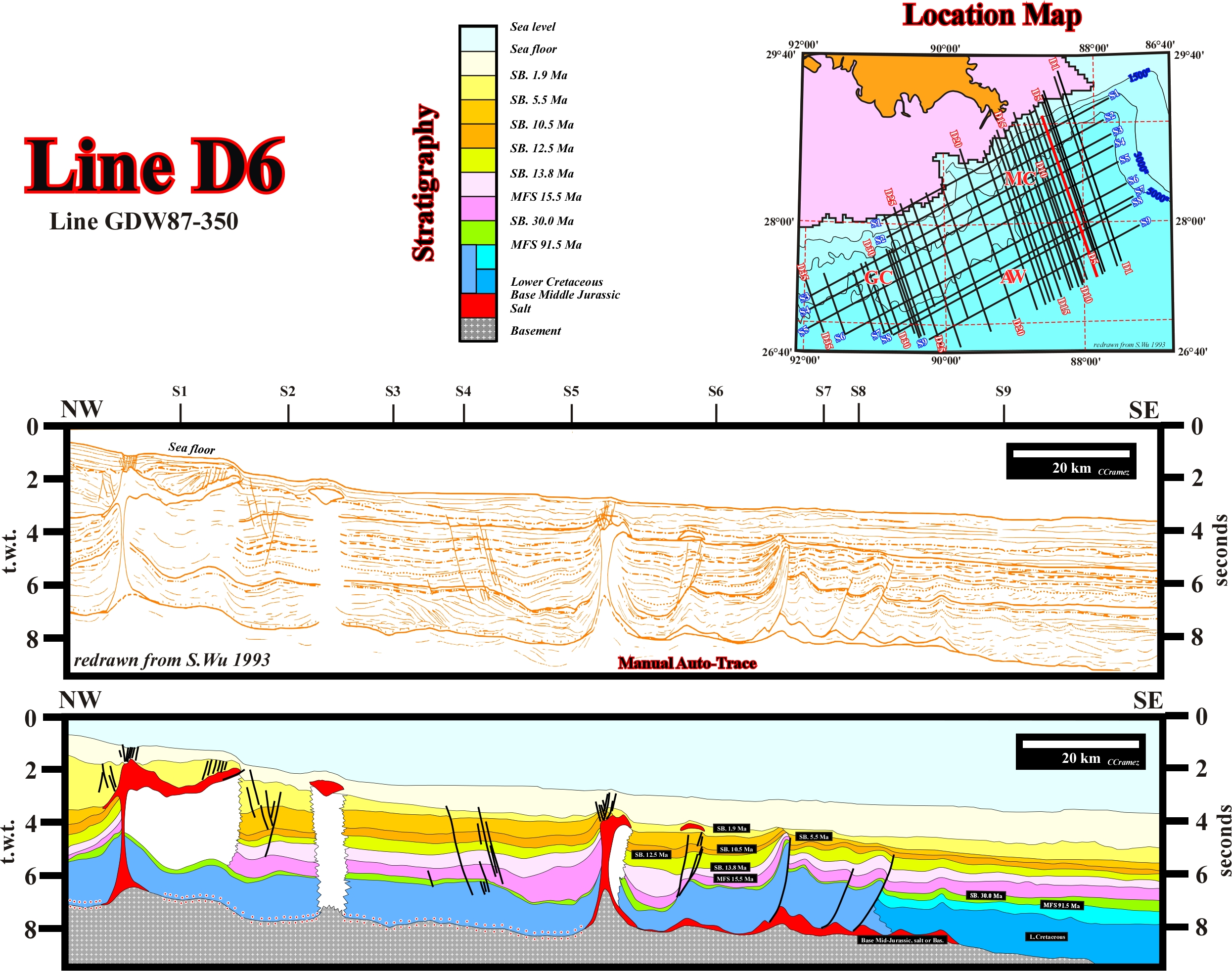
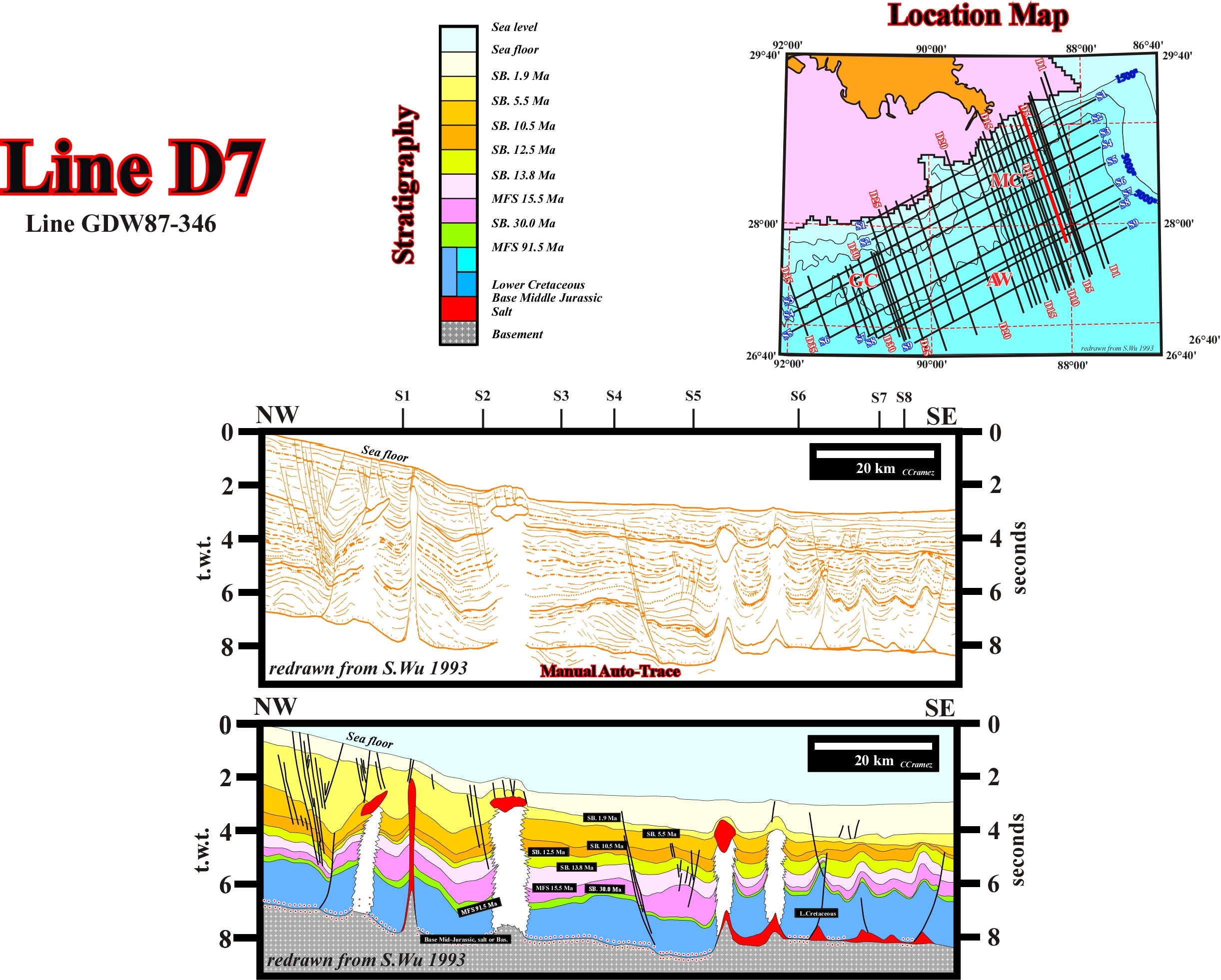
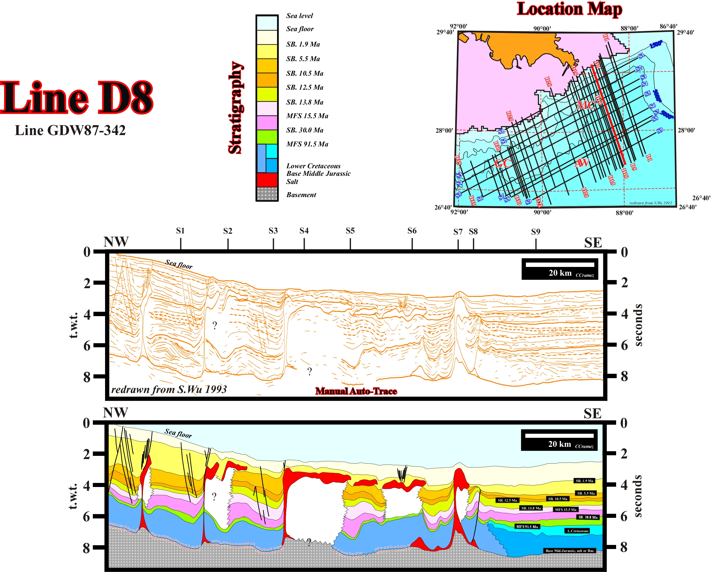
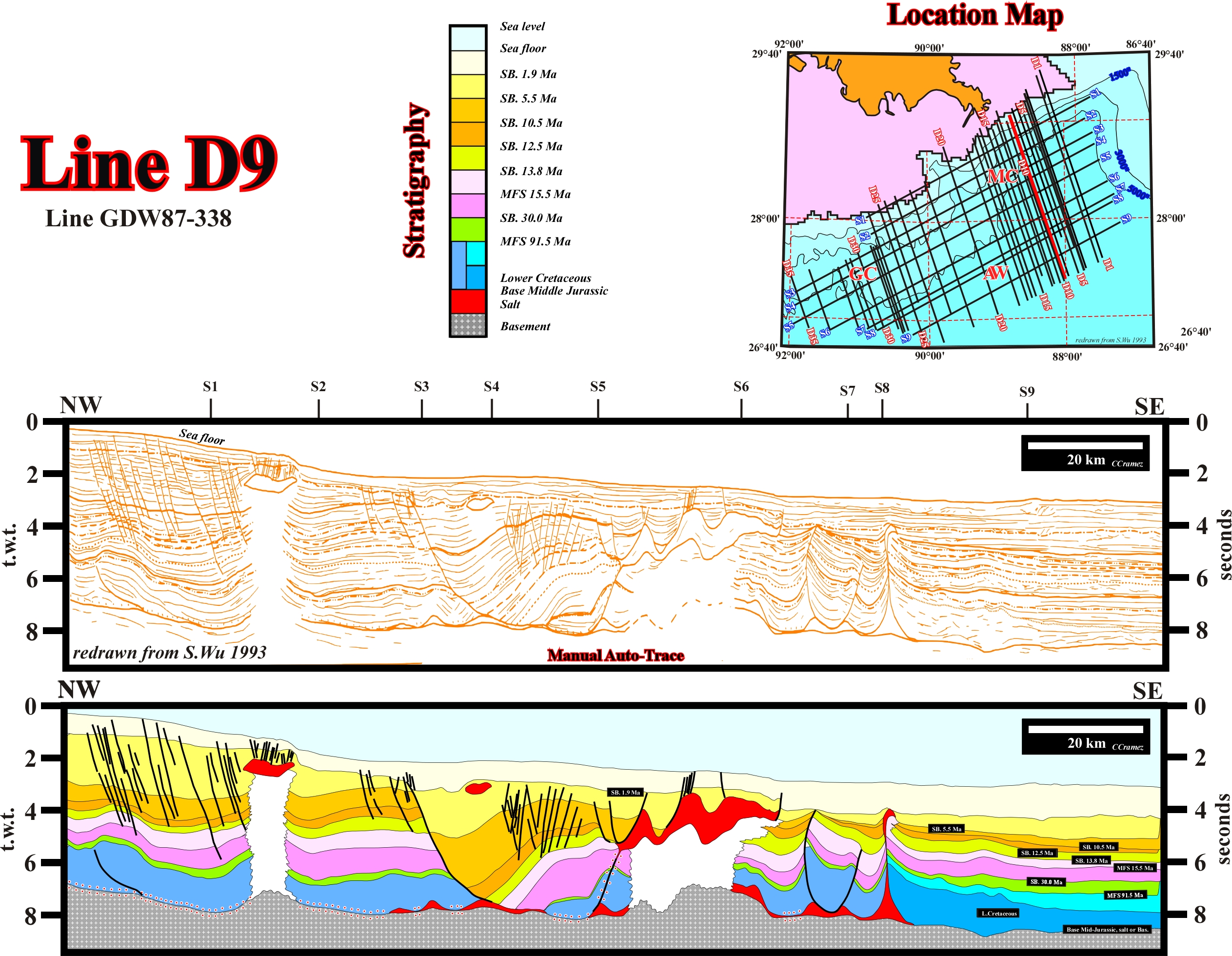
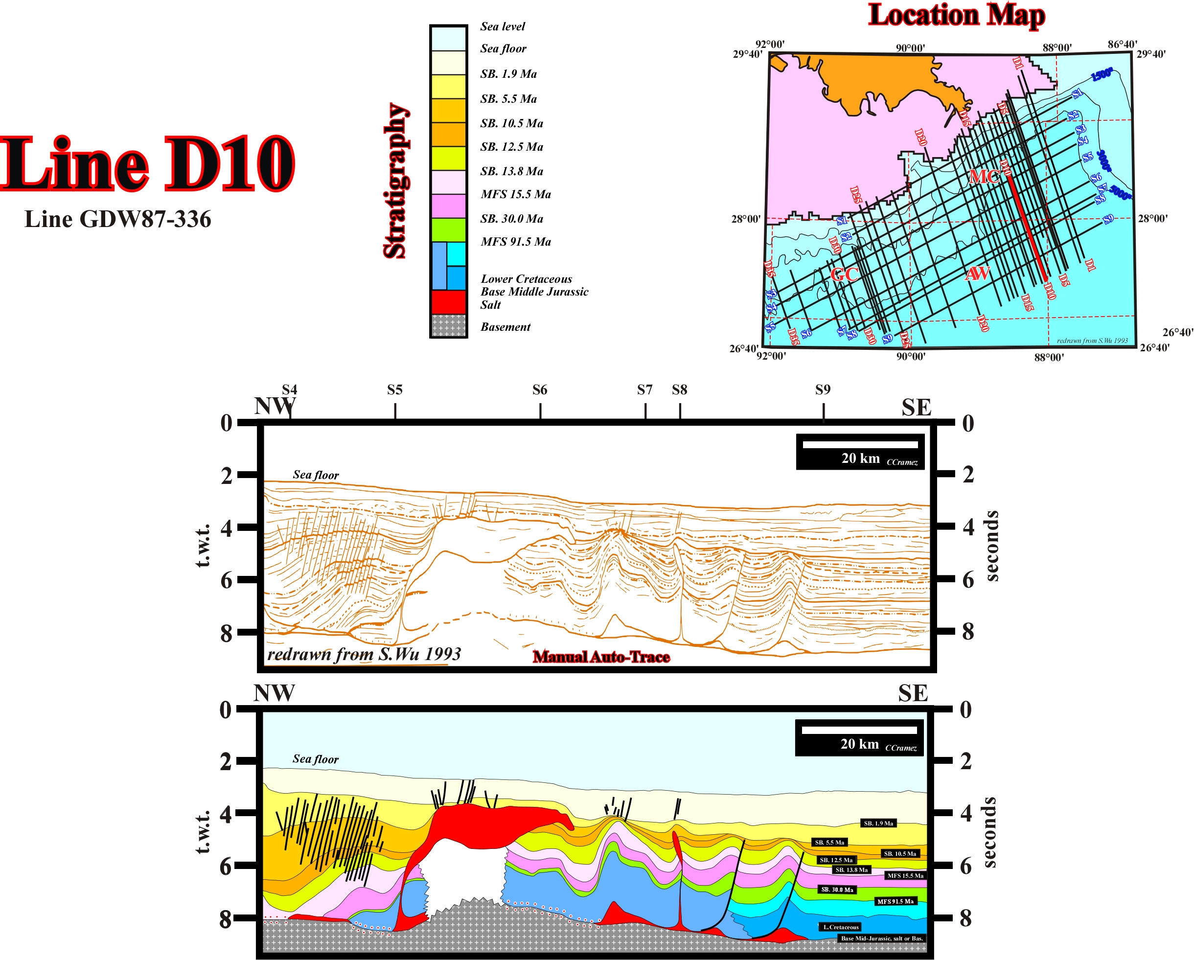
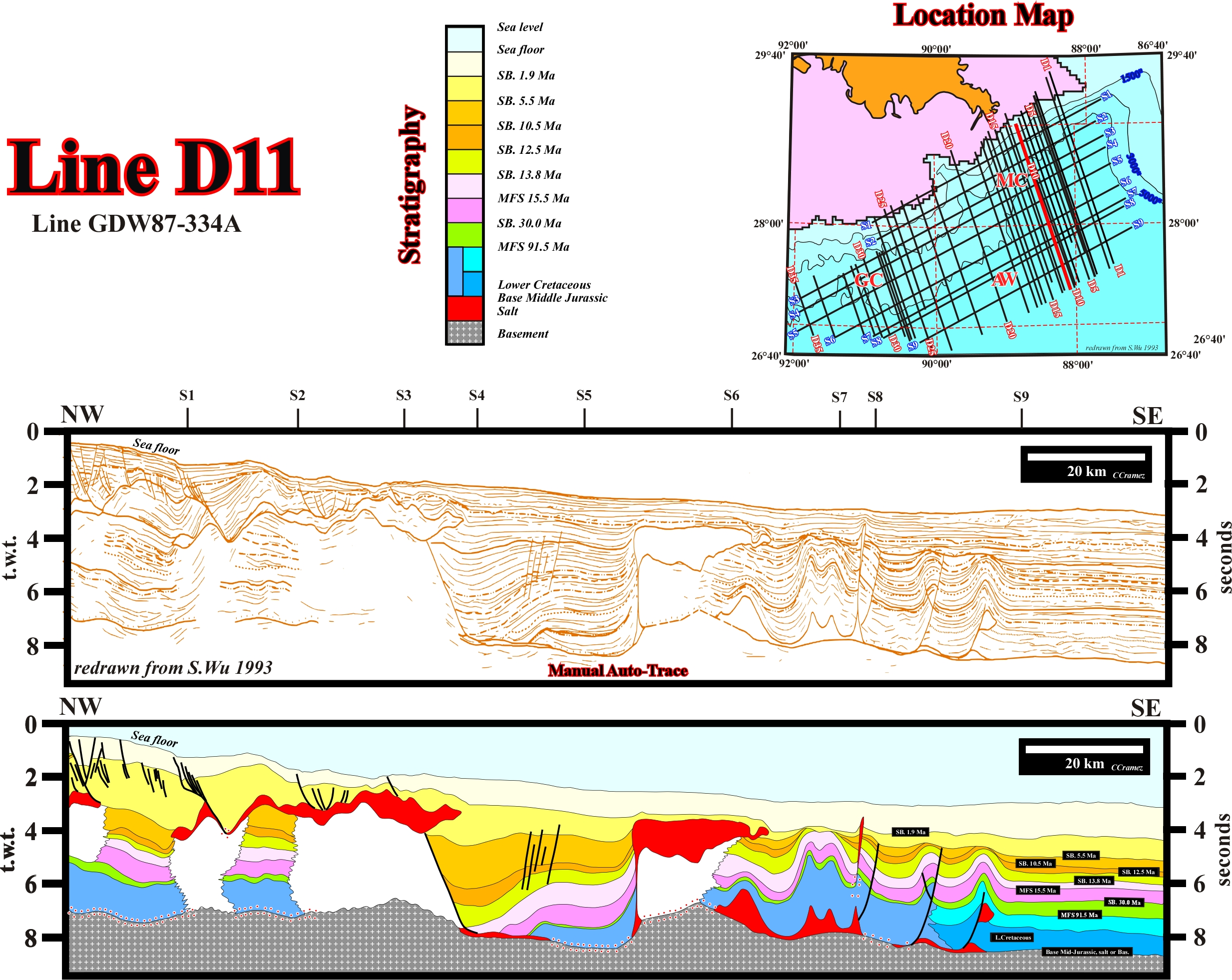
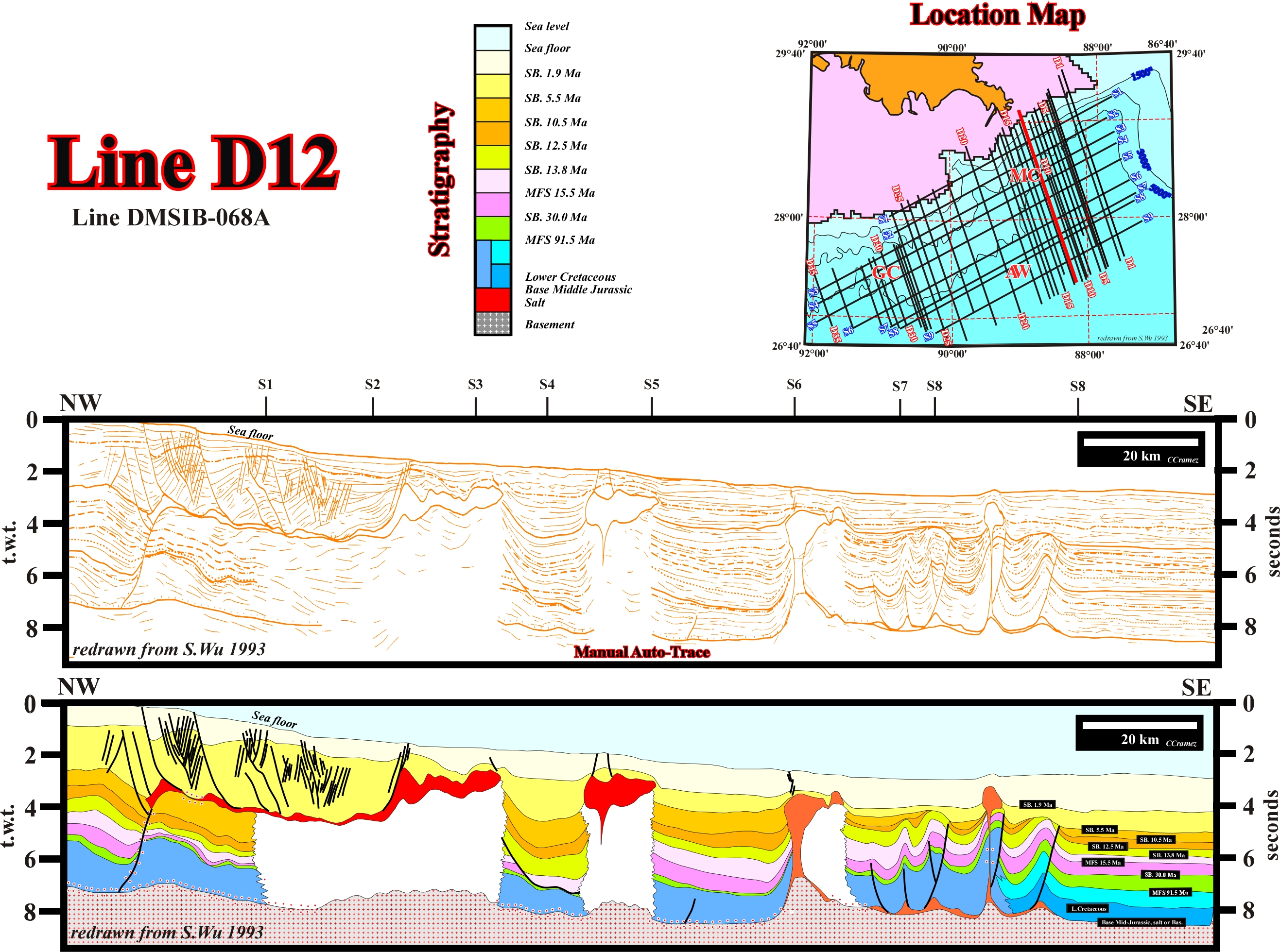
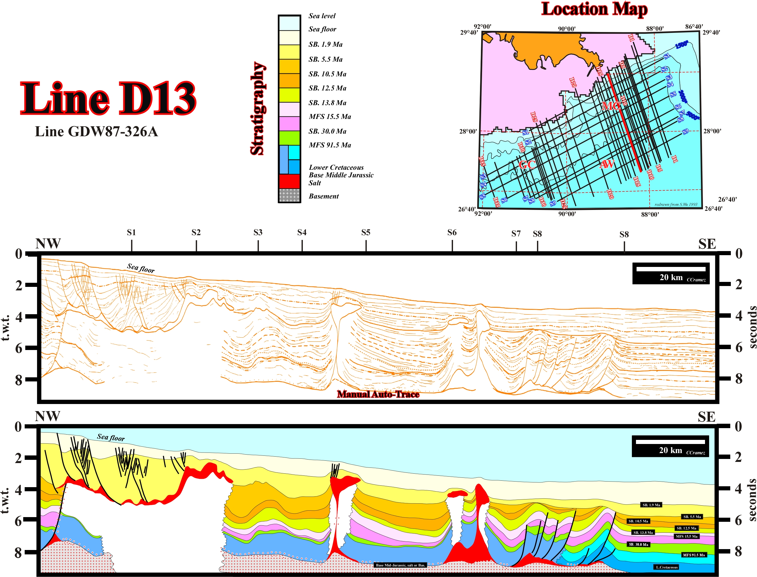
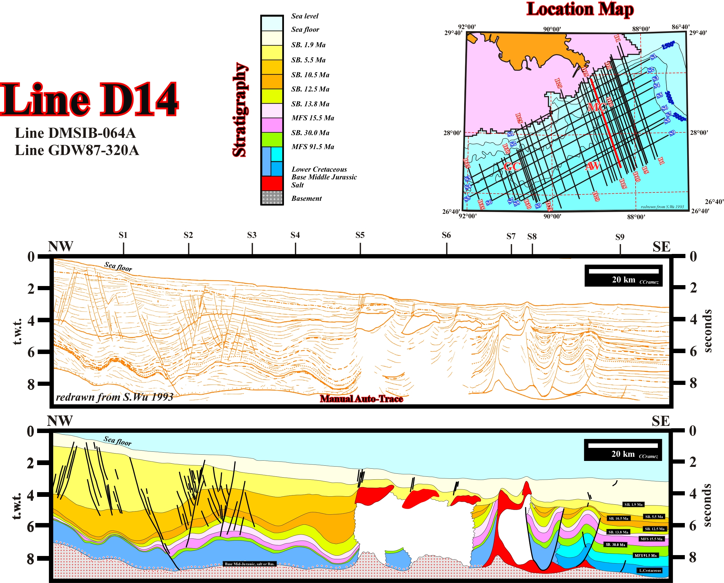
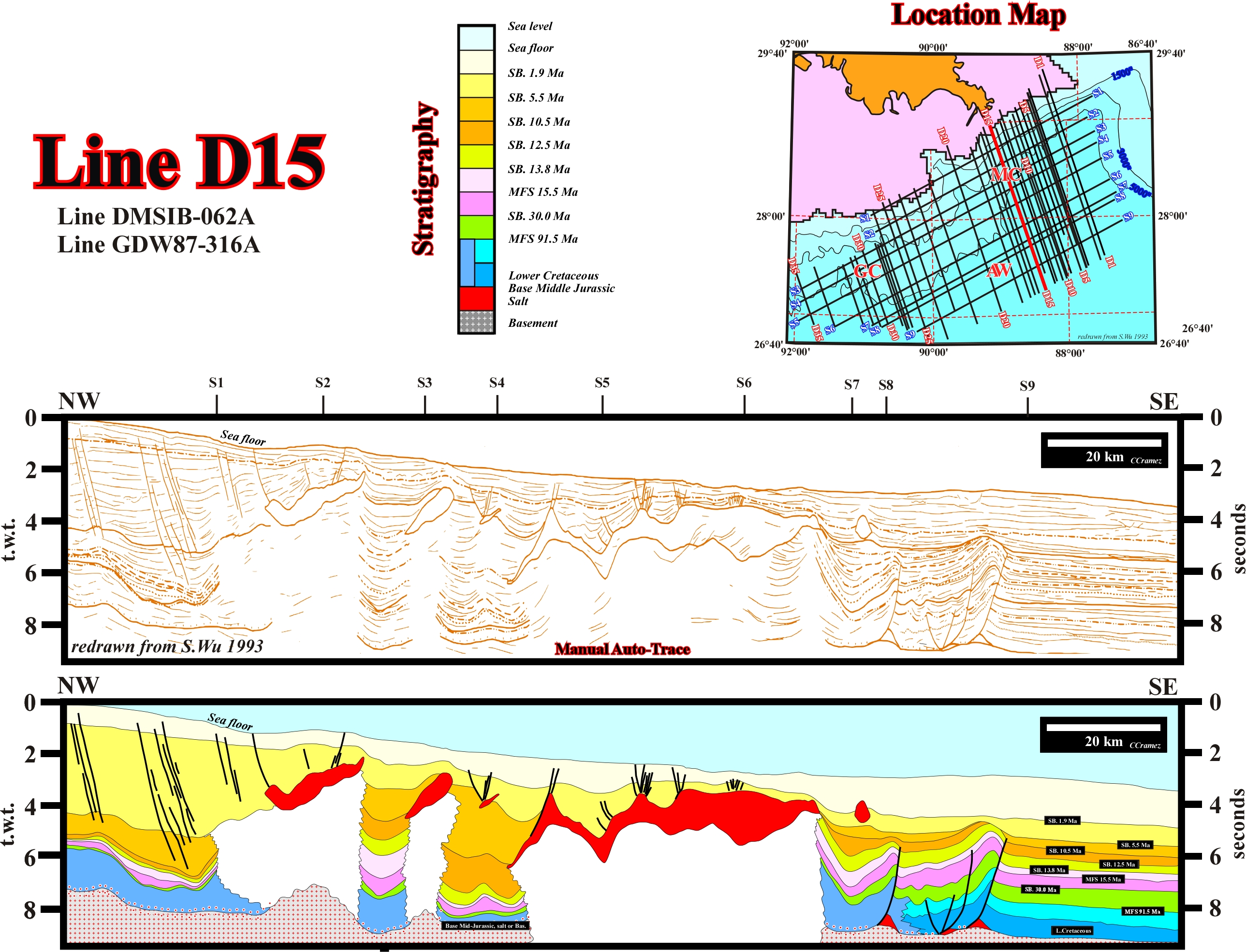
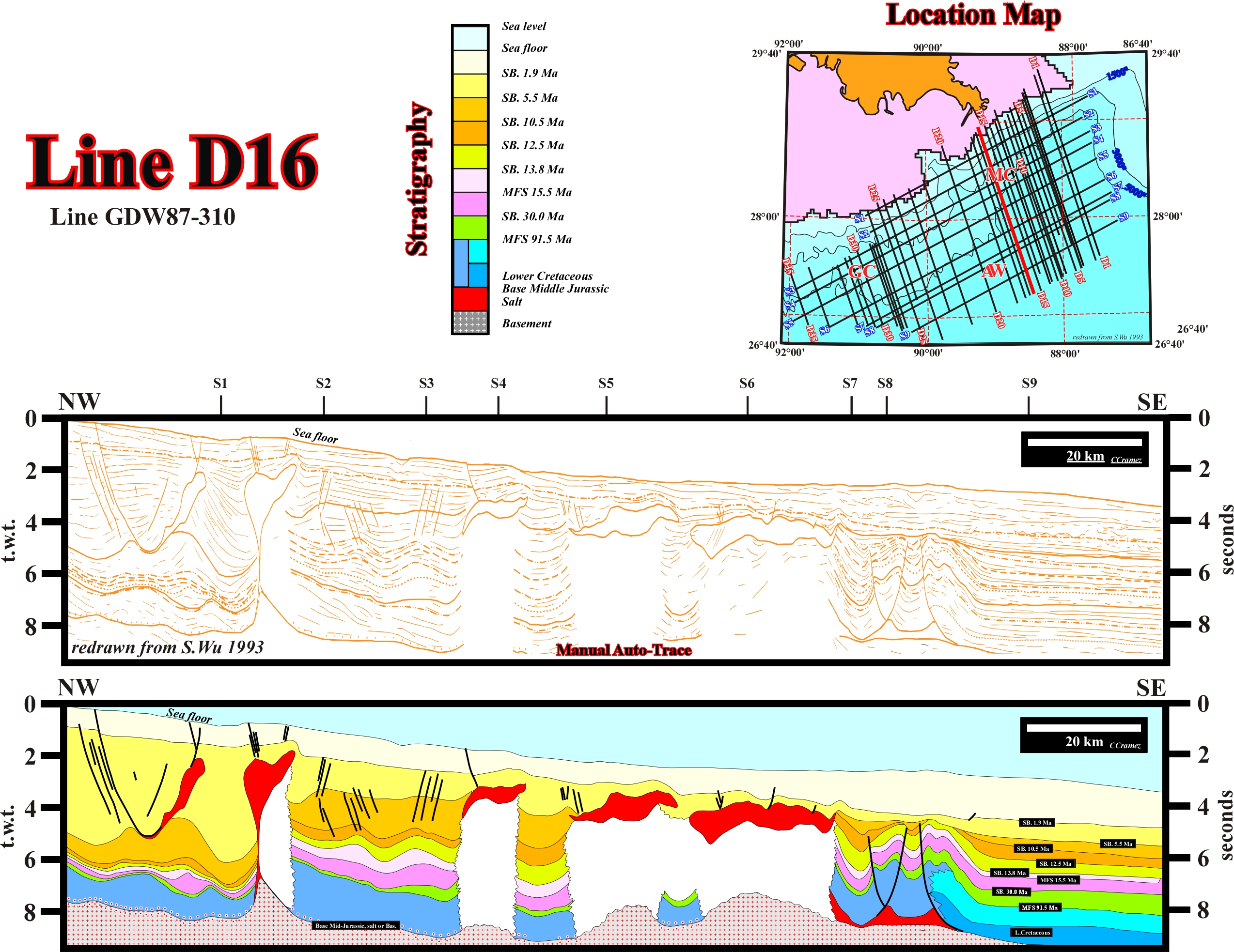
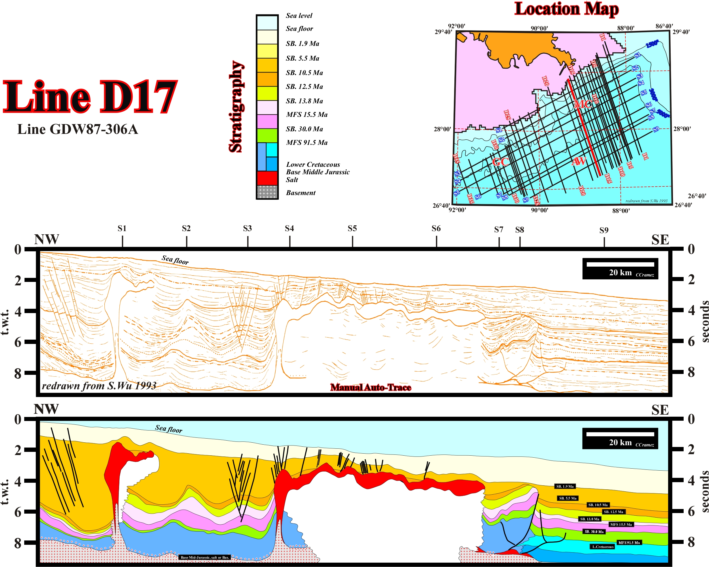
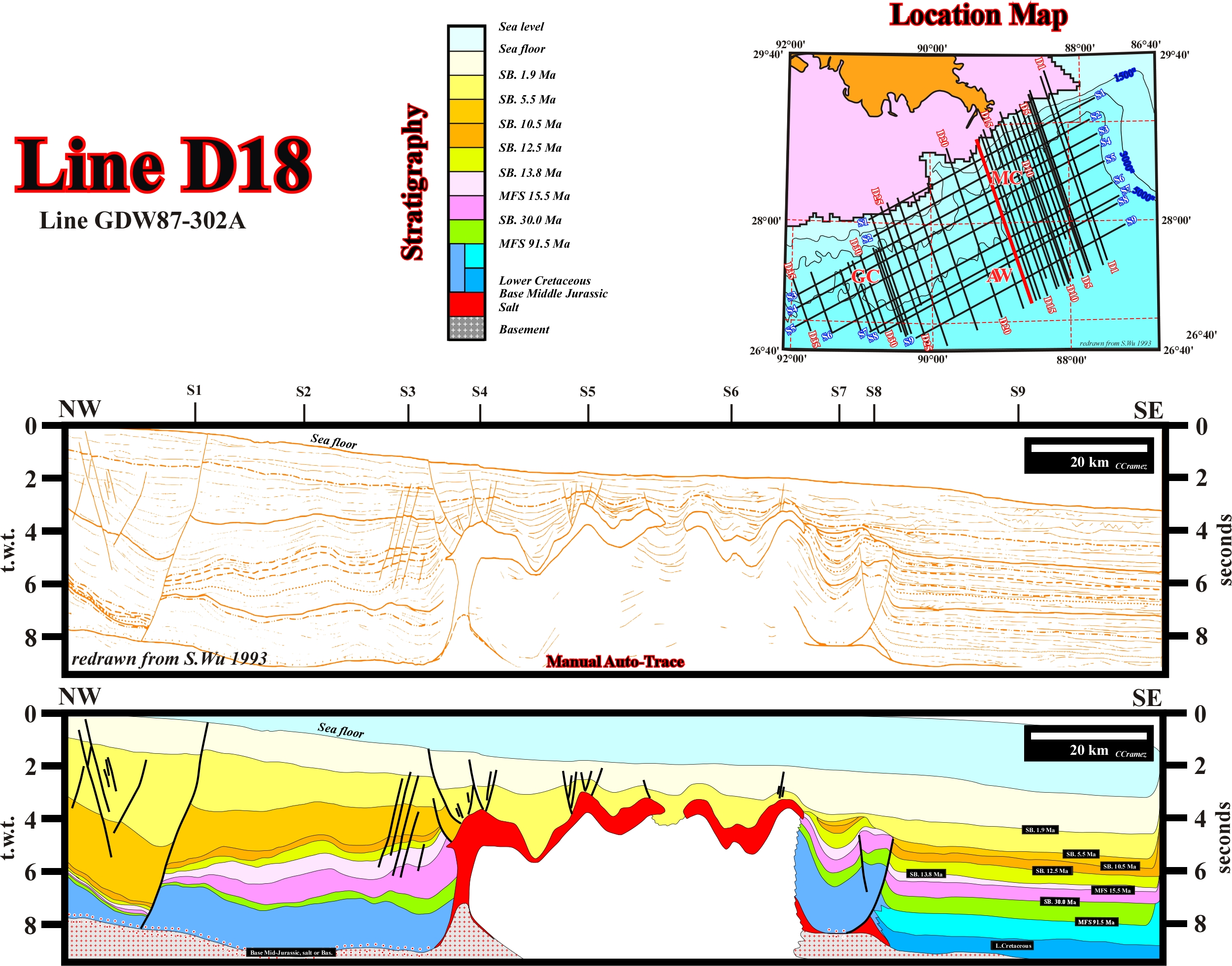
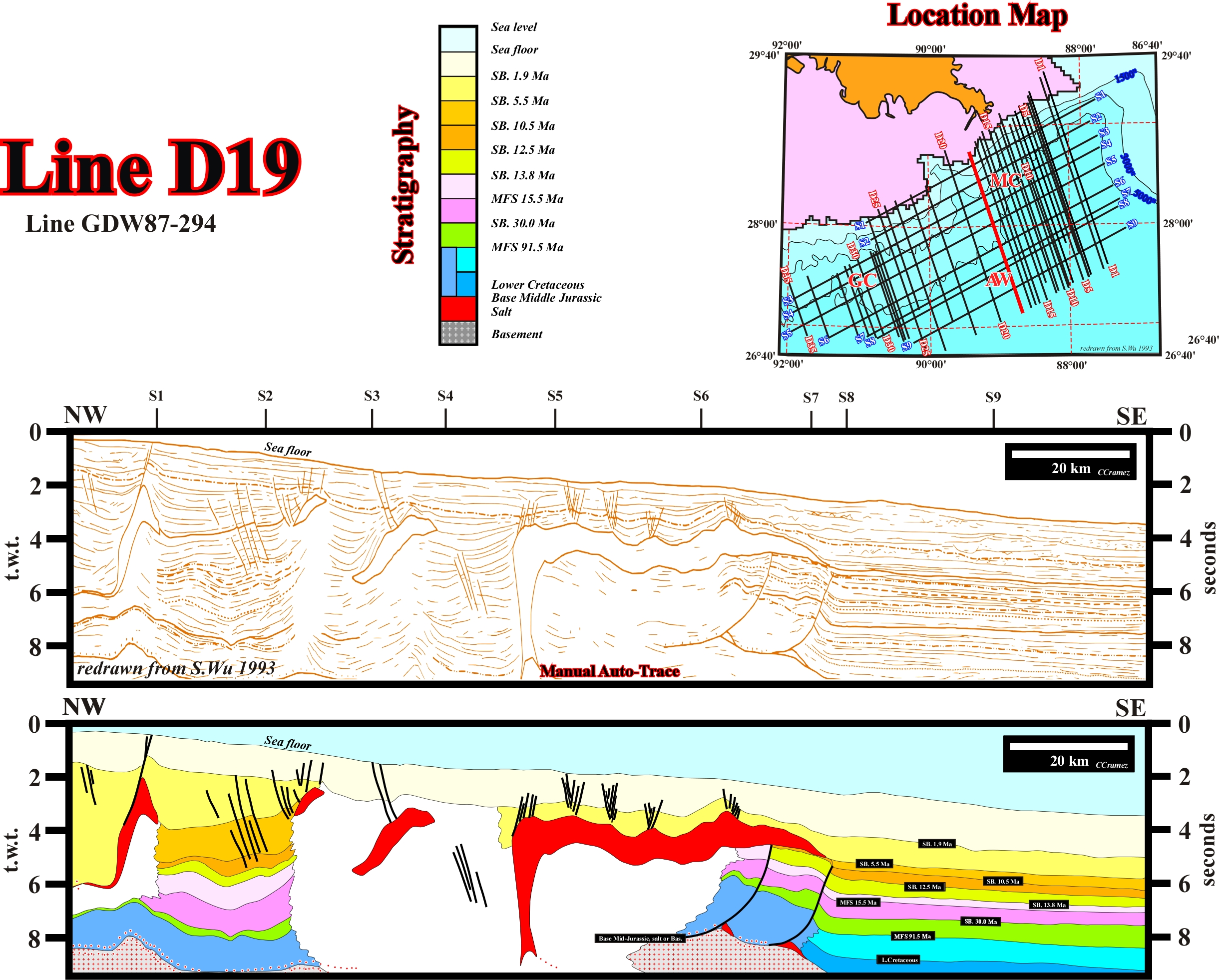
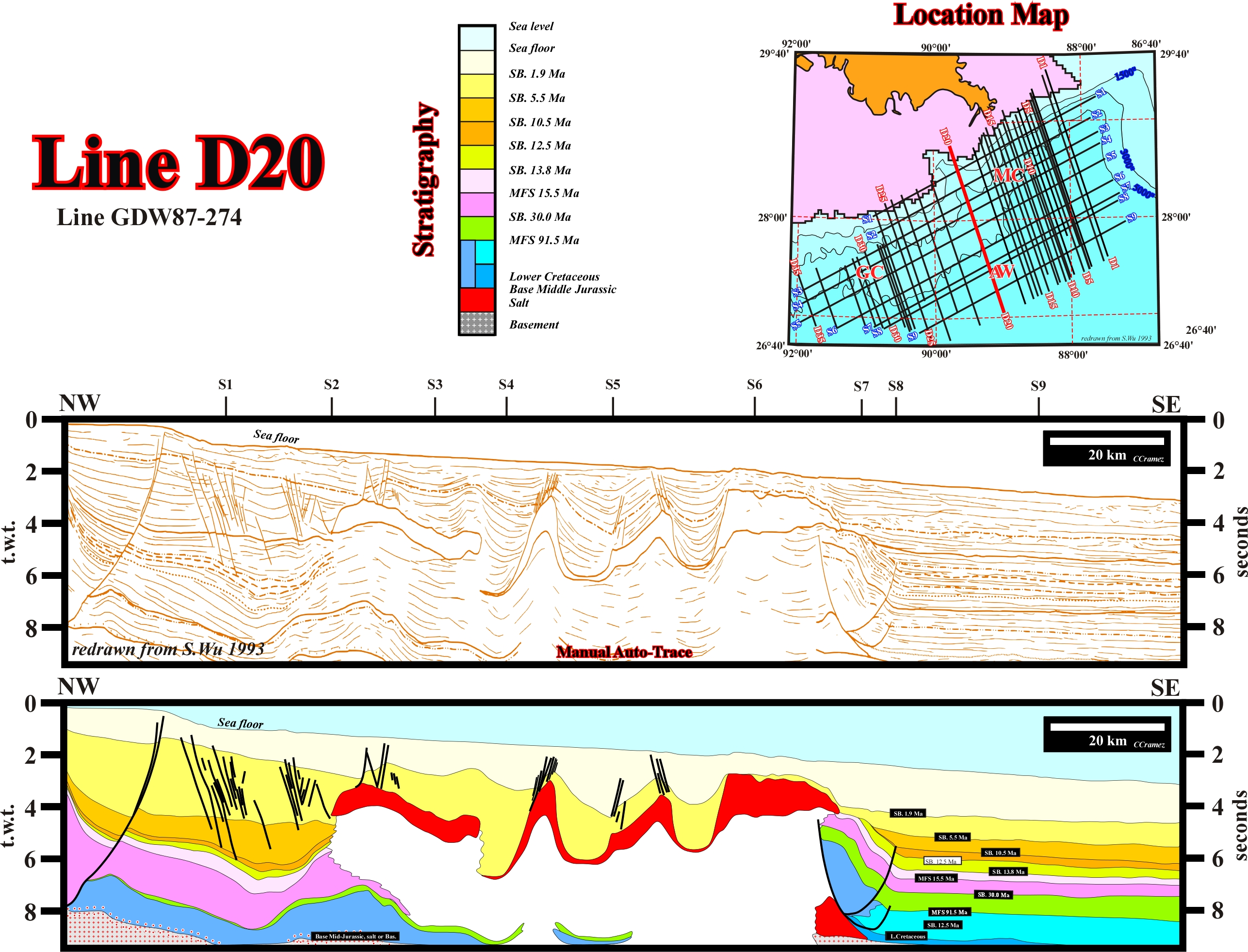
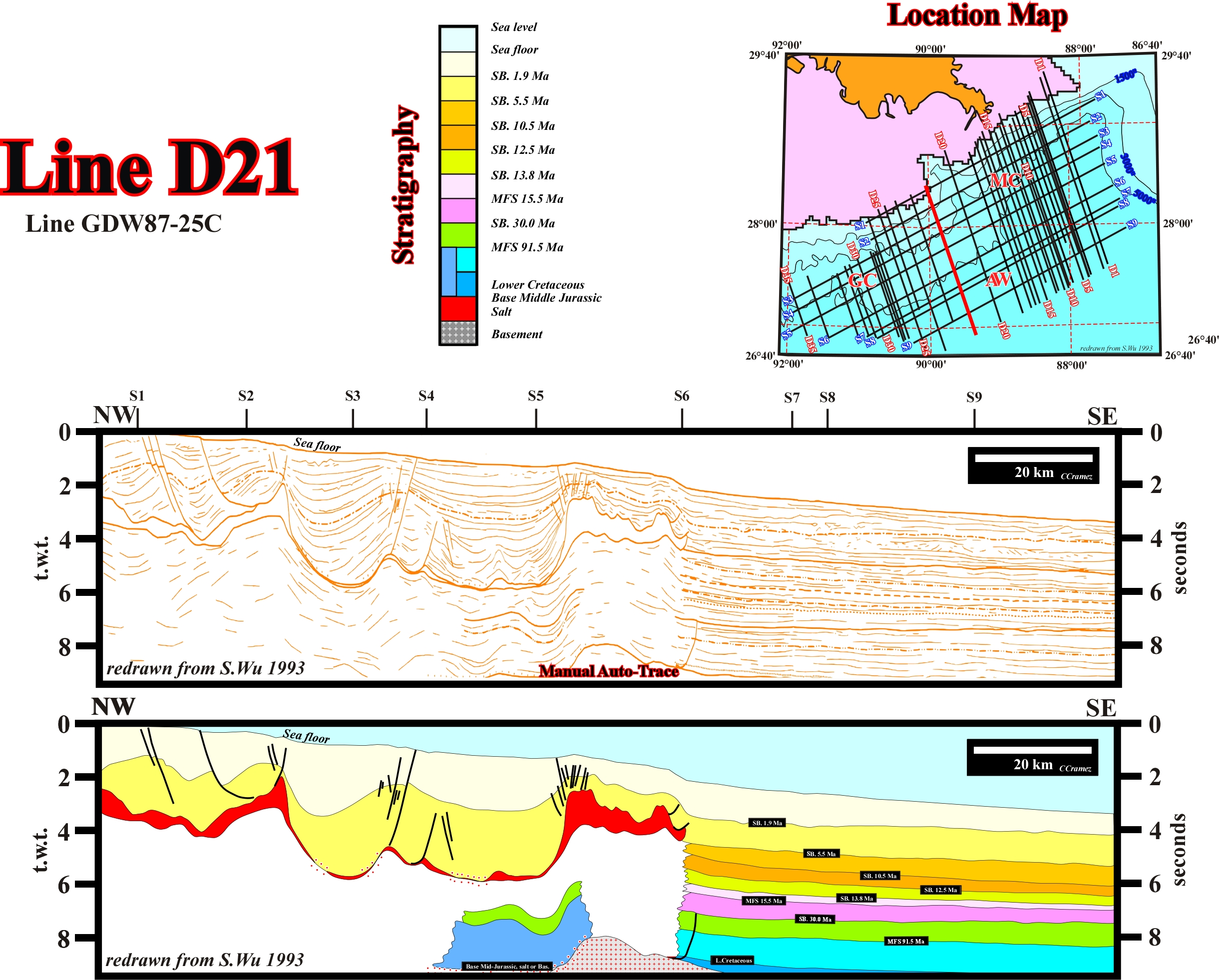
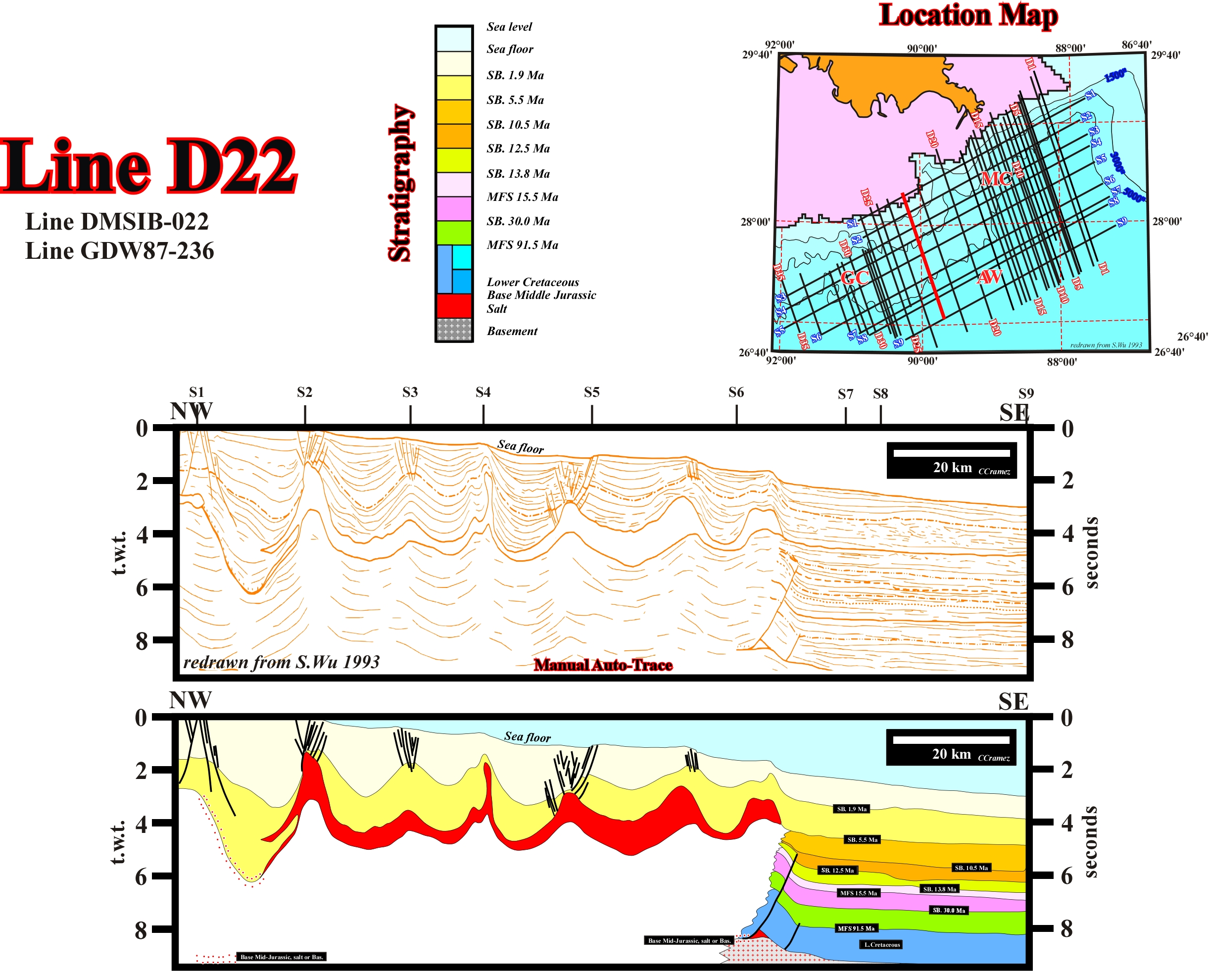
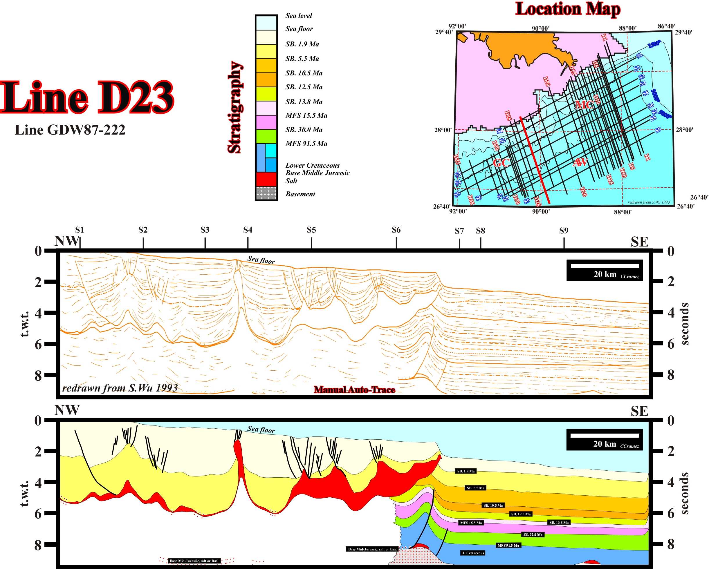
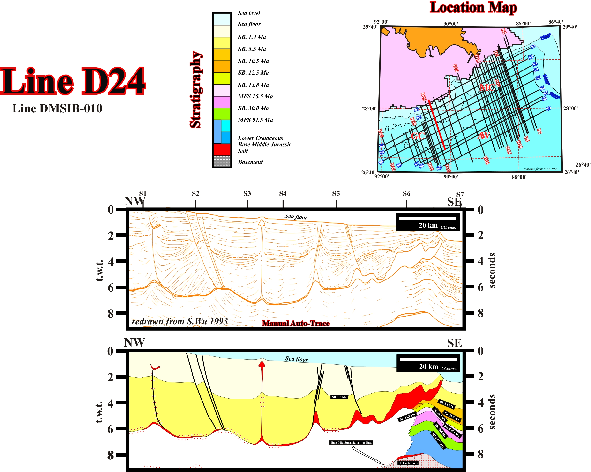
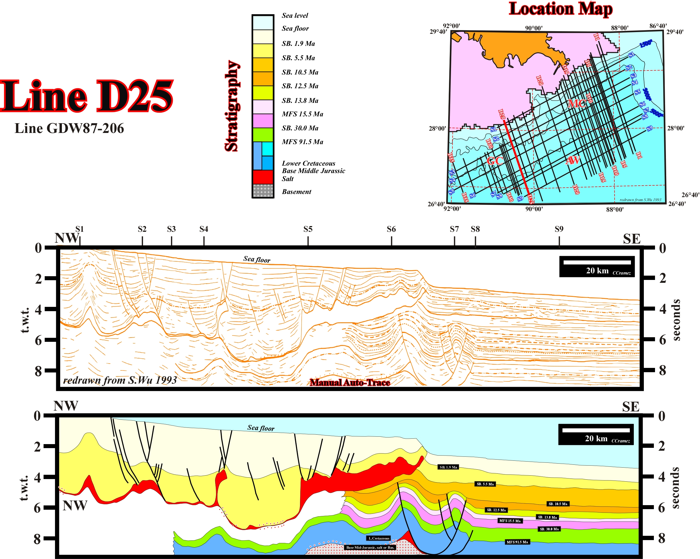
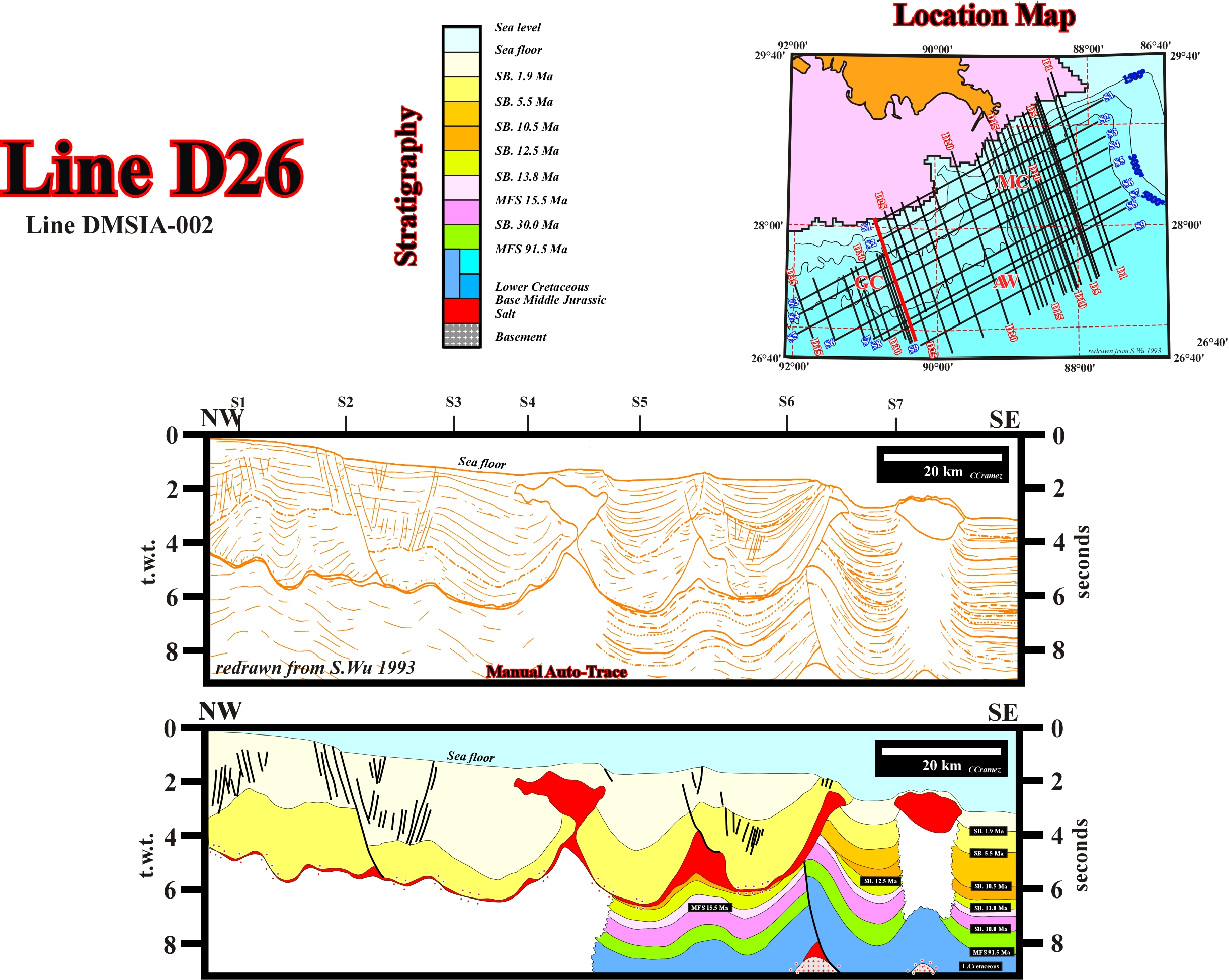
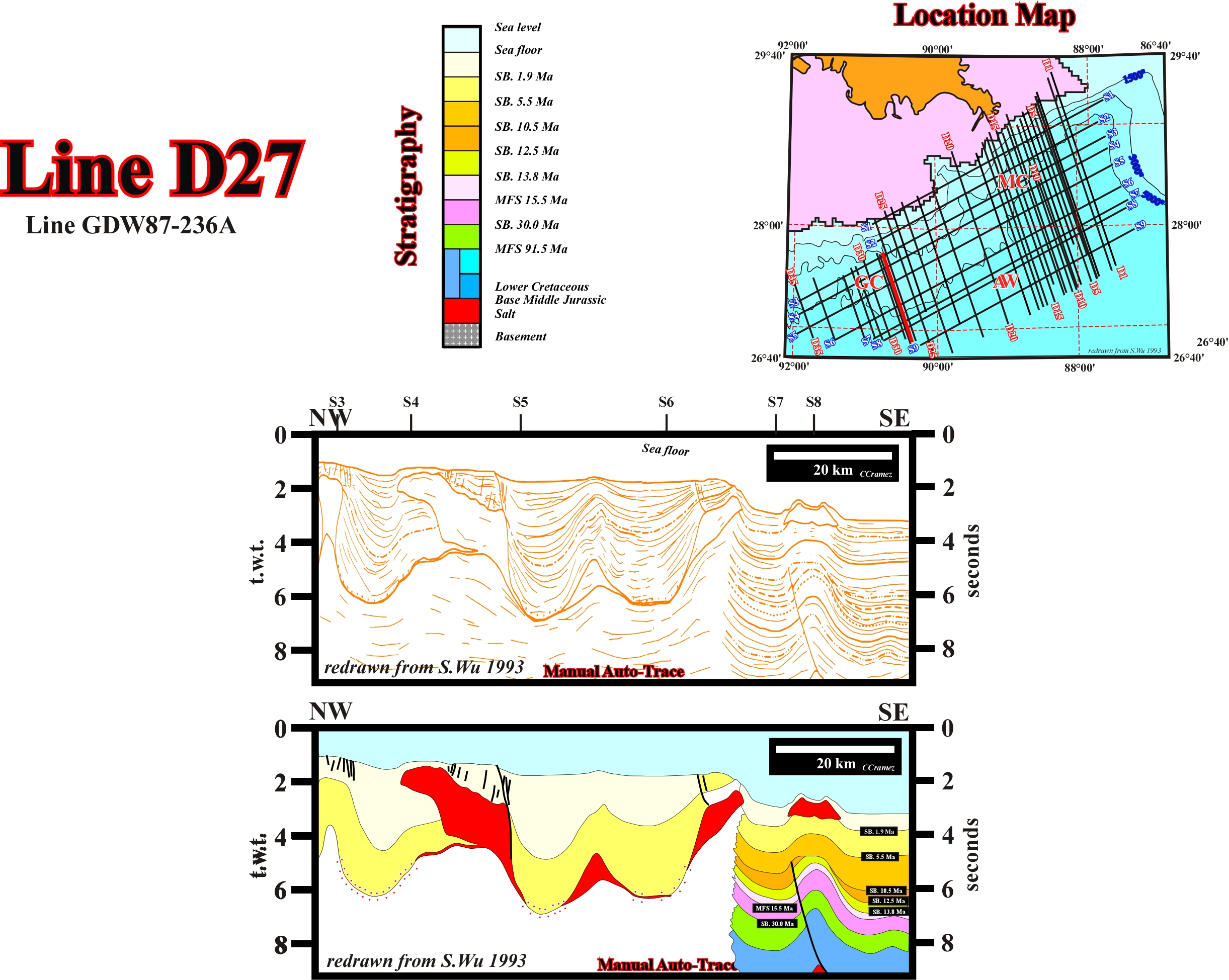
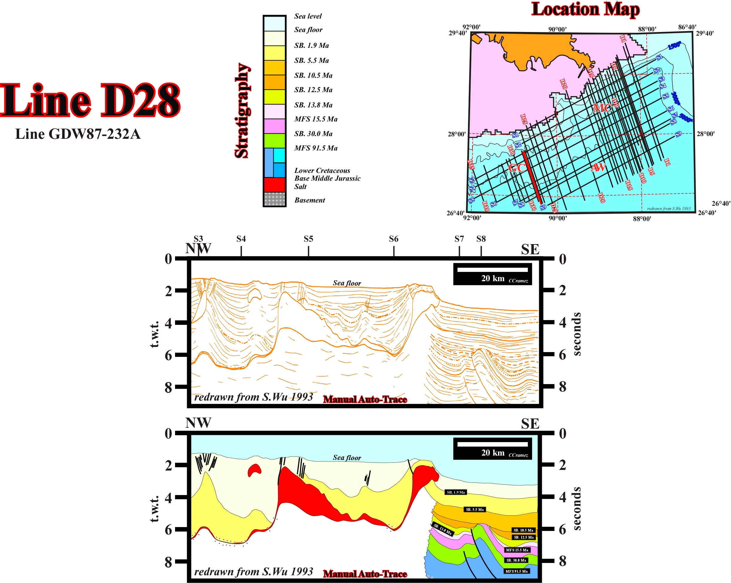
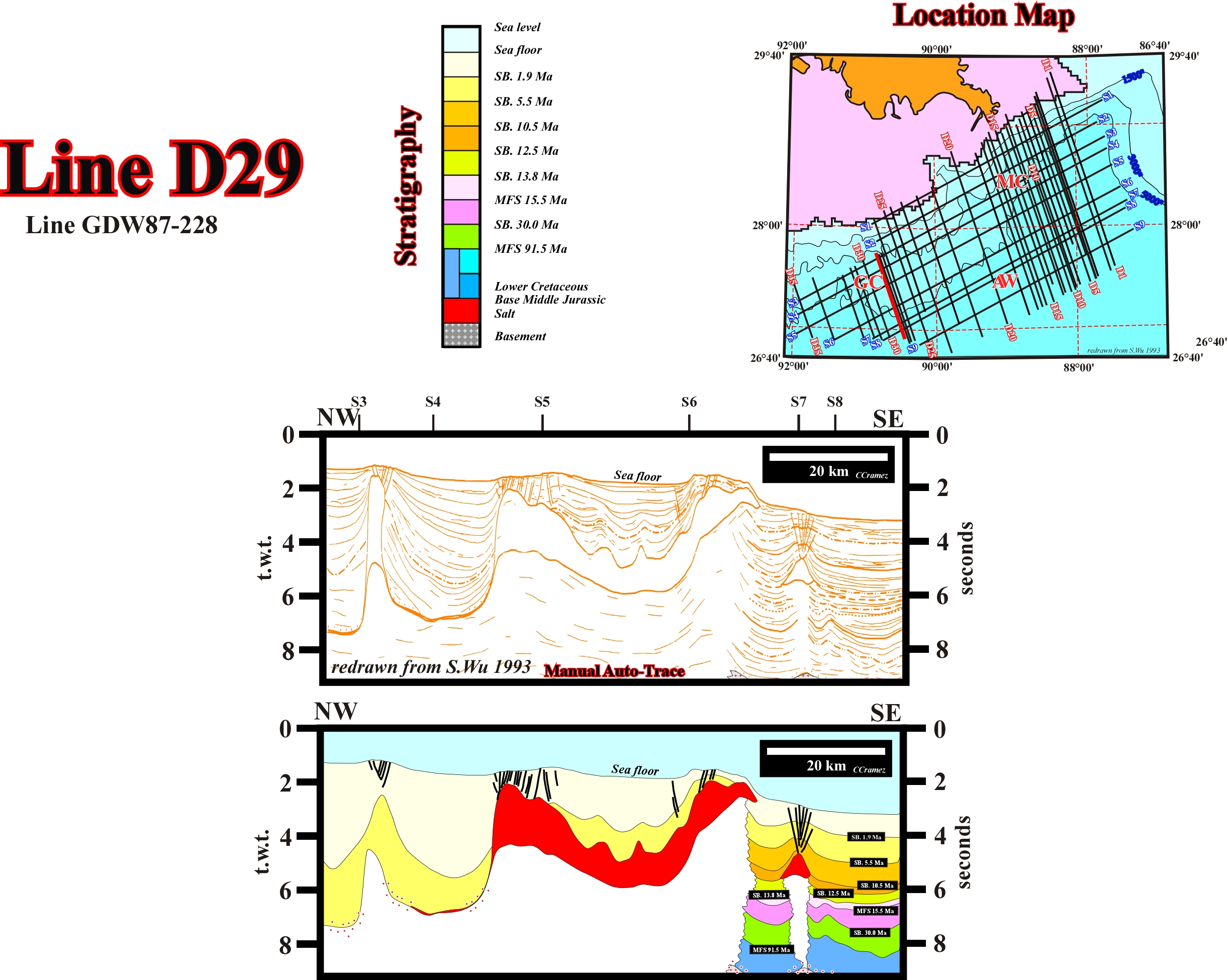
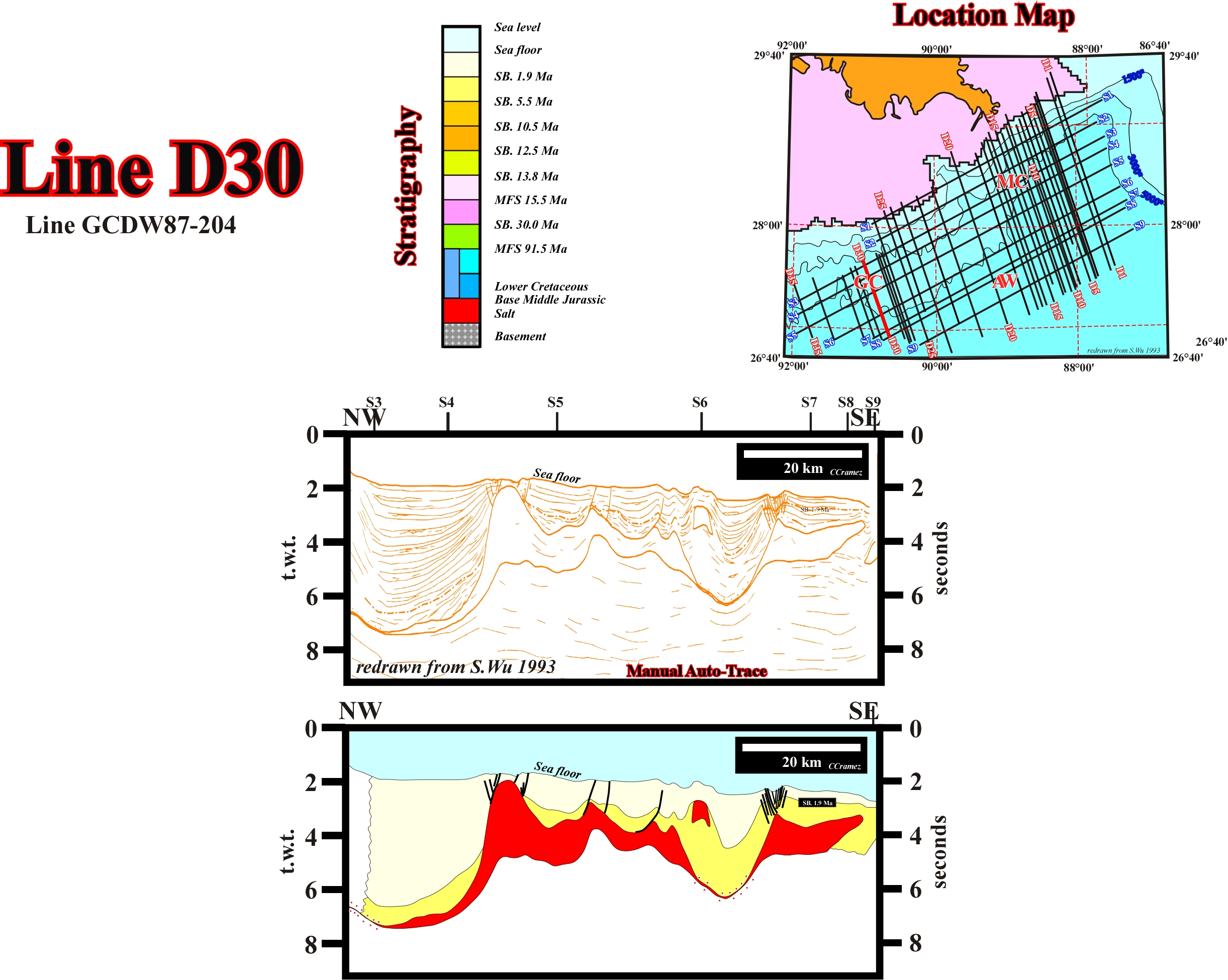
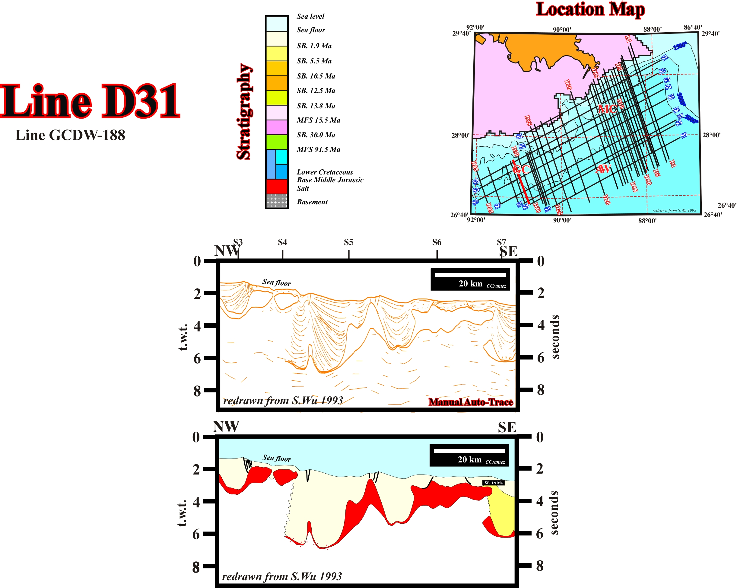
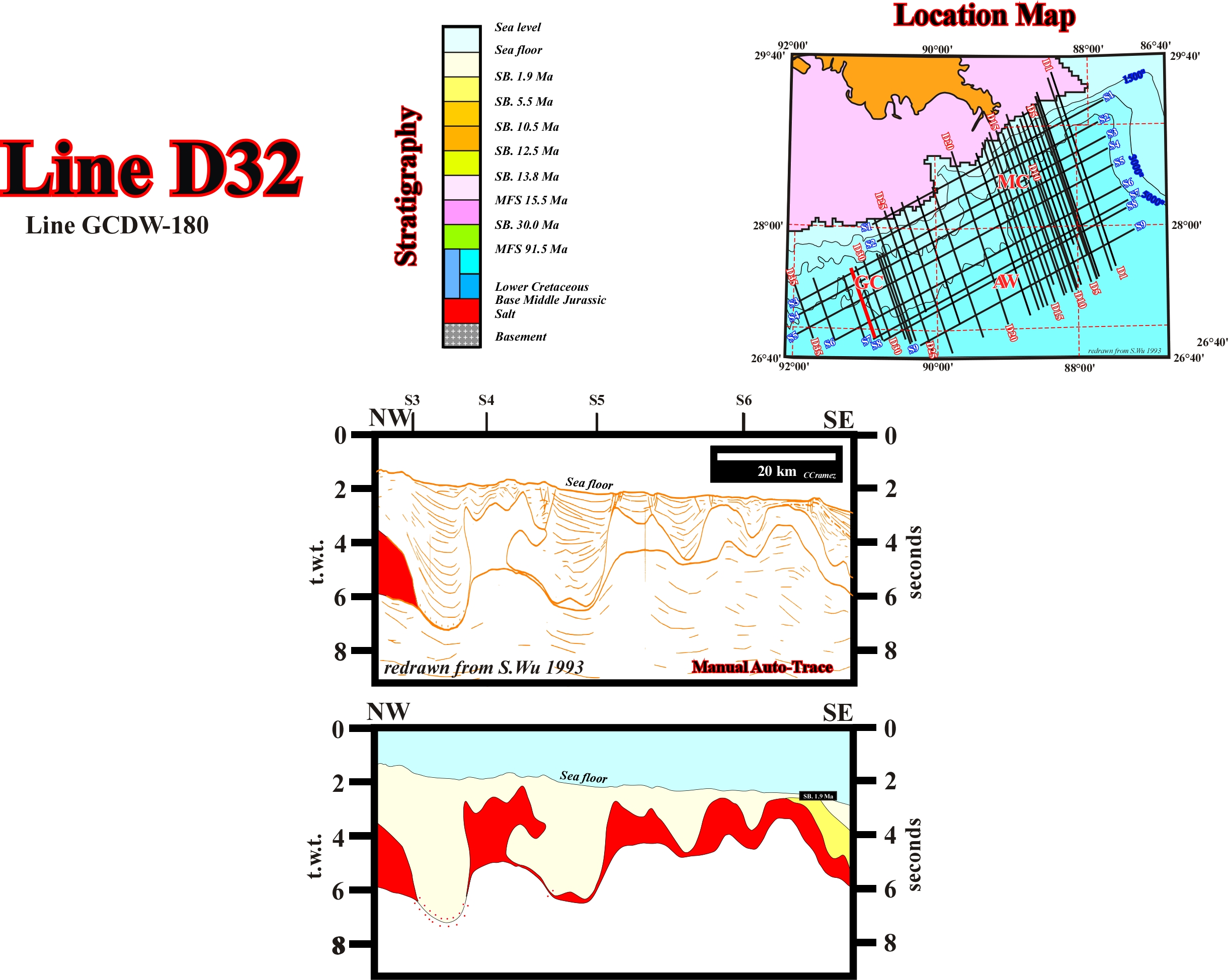
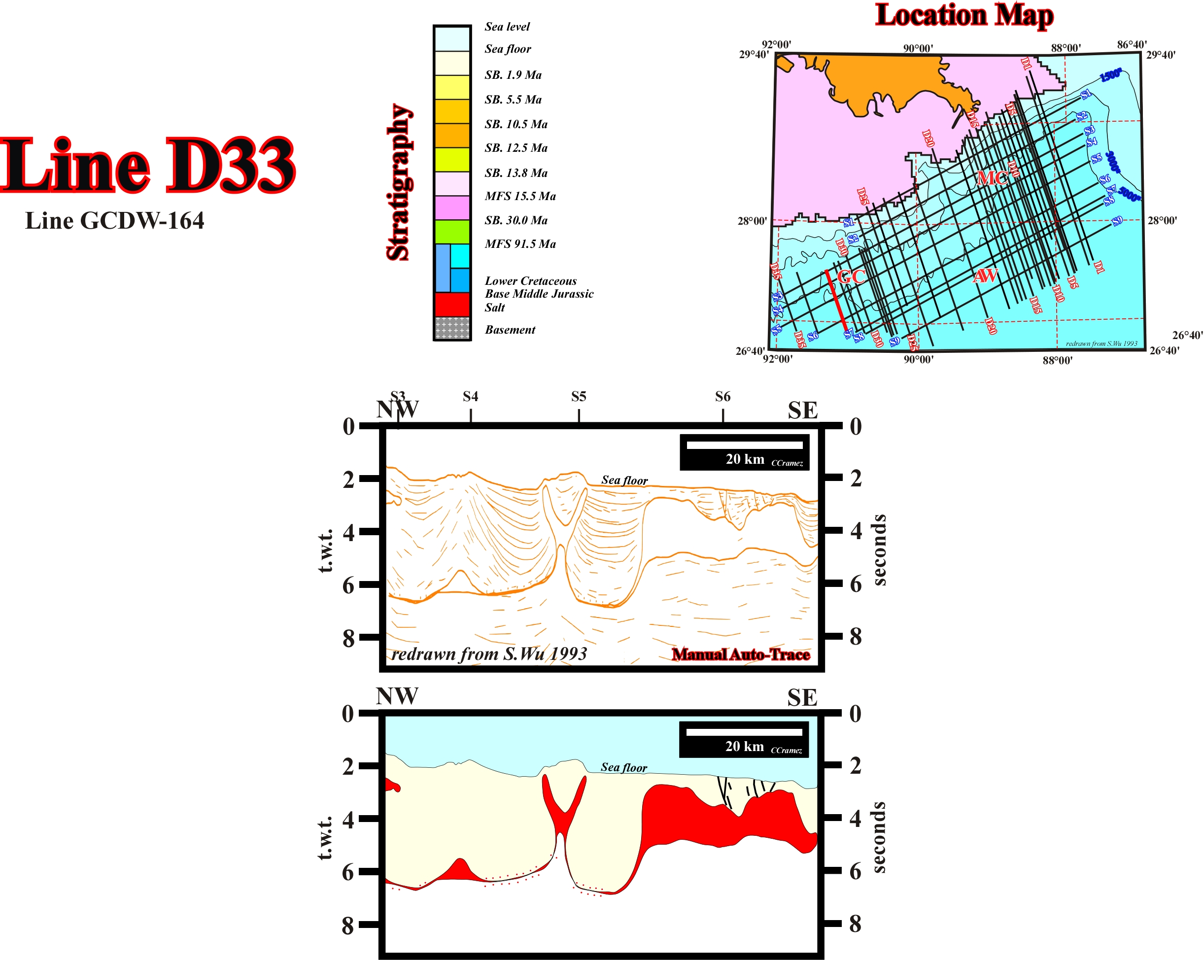
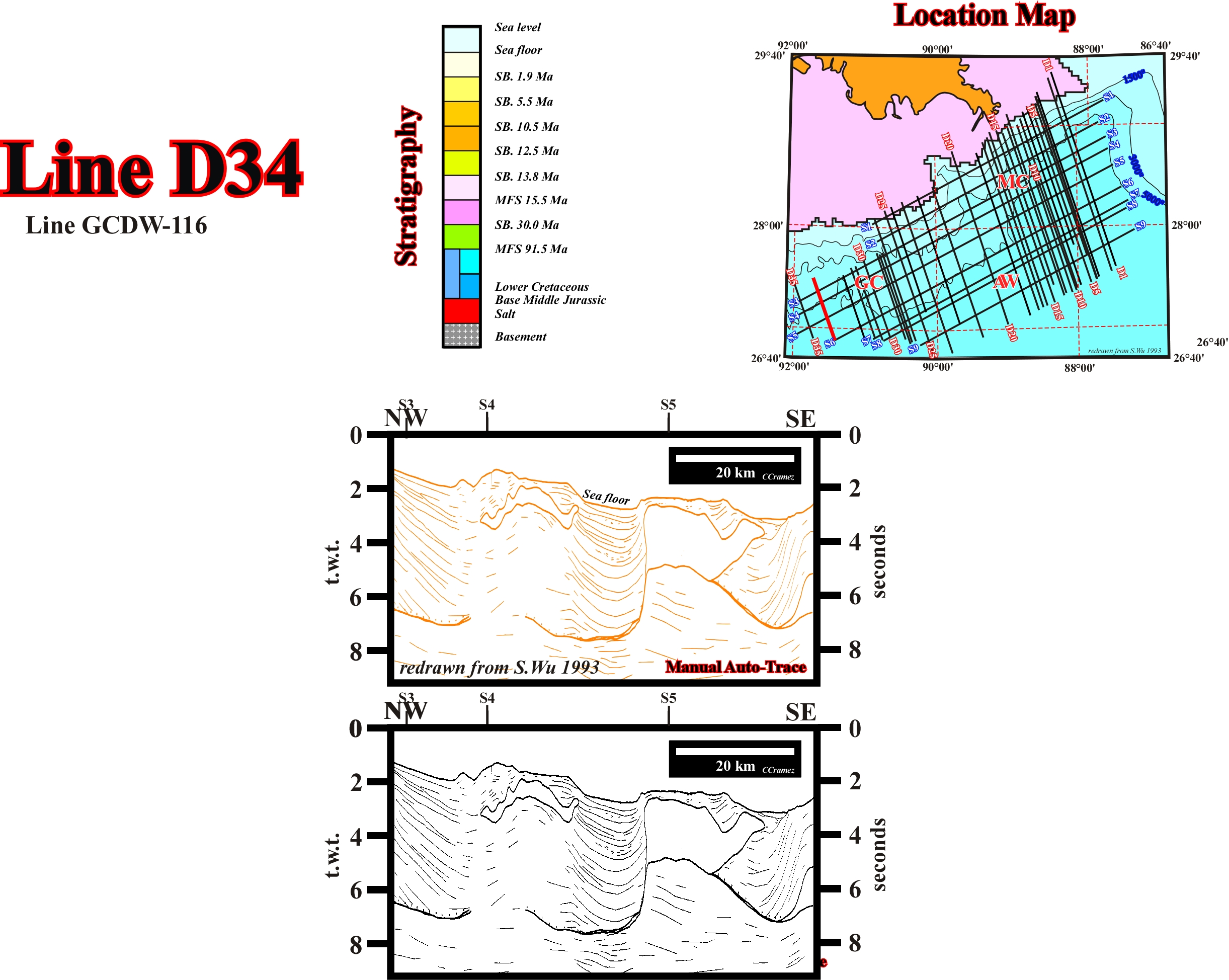
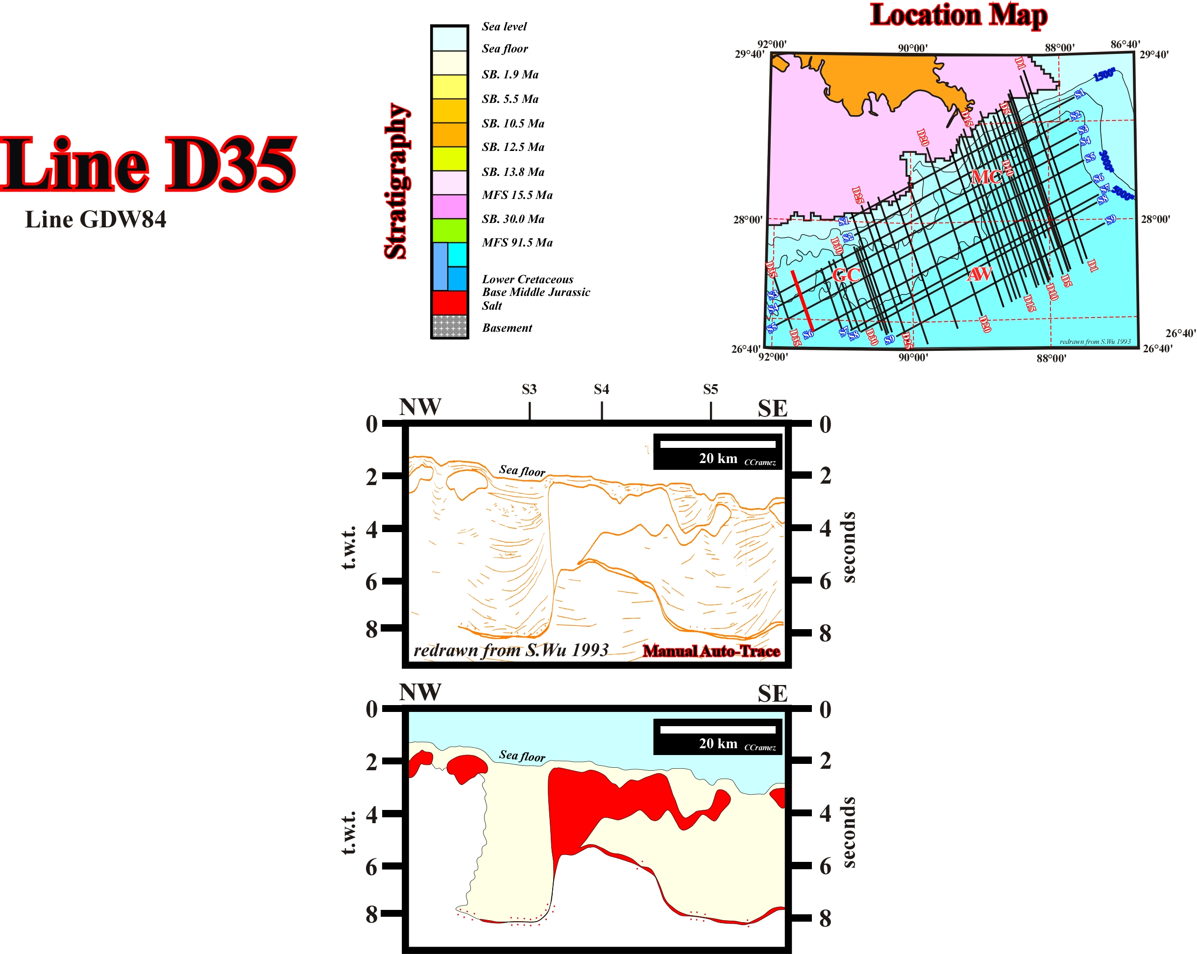
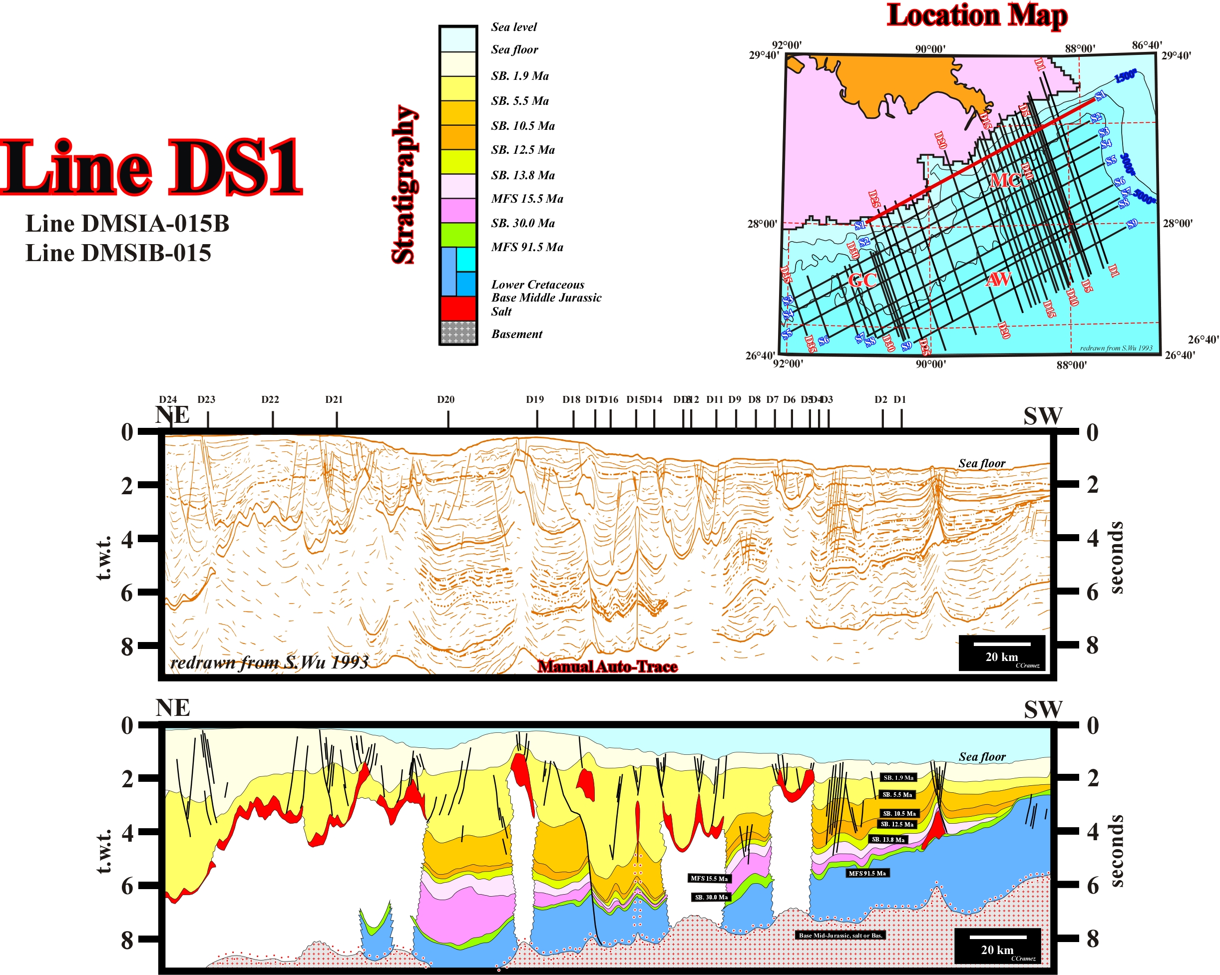
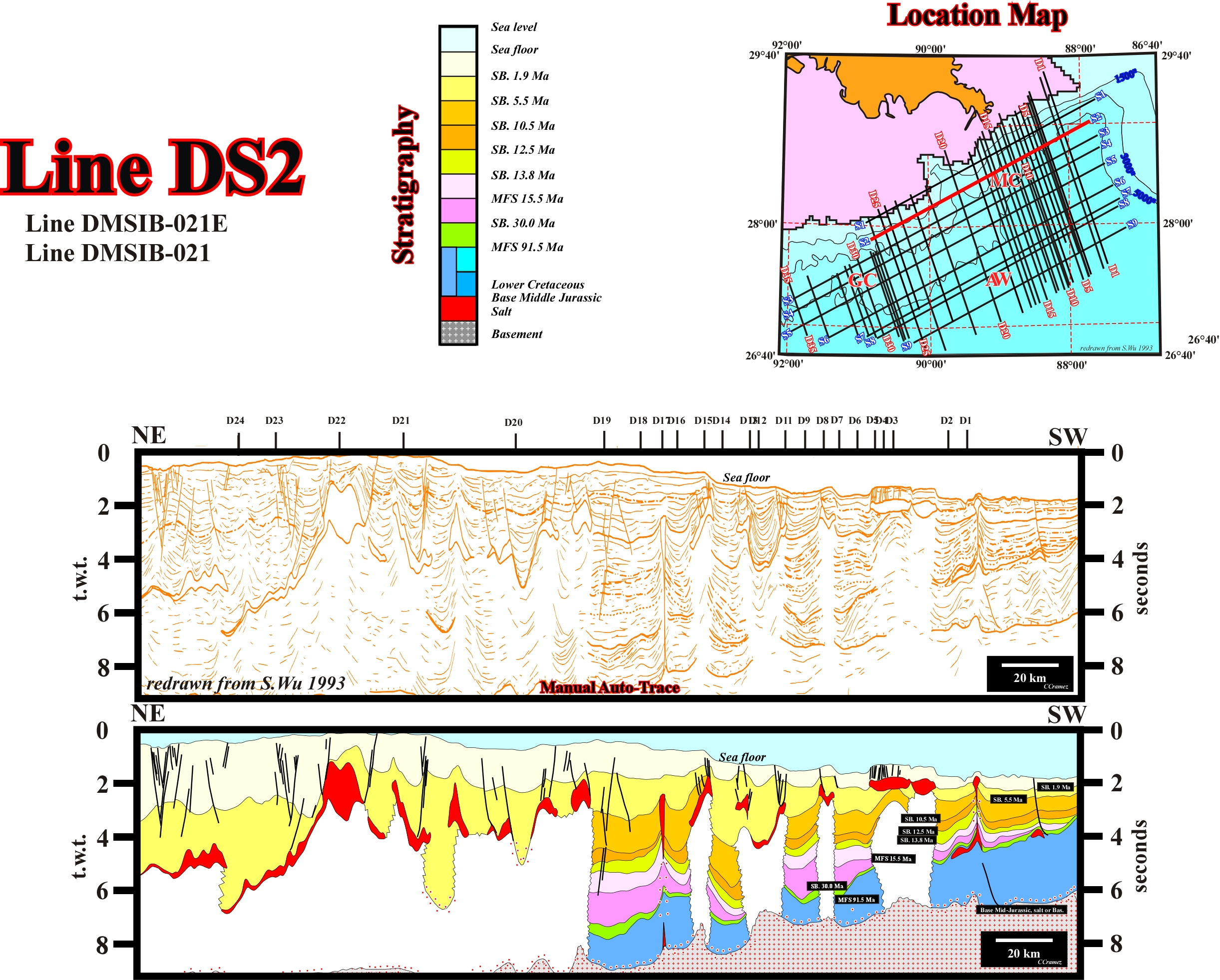
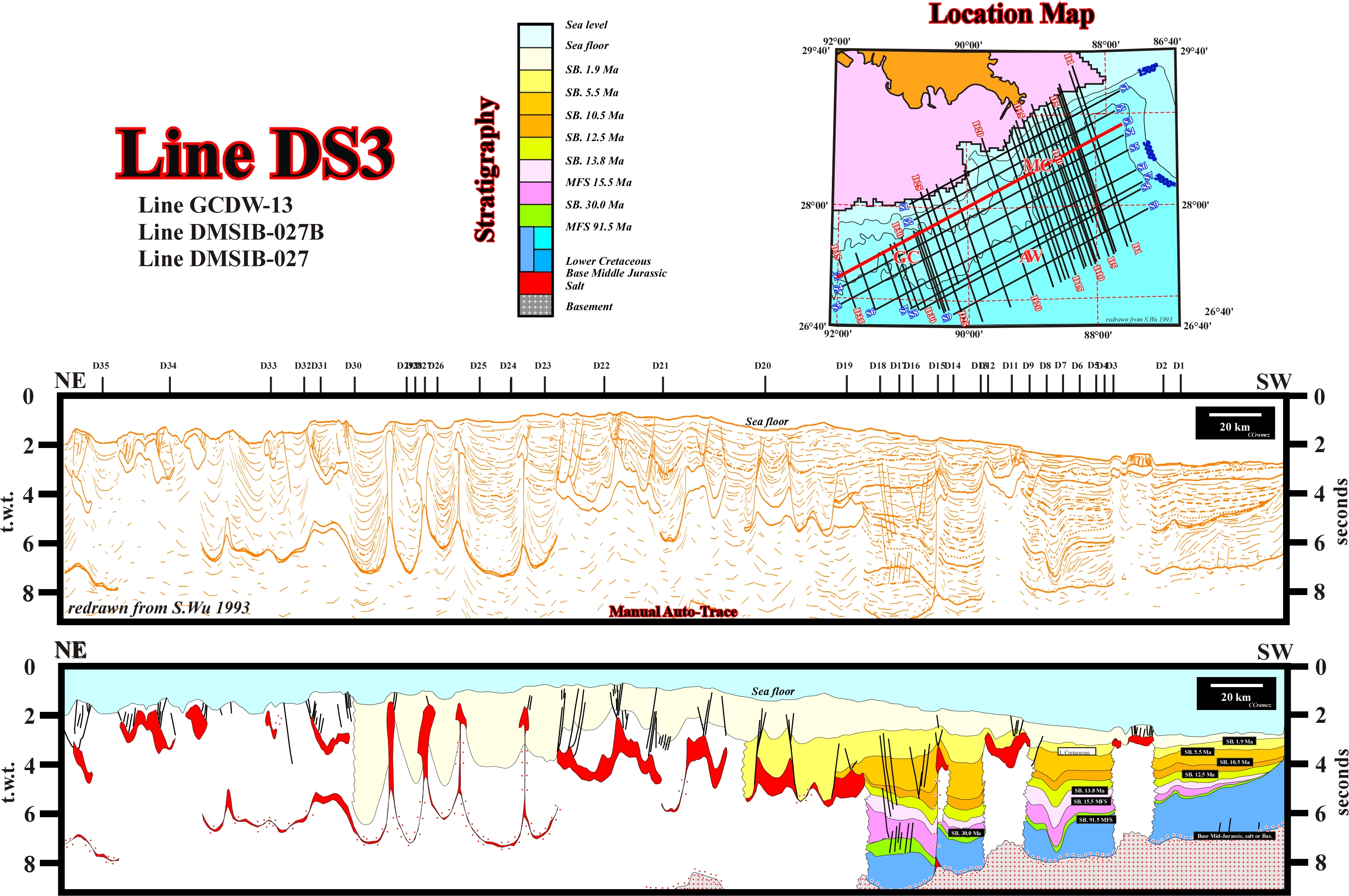
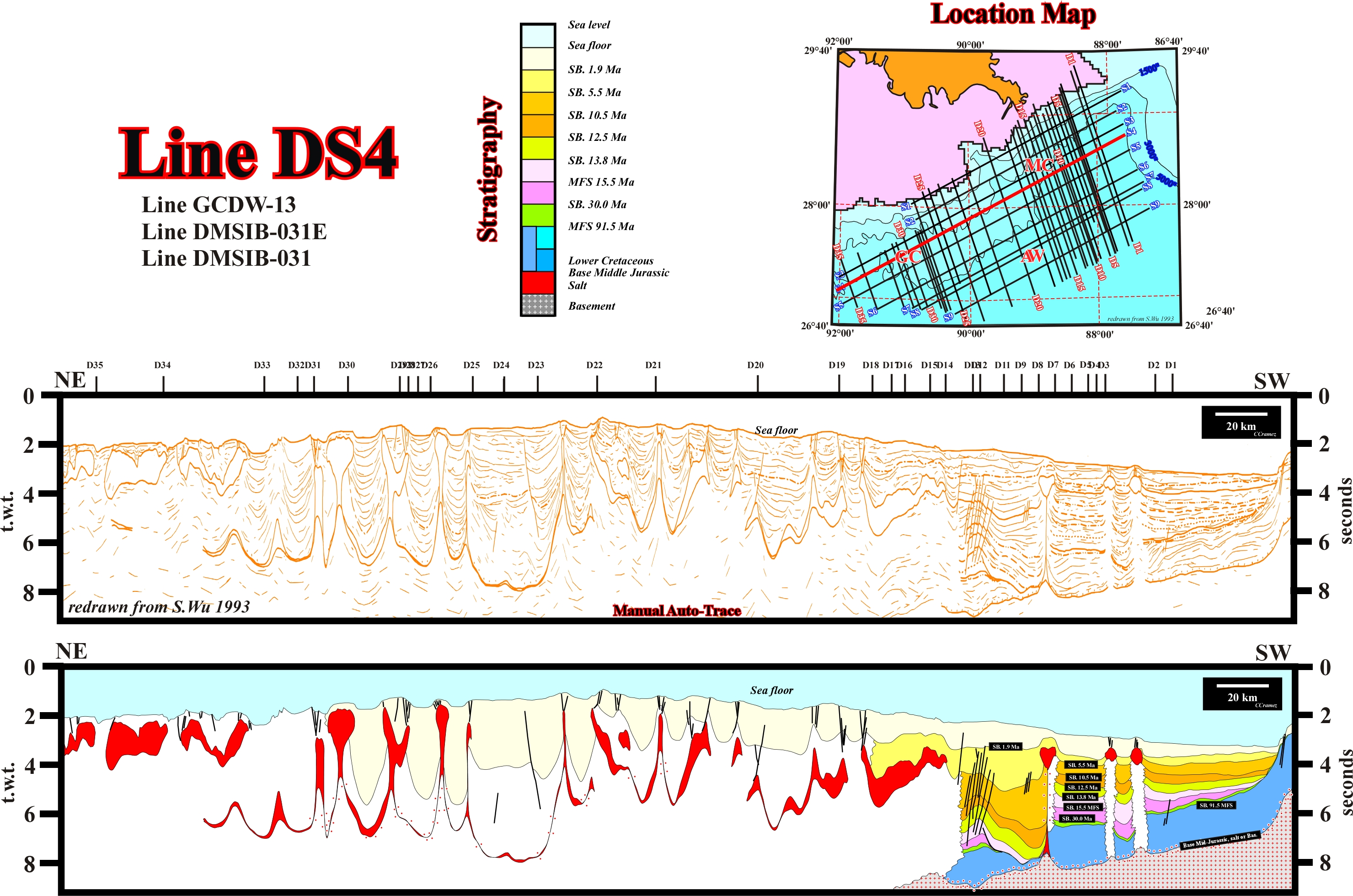
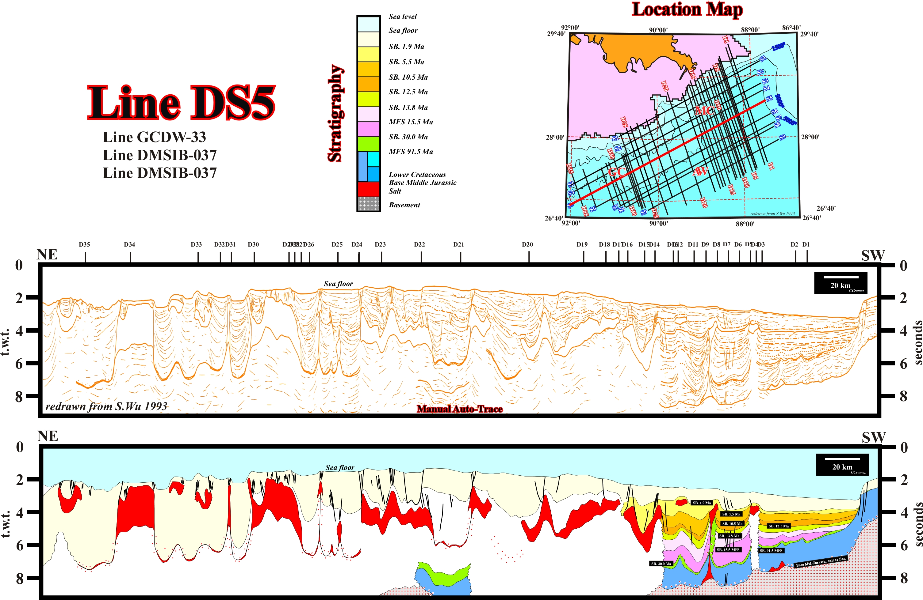
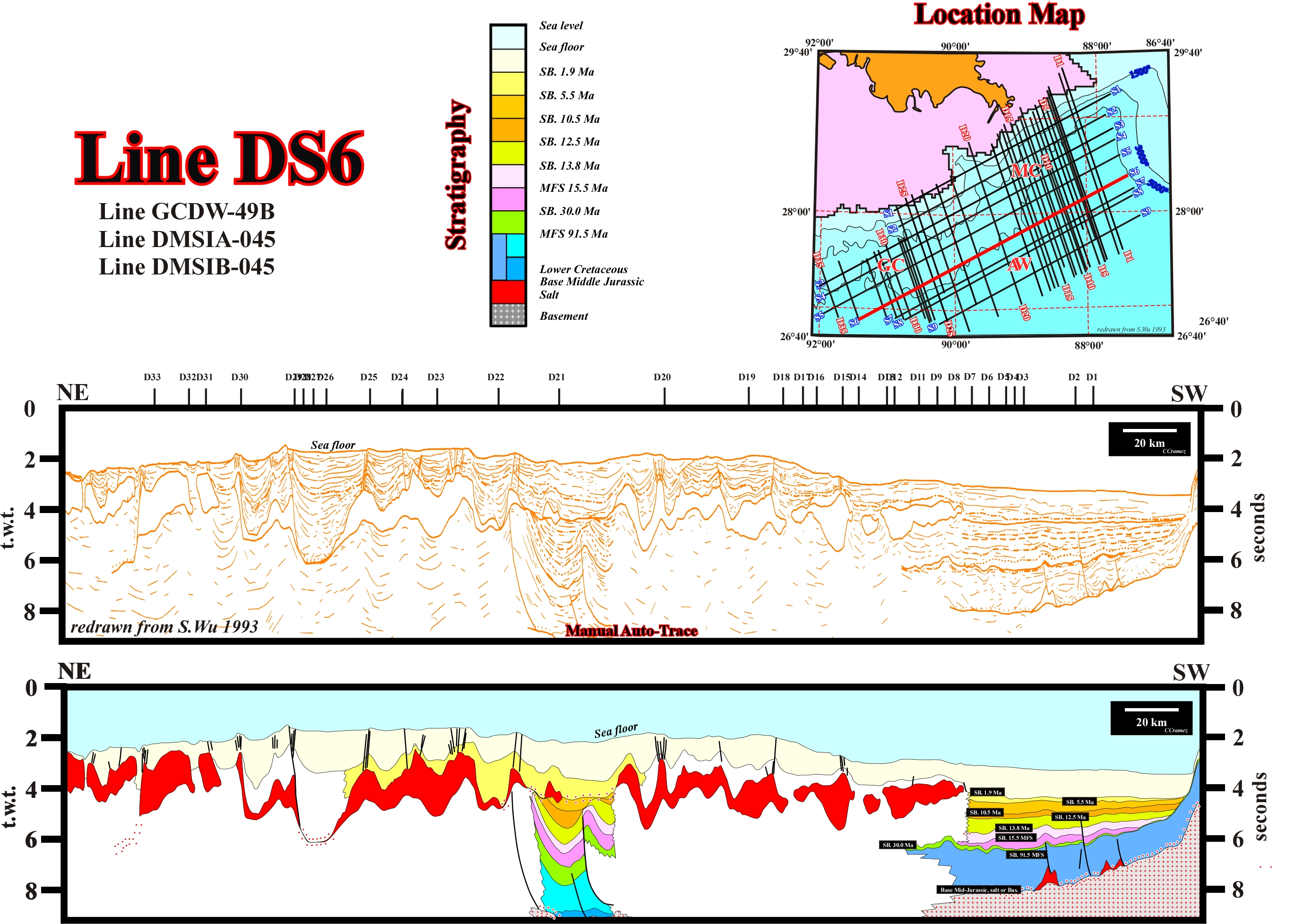
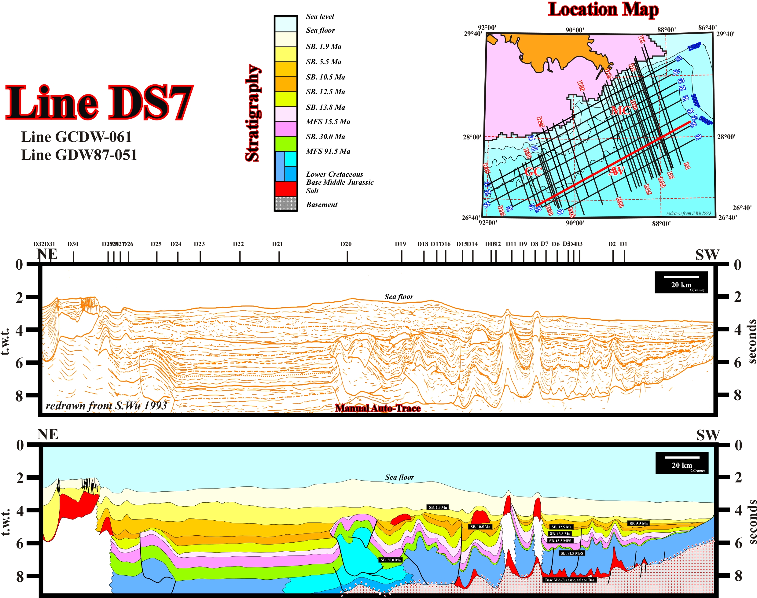
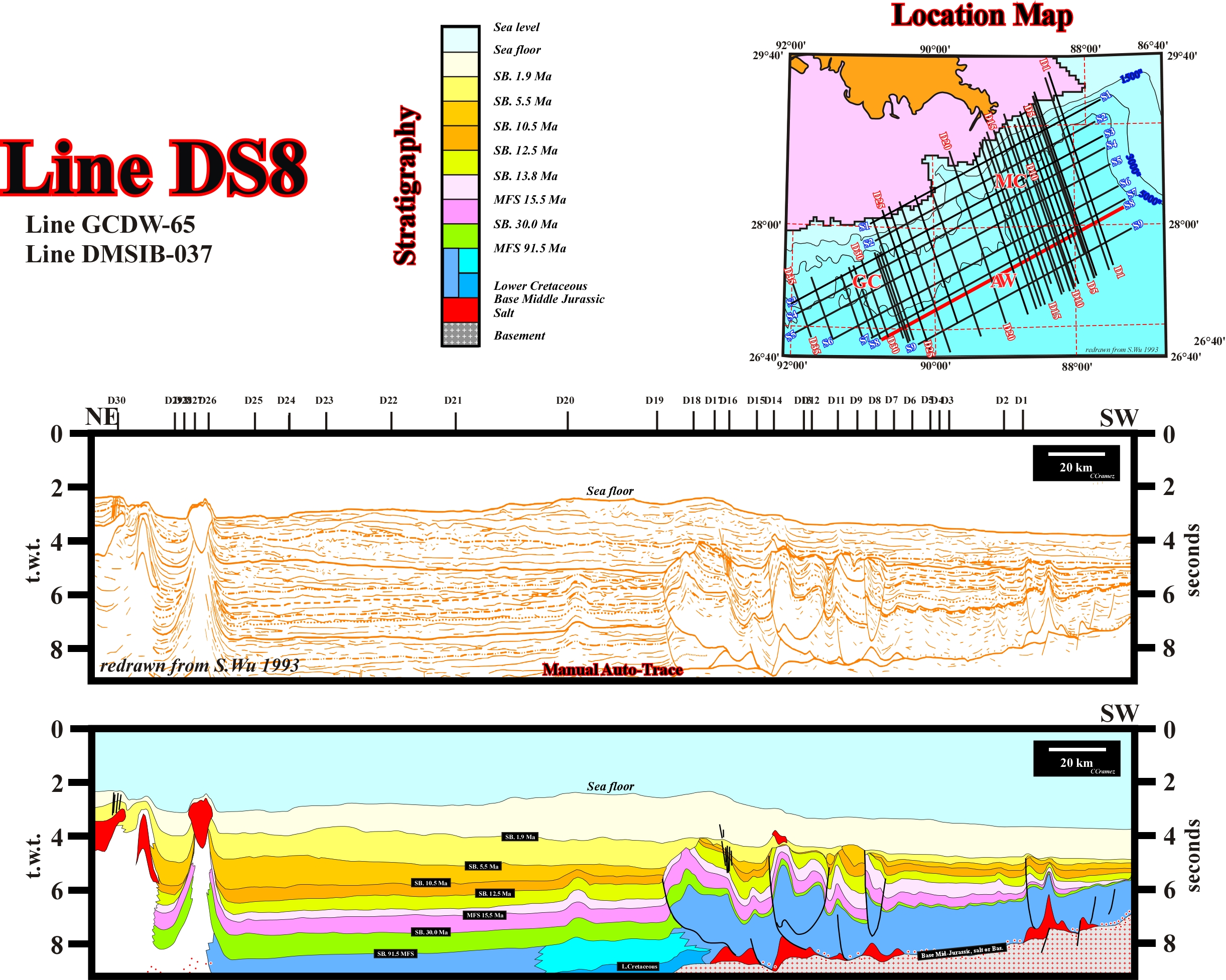
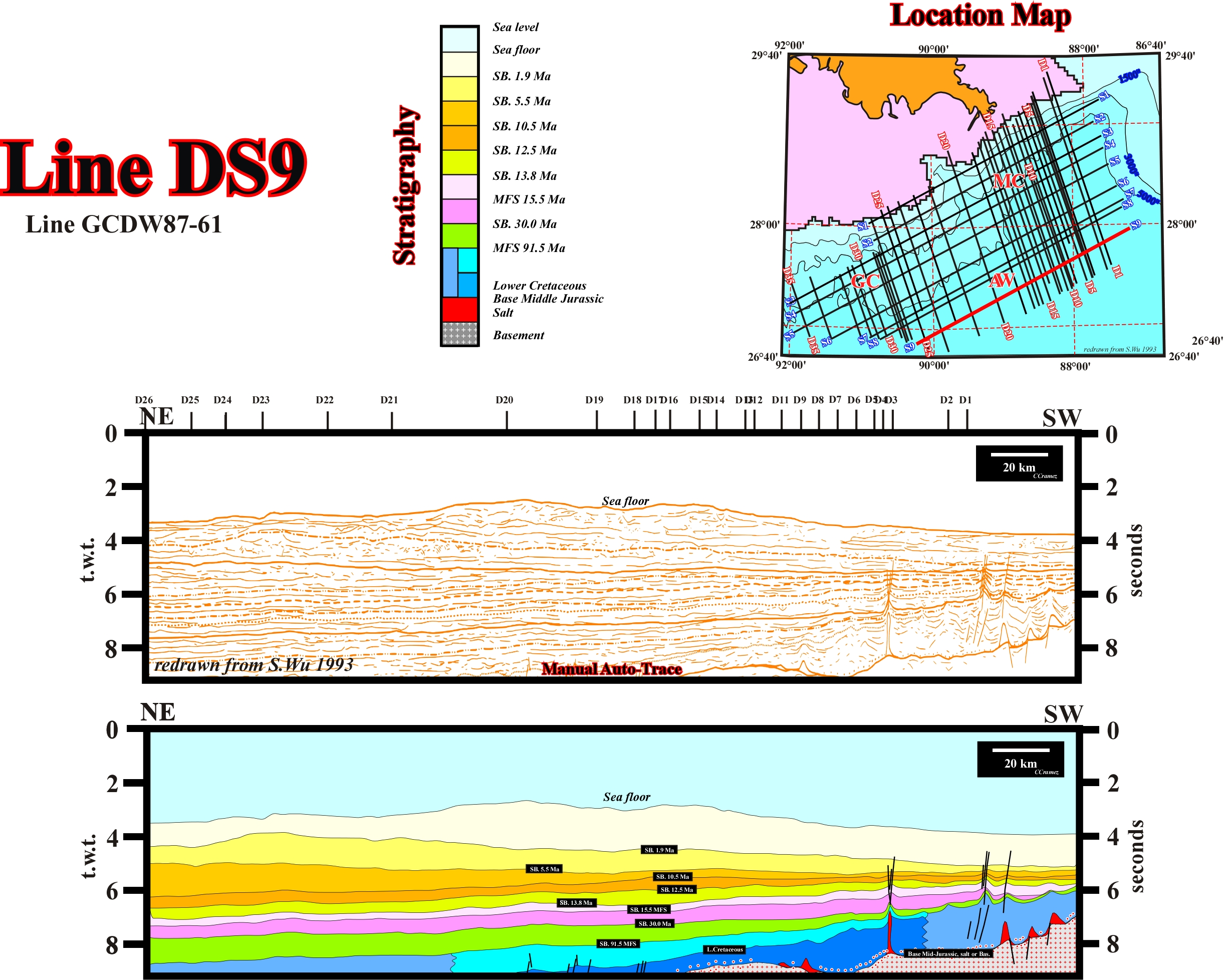
Fig. 330 - Theory precedes Observation (K. Popper, 1934) or in other words, if the geoscientist in charge of the seismic interpretation (the interpreter) doesn't not know what is, for instance, a salt weld or type-rift basin, it is evident that he can never recognize them, either on the seismic lines or manual or automatic autotraces. By the same token, depending on the geoscientist, a geological or geophysical observation has a large range of meanings. They range from observations made by naive inductive geoscientist (totally ignorant of the geological context and for who theory harms observations) to observations made by a rationalist geoscientist (who know what the is looking for and for who Theory precedes Observation). For a rationalist geoscientist there are not pure geological observations, i.e., there are no observations without an important theoretical component :" all observations are interpretations of facts in the light of one or another theory, that is to say, all observations are theory dependent". Also, he does not confuse " Being " as, for instance, a salt expulsion basin or an allochthonous salt sheet with " Representing " (representation of "Being"), i.e., the seismic picture of a salt expulsion basin or allochthonous salt sheet. On the proposed tentative geological interpretations, the interpreter knew, a priori (geological knowledge) the seismic lines were shot in a Mediterranean-type basin, located in the concave arc of an Ampferer subduction (A-type subduction zone), in associated with the extension (lengthening) induced by a continental collision. In fact, the Gulf of Mexico was considered a Mesozoic Pannonian-type basin, developed on the concave arc of the A-type subduction of the Appalaches, forming the infra-structure of the Tertiary non Atlantic-type divergent margin. However, presently, taking into account the new seismic data, particularly, the data shot in deep water, the basin is rather a Mediterranean-type basin, since oceanization took place: the highlighting of seaward dipping reflectors (sub-aerial lava-flows) and their gradual transition to the oceanic crust, strongly, suggests an oceanization below the Mesozoic Mediterranean-type basins. On the bottom of the Mediterranean-type basin, a thick potash-rich salt interval was deposited, which movements are, highly responsible of the majority of the structures recognized on the seismic lines. The proposed tentative geological interpretations of the autotraces of the above Gulf of Mexico seismic lines illustrated how the knowledge of the basic principles of Salt Tectonics is indispensable to propose tentative interpretations difficult to falsify. Actually, rafting, translation, allochthonous salt sheets, salt rollers, faults welds, diapirs, salt expulsion basins and turbidite depositional systems are a priori key hypotheses in seismic interpretation of sedimentary basins with a significant salt interval.
Summing up : Geoscientists knowing the regional and global geological context of the Gulf Coast, as well as, the main geological models in Salt Tectonics, will interpret, easily and tentatively, the seismic data of the area and they will recognize, without major difficulty, the more likely associated petroleum systems, i.e, the pods of active source-rock and all related oil and gas.
to continue press
next
![]()